Best viewed with:

Right click to "Save as..."
(The
worldfiles are georeferenced to the cropped image files only.)
.jpg)
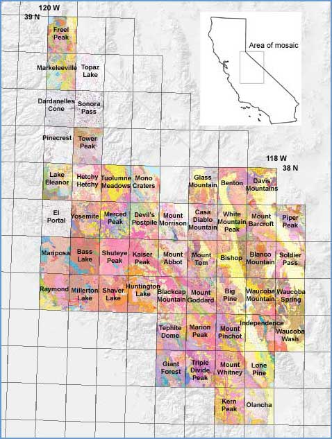
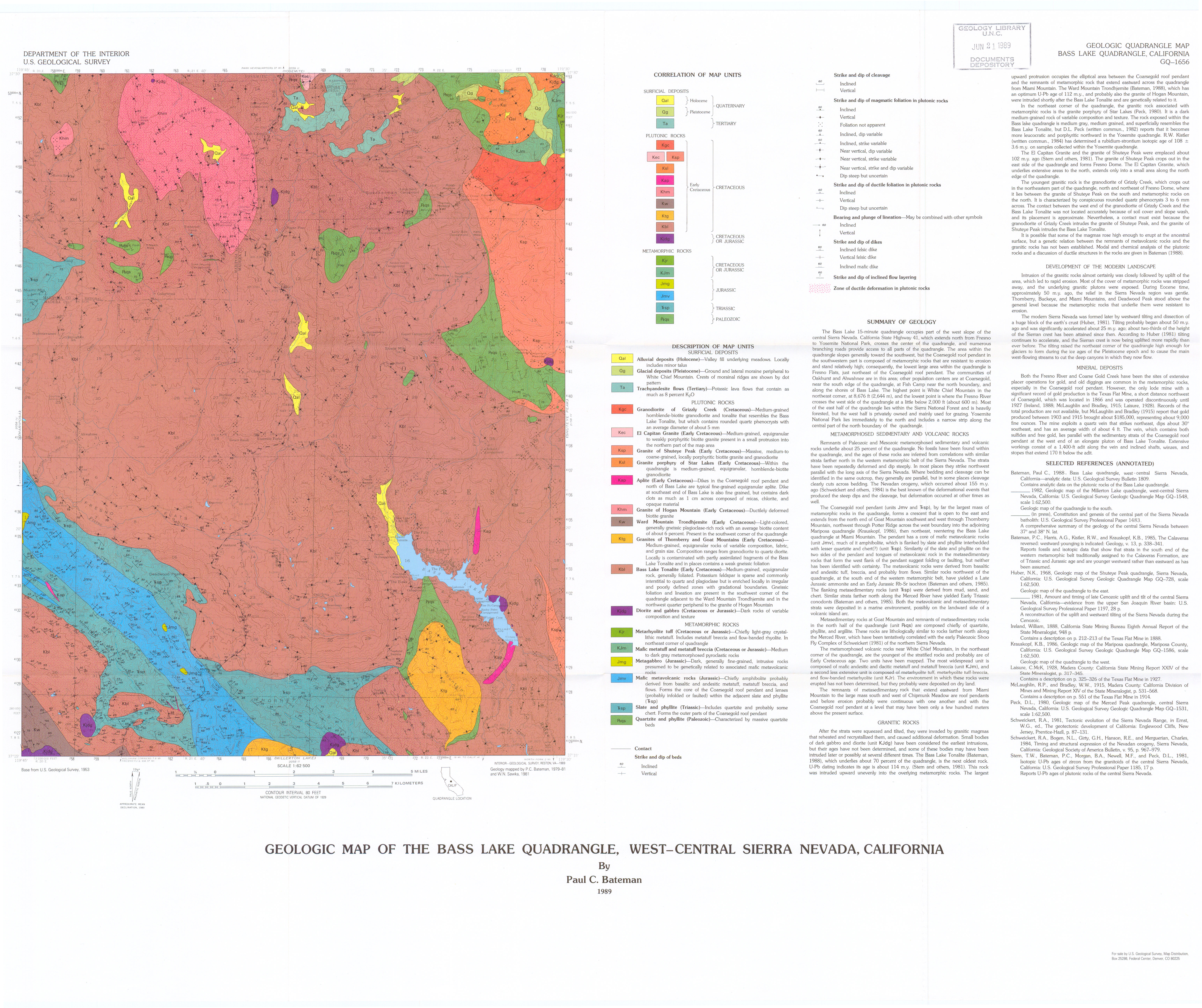
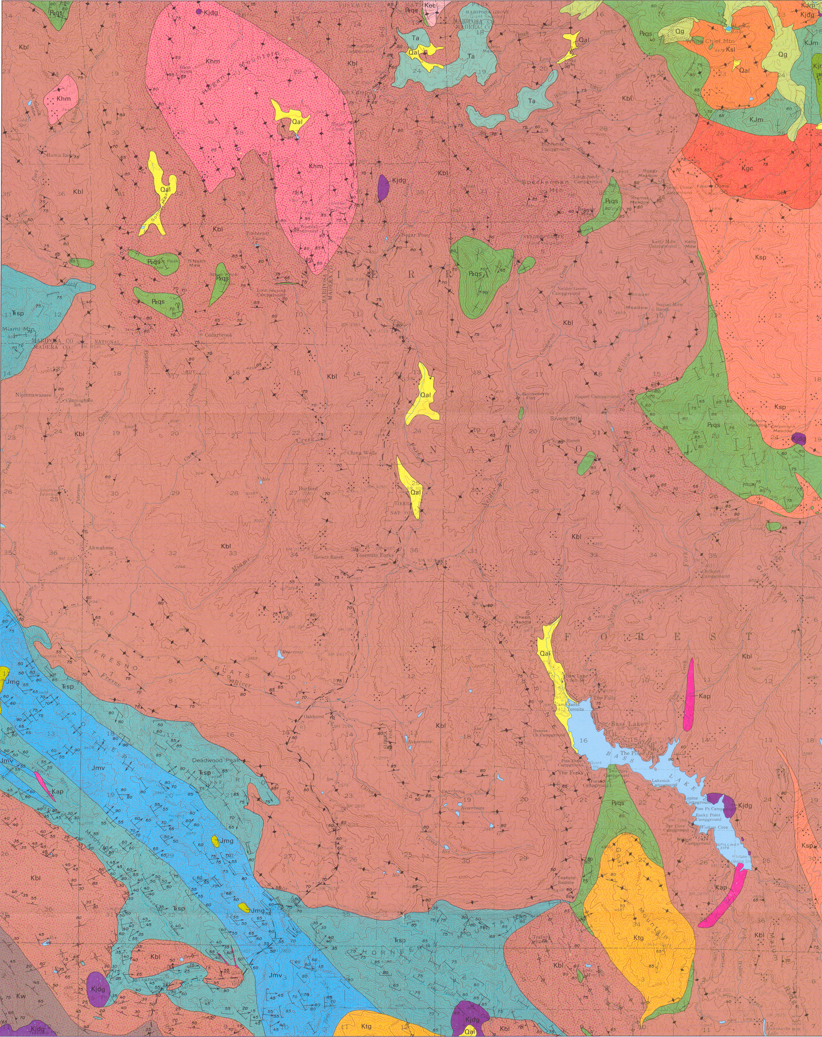
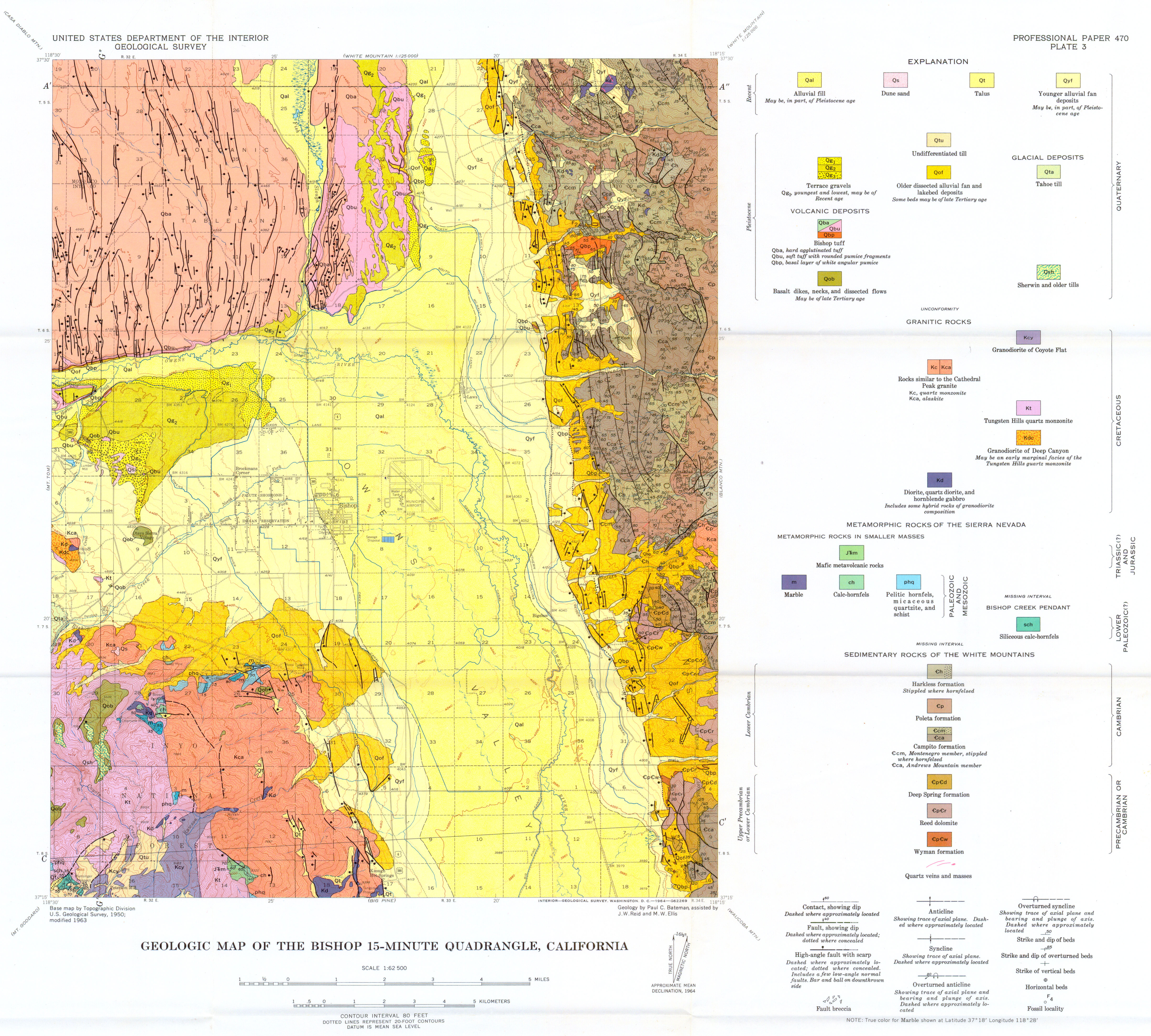
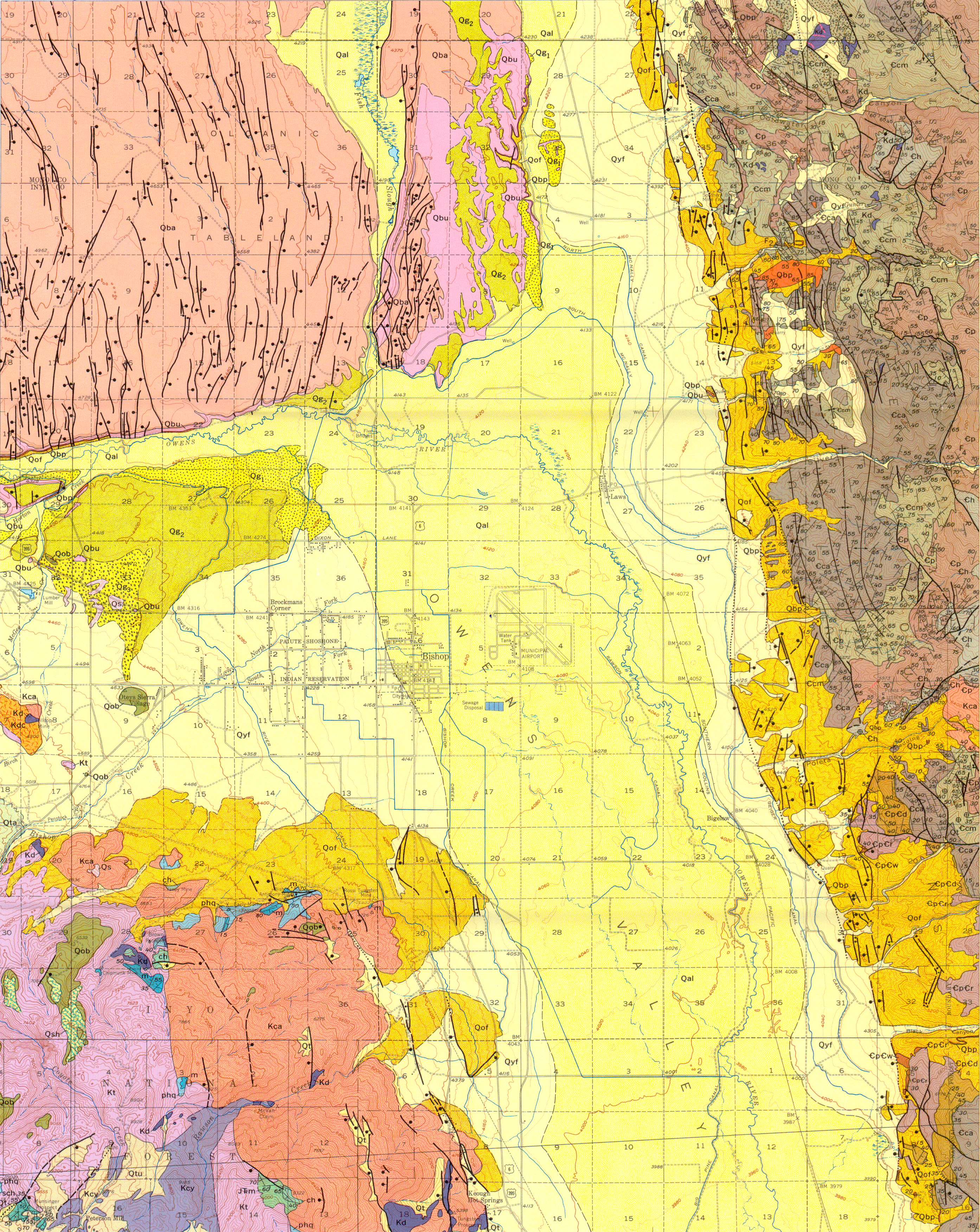
Map Name:
Geologic map of the Bass Lake Quadrangle, west-central Sierra Nevada, California
Author(s):
Source: Geologic Quadrangle Map - U. S. Geological Survey, Report: GQ-1656, 1 sheet, 1989
Map Name:
Geologic map of the Benton Quadrangle, Mono County, California, and Esmeralda and Mineral counties, Nevada
Author(s):
Source: Geologic Quadrangle Map - U. S. Geological Survey, Report: GQ-1013, 1972
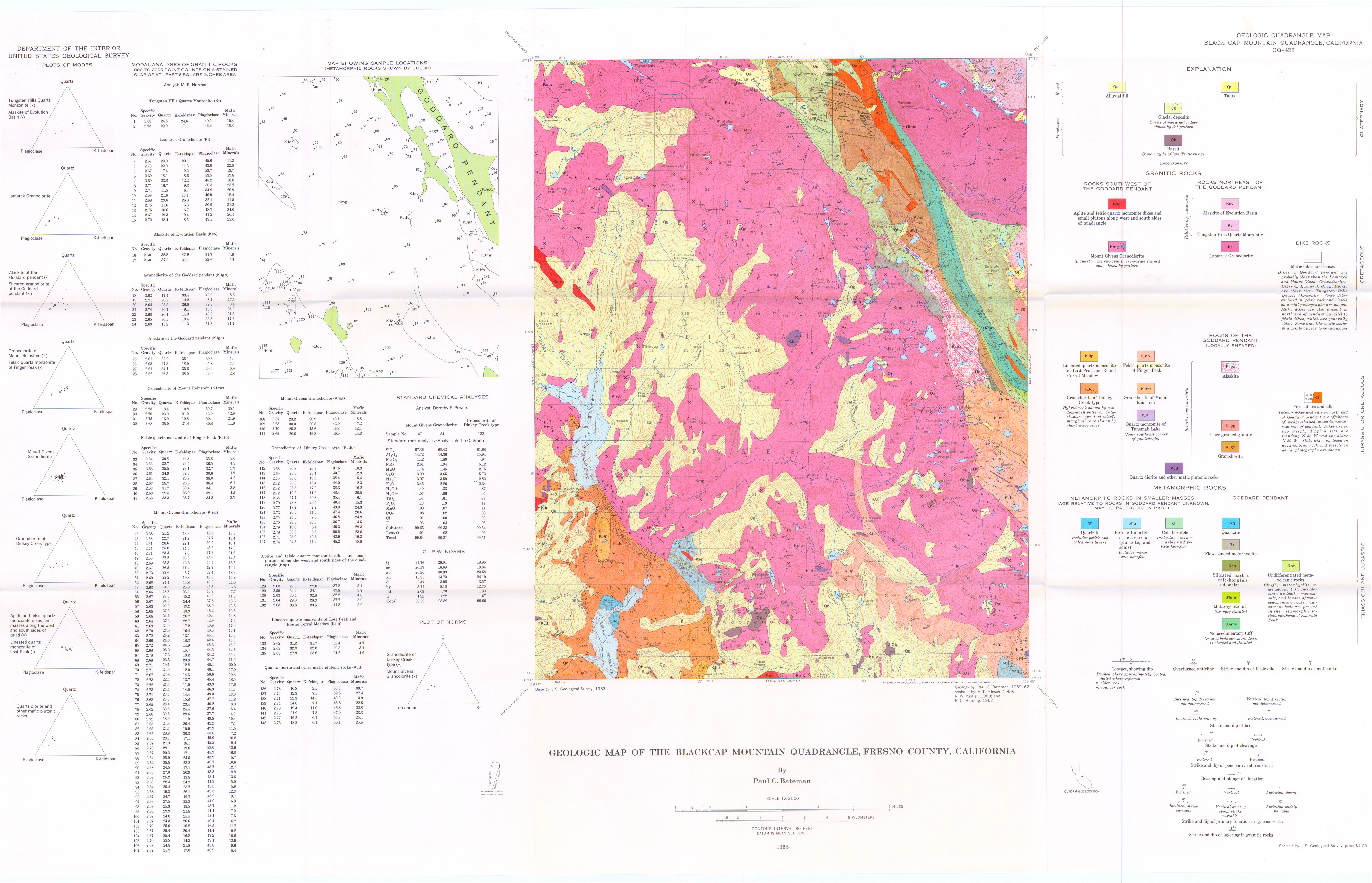
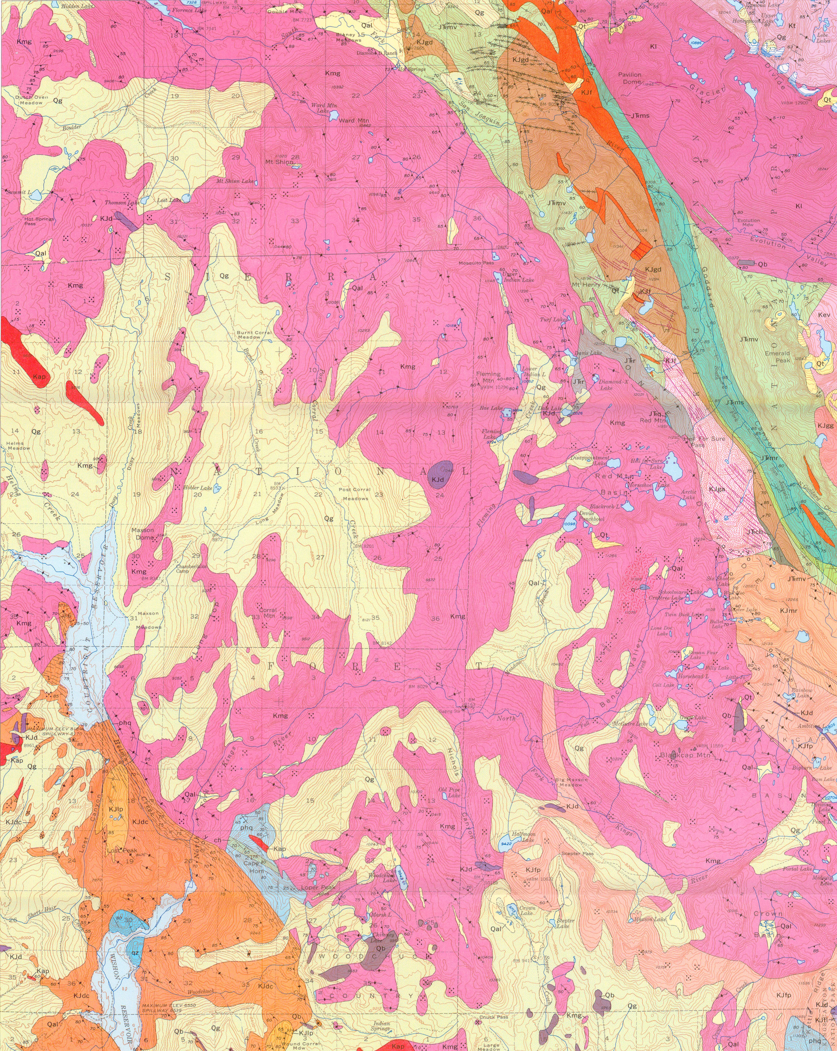
Map Name:
Geologic map of the Blackcap Mountain Quadrangle, Fresno County, California
Author(s):
Source: Geologic Quadrangle Map - U. S. Geological Survey, Report: GQ-0428, 1965
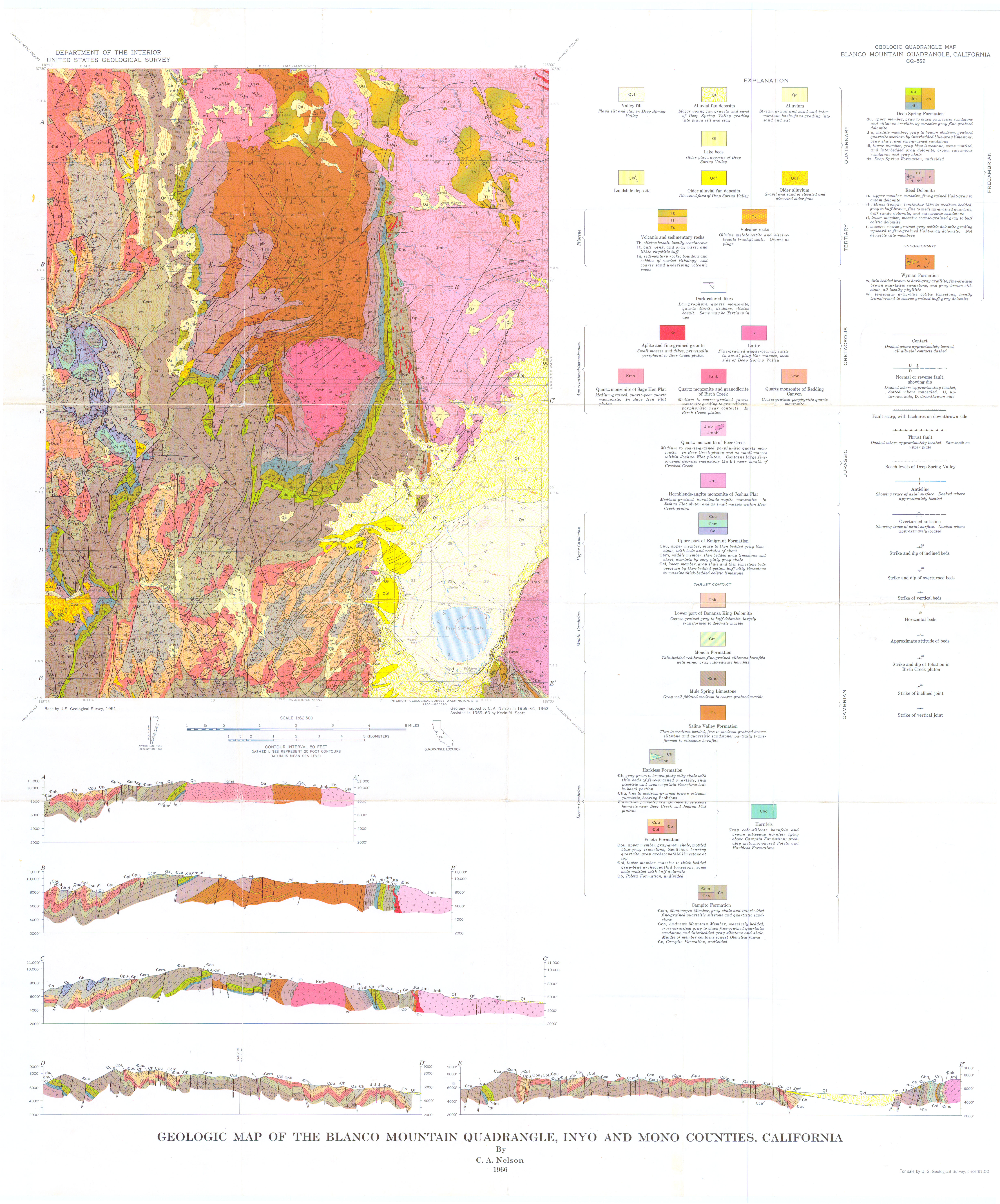
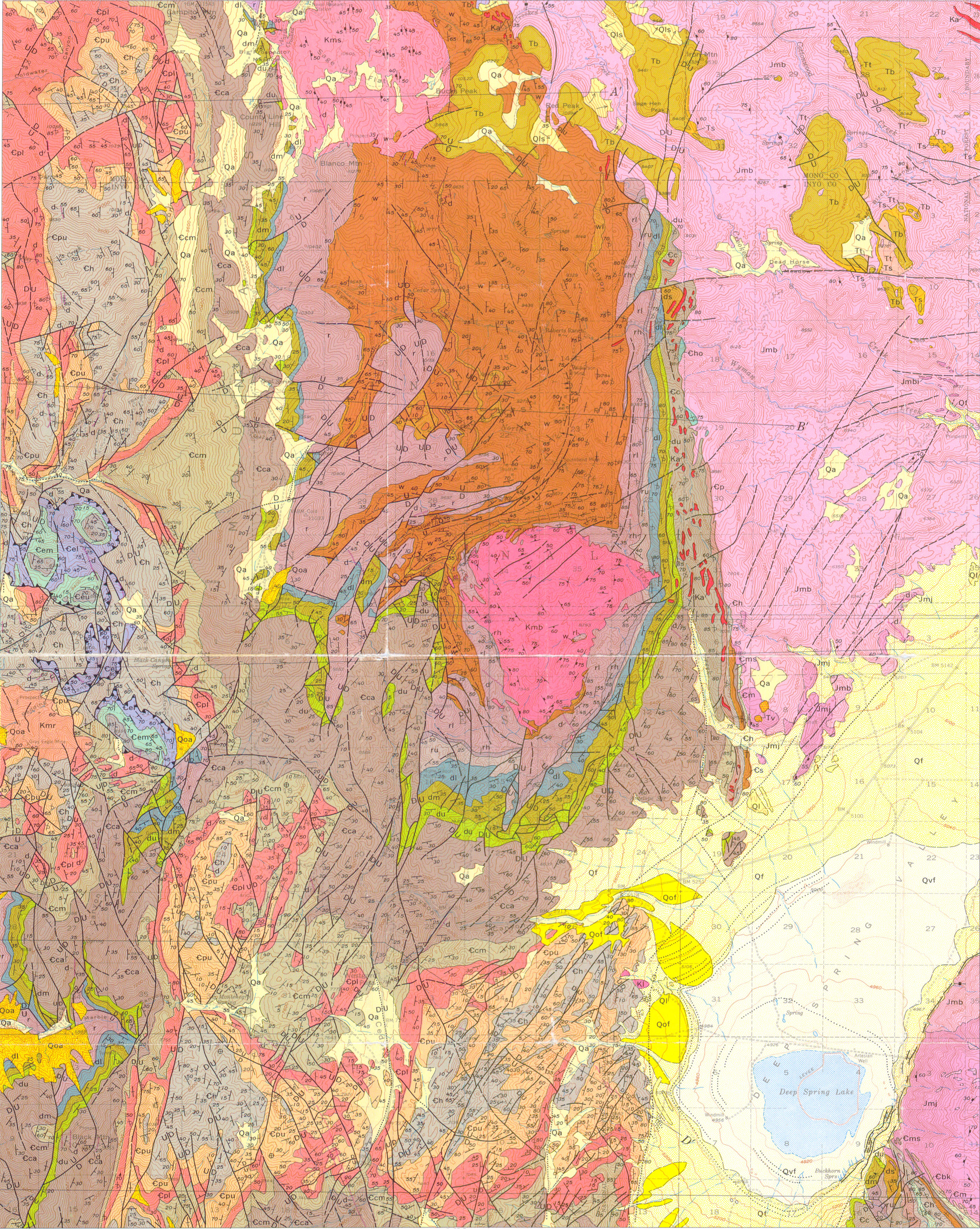
Map Name:
Geologic map of the Blanco Mountain Quadrangle, Inyo and Mono counties, California
Author(s):
Source: eologic Quadrangle Map - U. S. Geological Survey, Report: GQ-0529, 1966
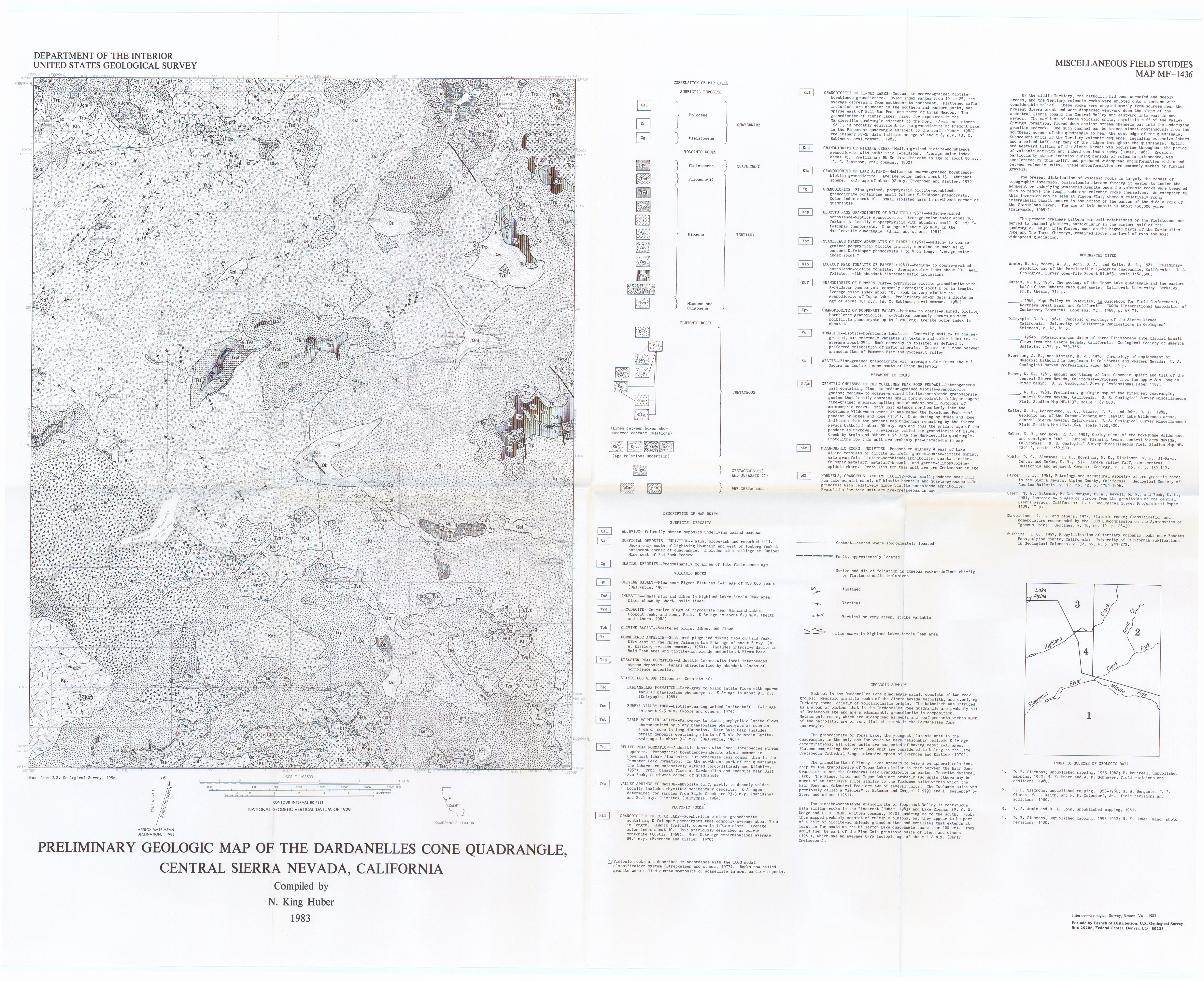
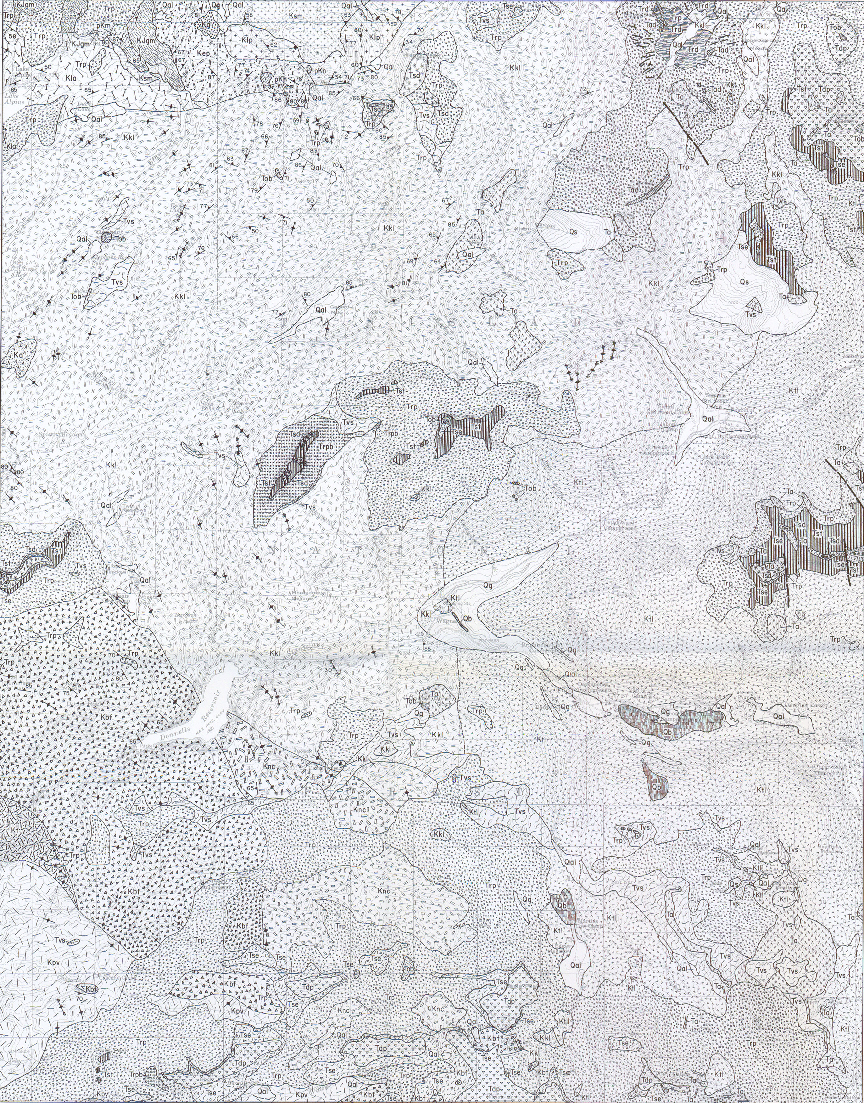
Map Name:
Preliminary geologic map of the Dardanelles Cone Quadrangle, central Sierra Nevada, California
Author(s):
Source: Miscellaneous Field Studies Map - U. S. Geological Survey, Report: MF- 1436, 1 sheet, 1983
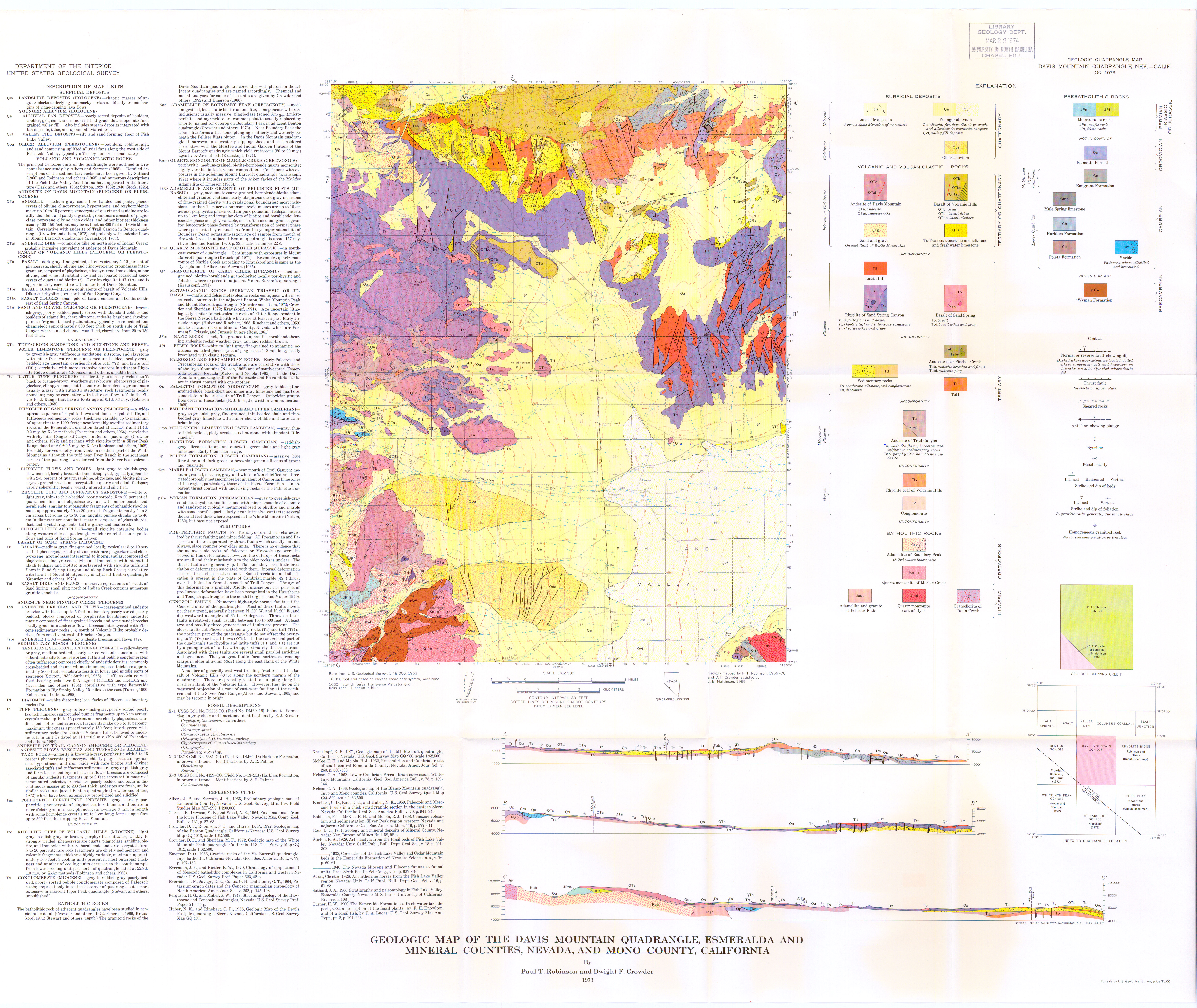
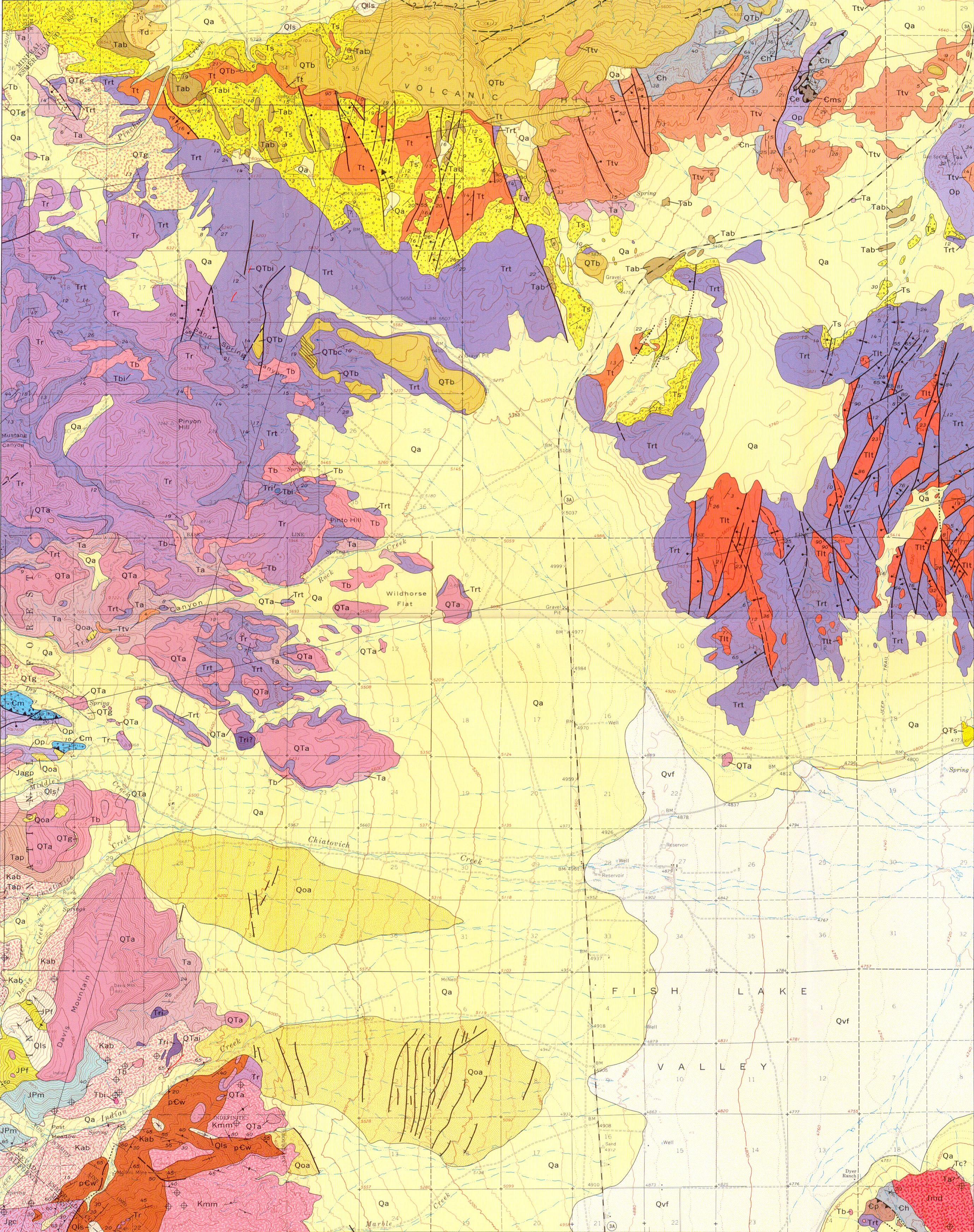
Map Name:
Geologic map of the Davis Mountain Quadrangle, Esmeralda and Mineral counties, Nevada, and Mono County, California
Author(s):
Source: Geologic Quadrangle Map - U. S. Geological Survey, Report: GQ-1078, 1973
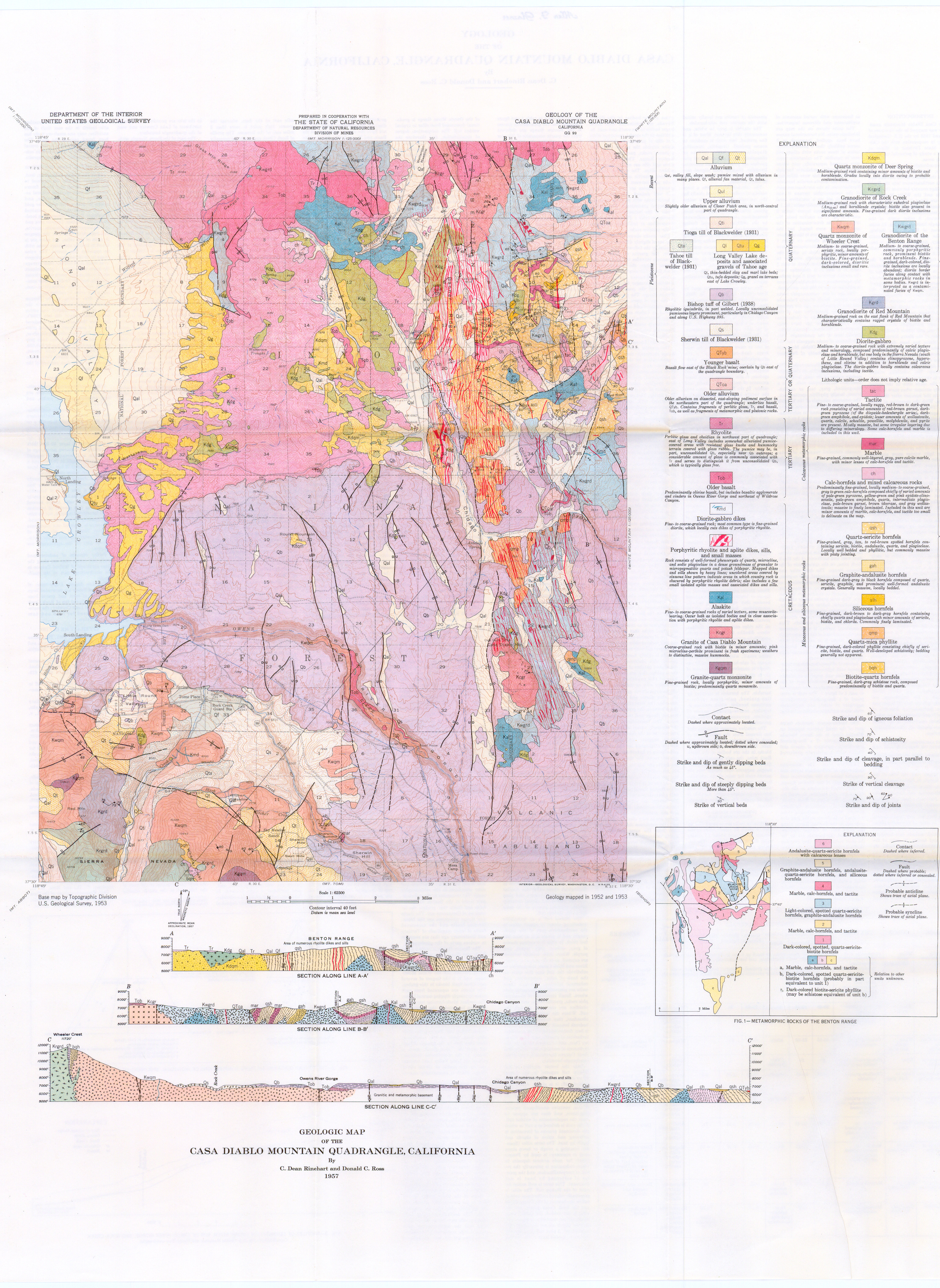
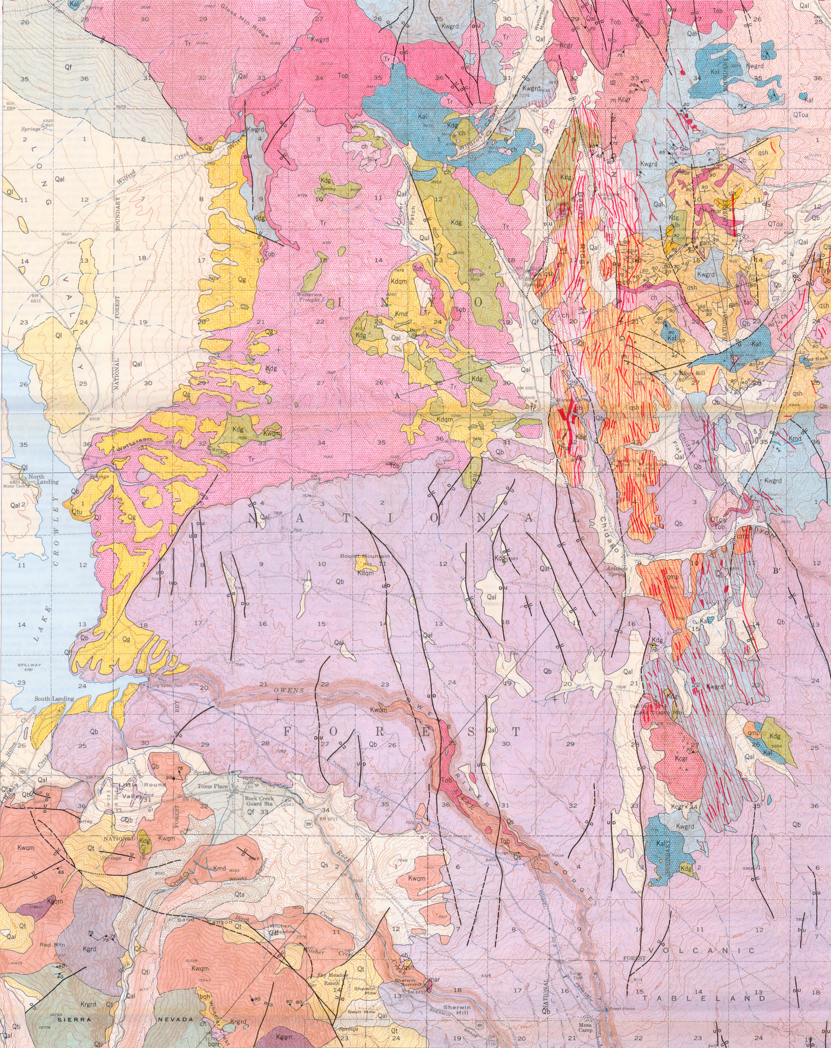
Map Name:
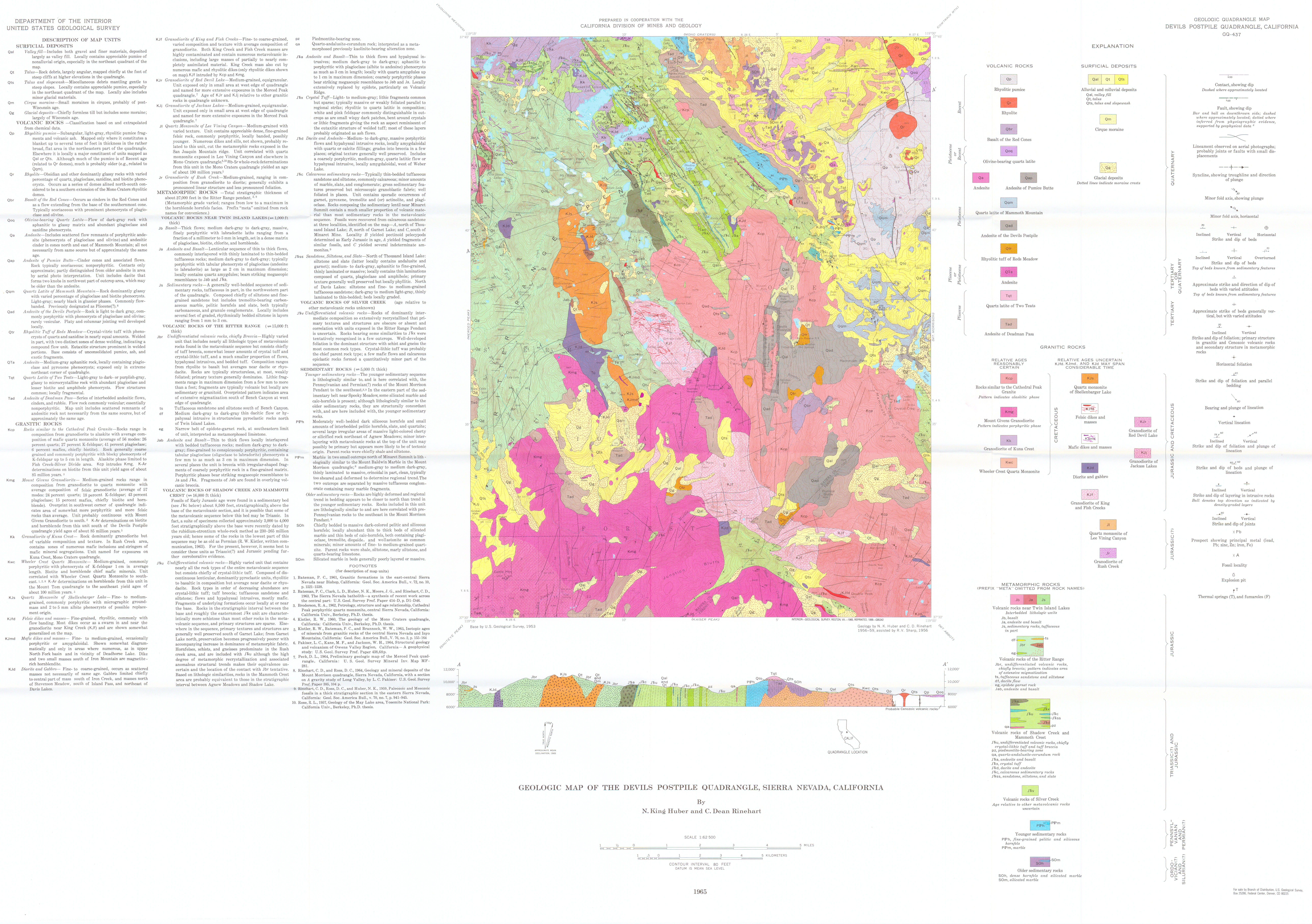
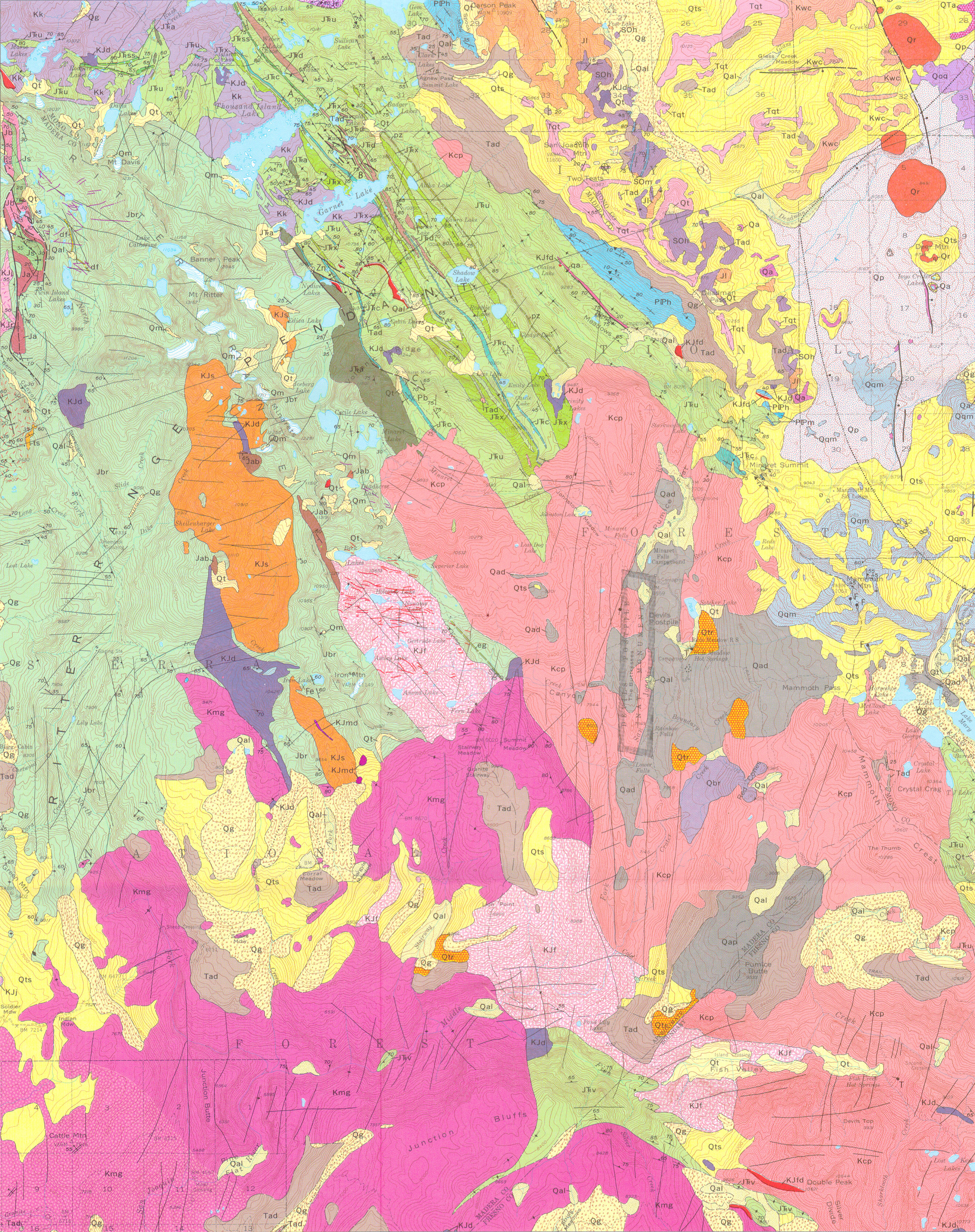
Geologic map of the Devils Postpile Quadrangle, Sierra Nevada, California
Author(s):
Source:
Map Name:
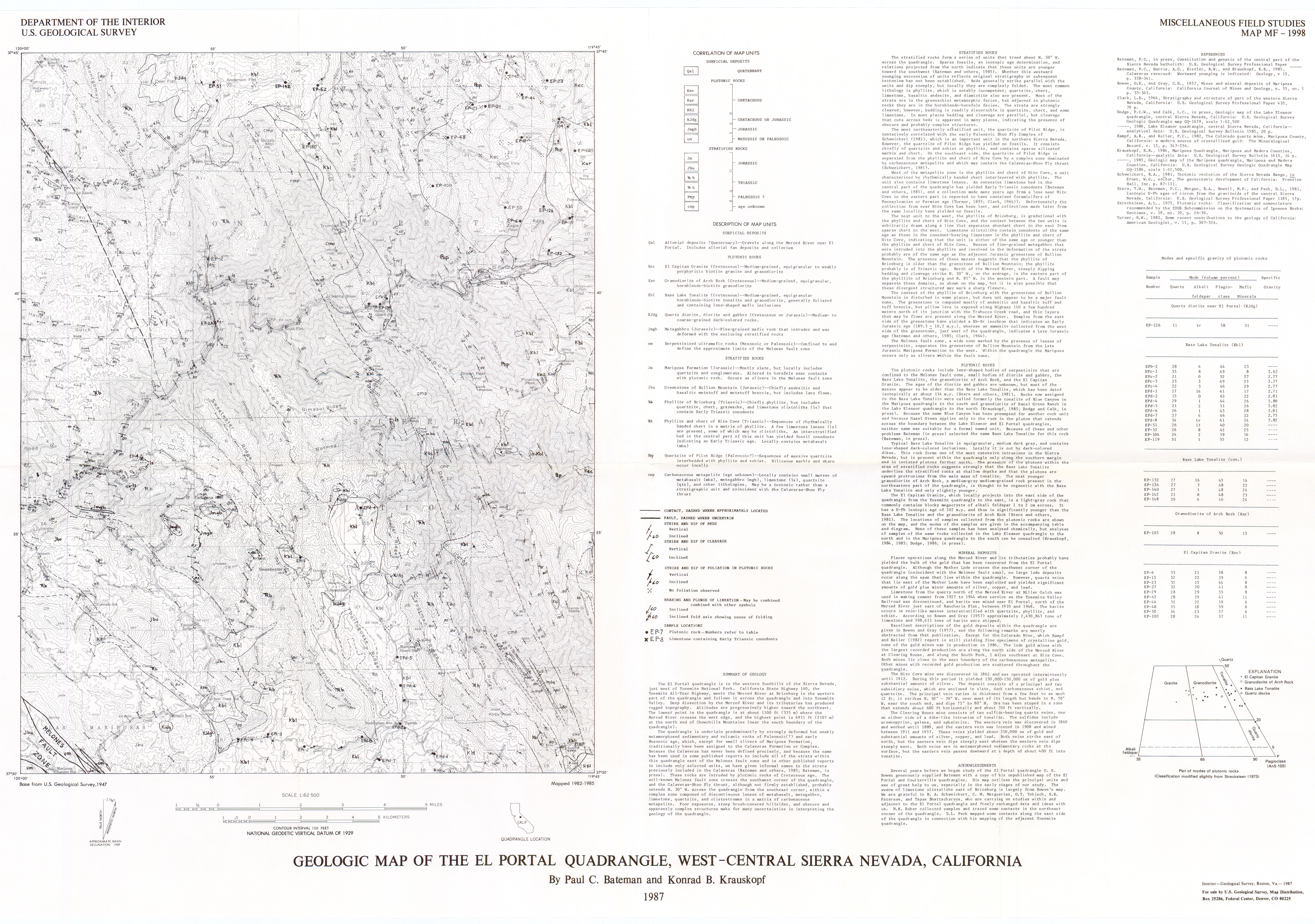
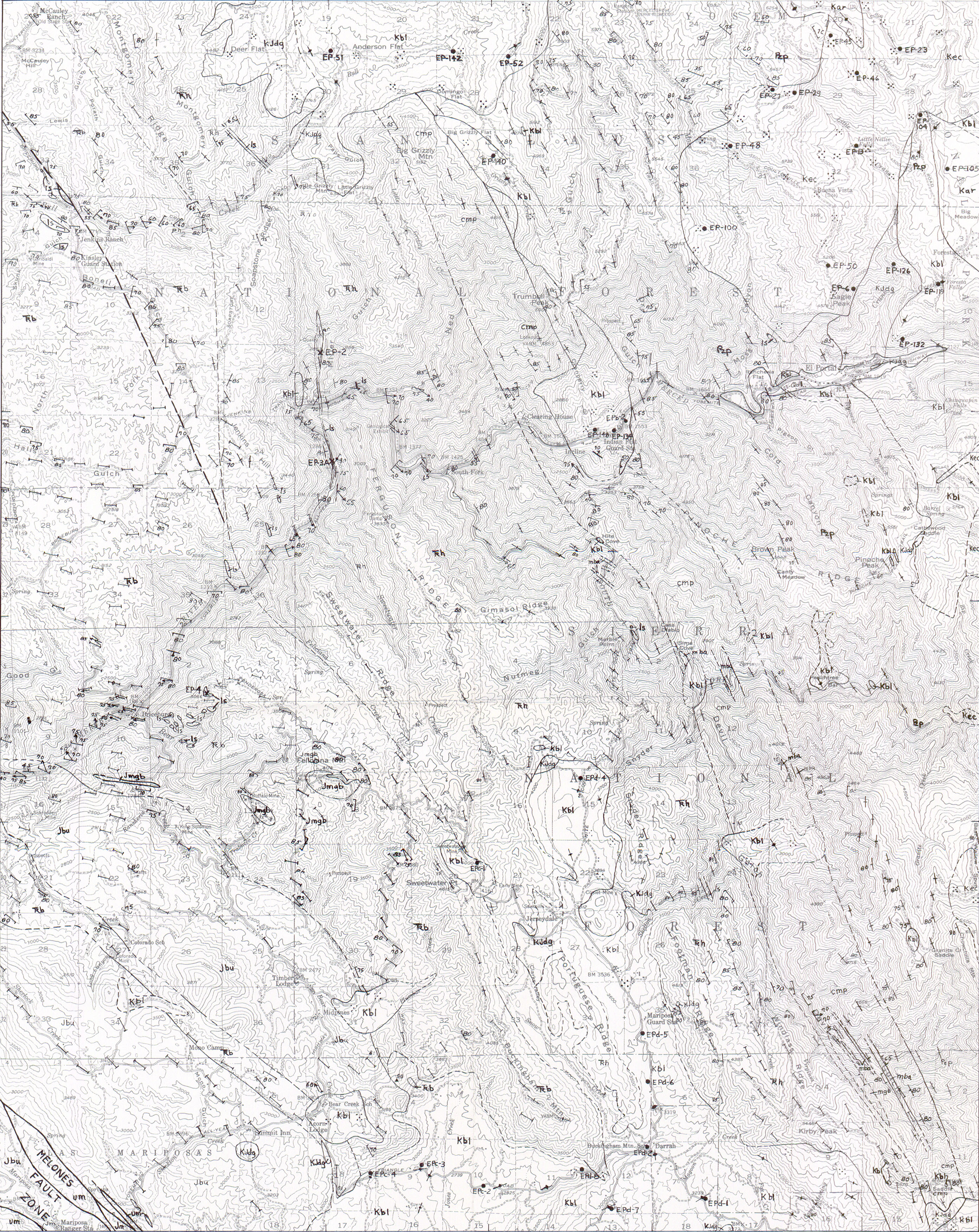
Geologic map of the El Portal Quadrangle, west-central Sierra Nevada, California
Author(s):
Source: Miscellaneous Field Studies Map - U. S. Geological Survey, Report: MF-1998, 1 sheet, 1987
Map Name:
Geologic map of the Freel Peak 15-minute Quadrangle, California and Nevada
Author(s):
Source: Miscellaneous Investigations Series - U. S. Geological Survey, Report: I-1424, 1 sheet, 1983
Map Name:
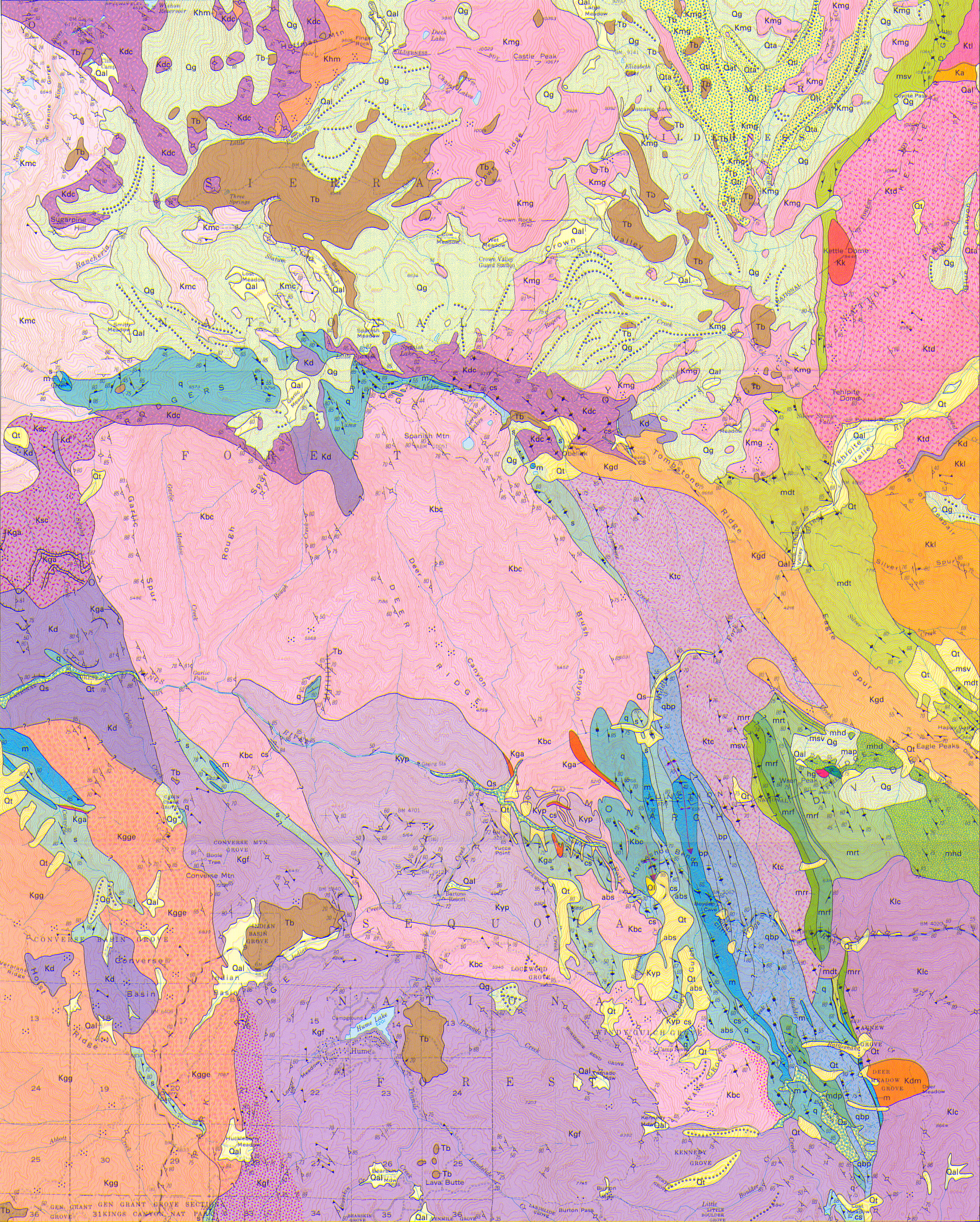
Geologic map of the Giant Forest Quadrangle, Tulare County, California
Author(s):
Source: Geologic Quadrangle Map - U. S. Geological Survey, Report: GQ-1751, 1 sheet, 1994
Map Name:
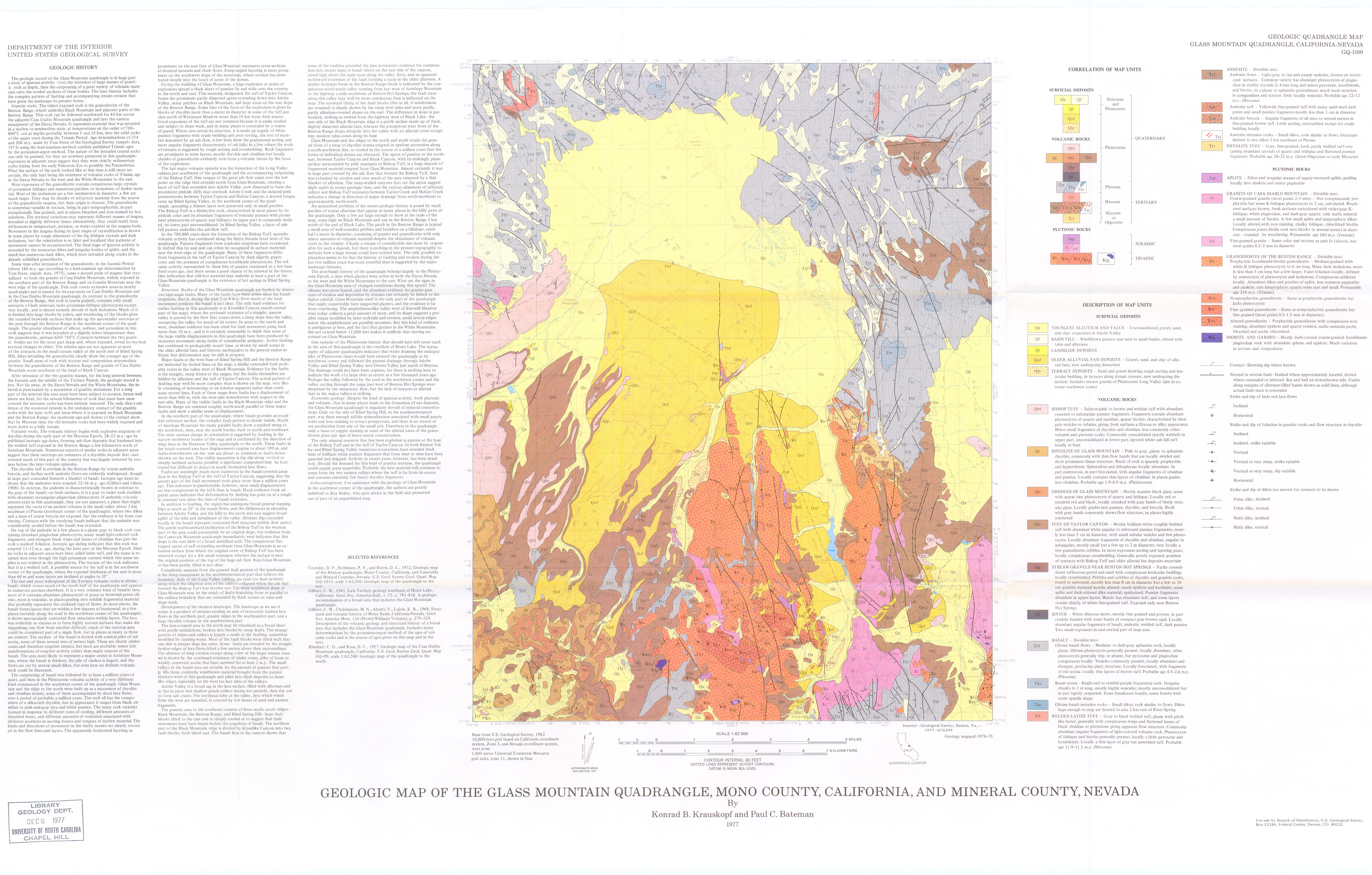
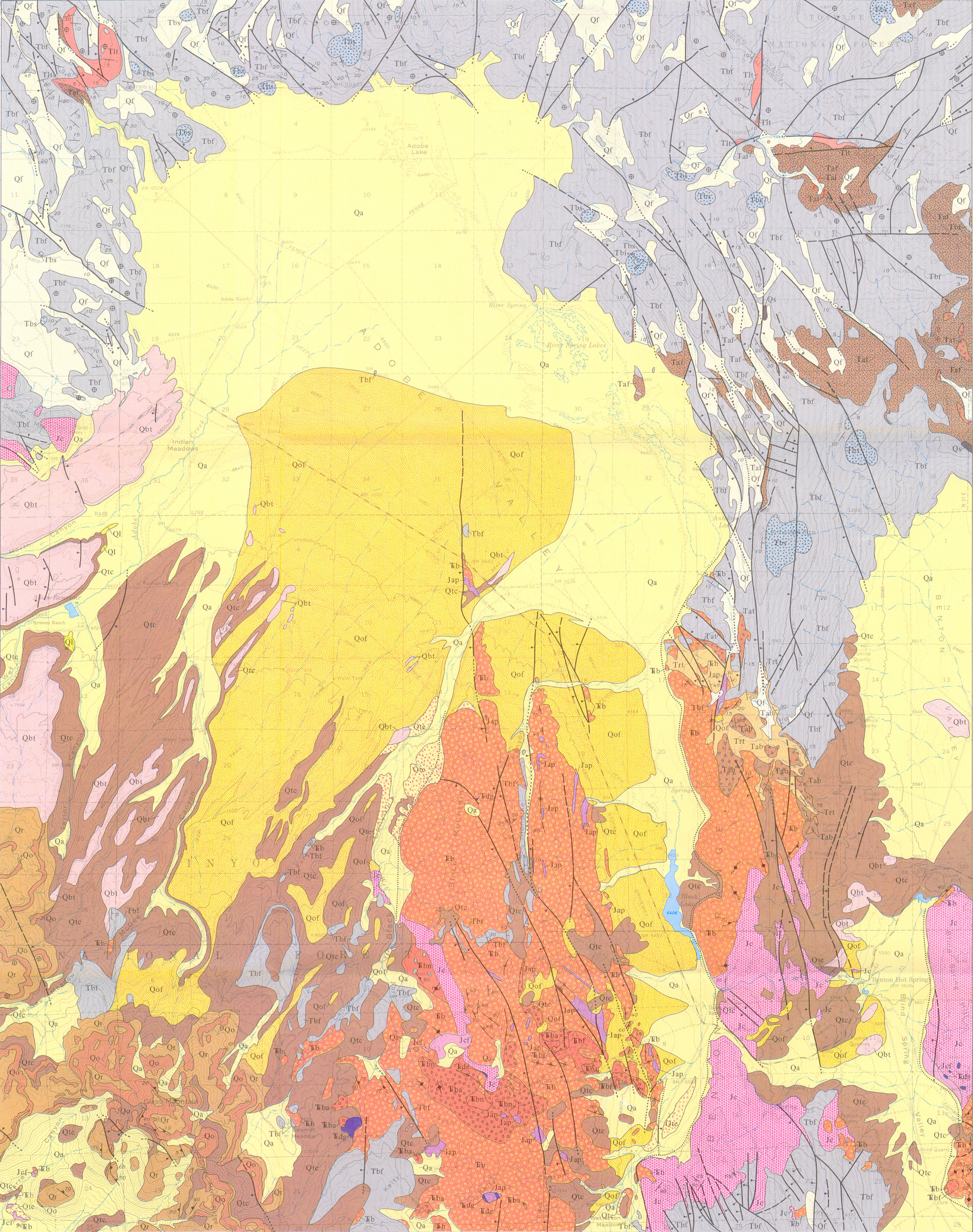
Geologic map of the Glass Mountain Quadrangle, Mono County, California, and Mineral County, Nevada
Author(s):
Source: Geologic Quadrangle Map - U. S. Geological Survey, Report: GQ-1099, 1977
Map Name:
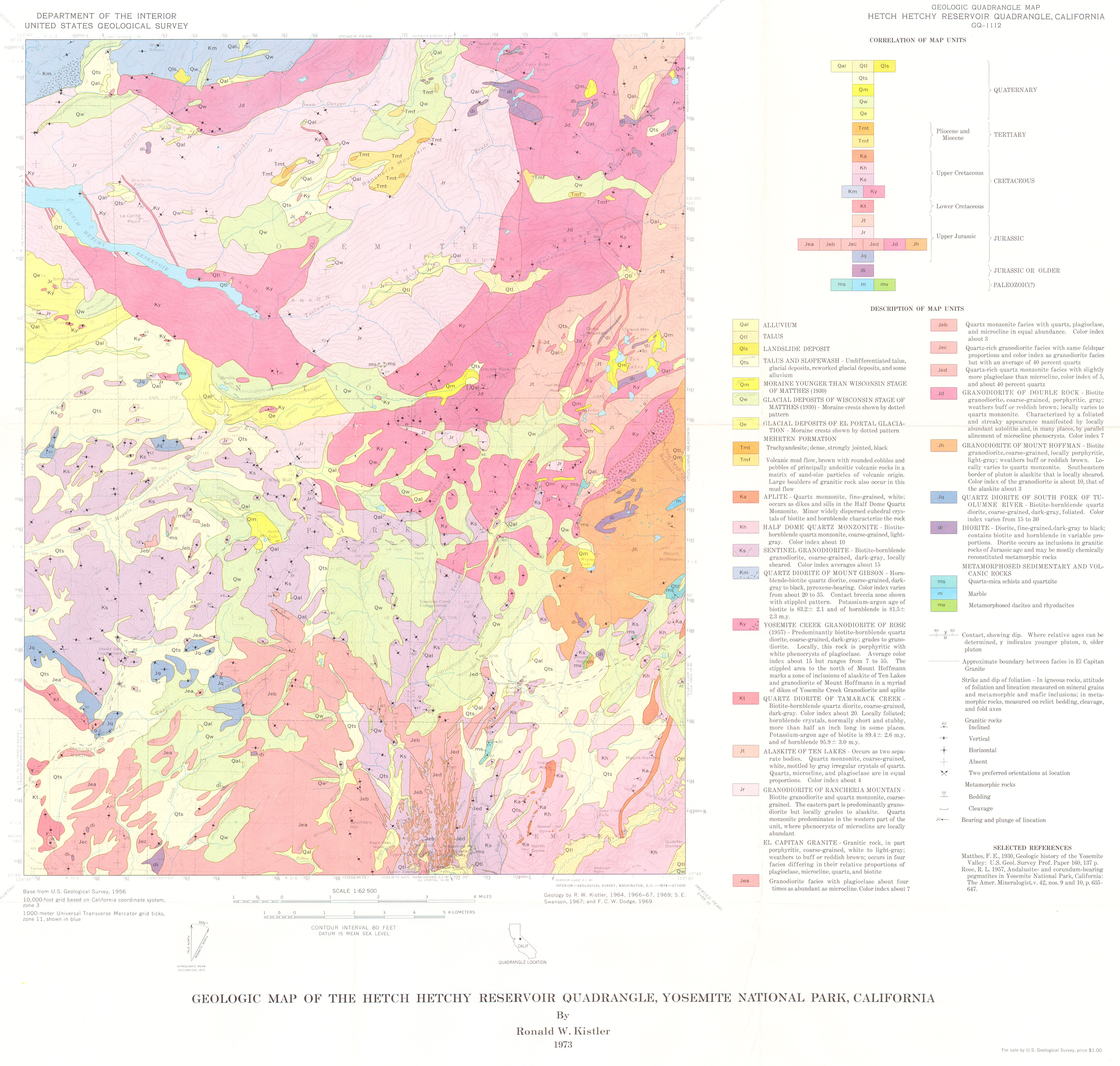
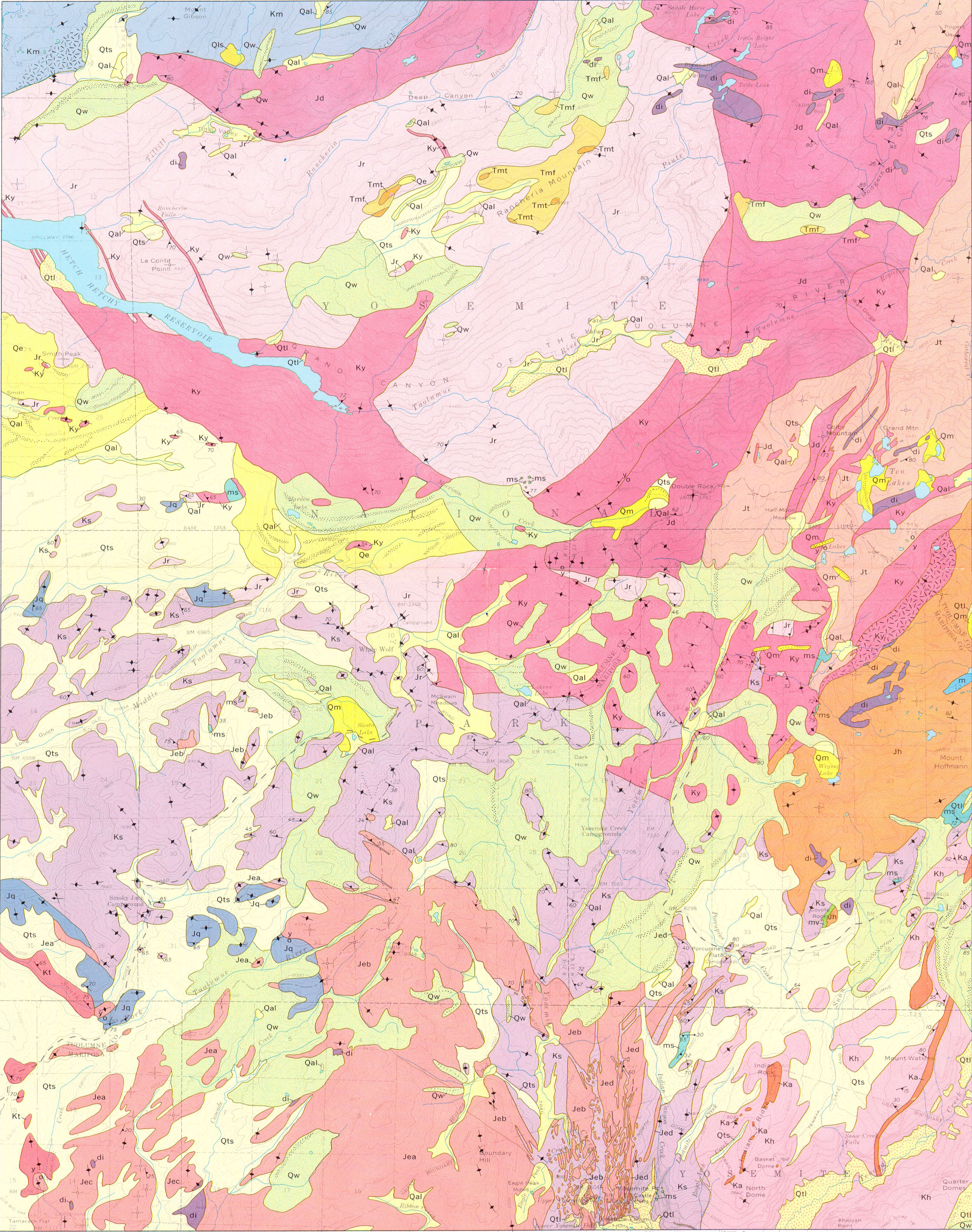
Geologic map of the Hetch Hetchy Reservoir Quadrangle, Yosemite National Park, California
Author(s):
Source: Geologic Quadrangle Map - U. S. Geological Survey, Report: GQ-1112, 1973
Map Name:
Geologic map of the Huntington Lake Quadrangle, central Sierra Nevada, California
Author(s):
Source: Geologic Quadrangle Map - U. S. Geological Survey, Report: GQ-0987, 1972
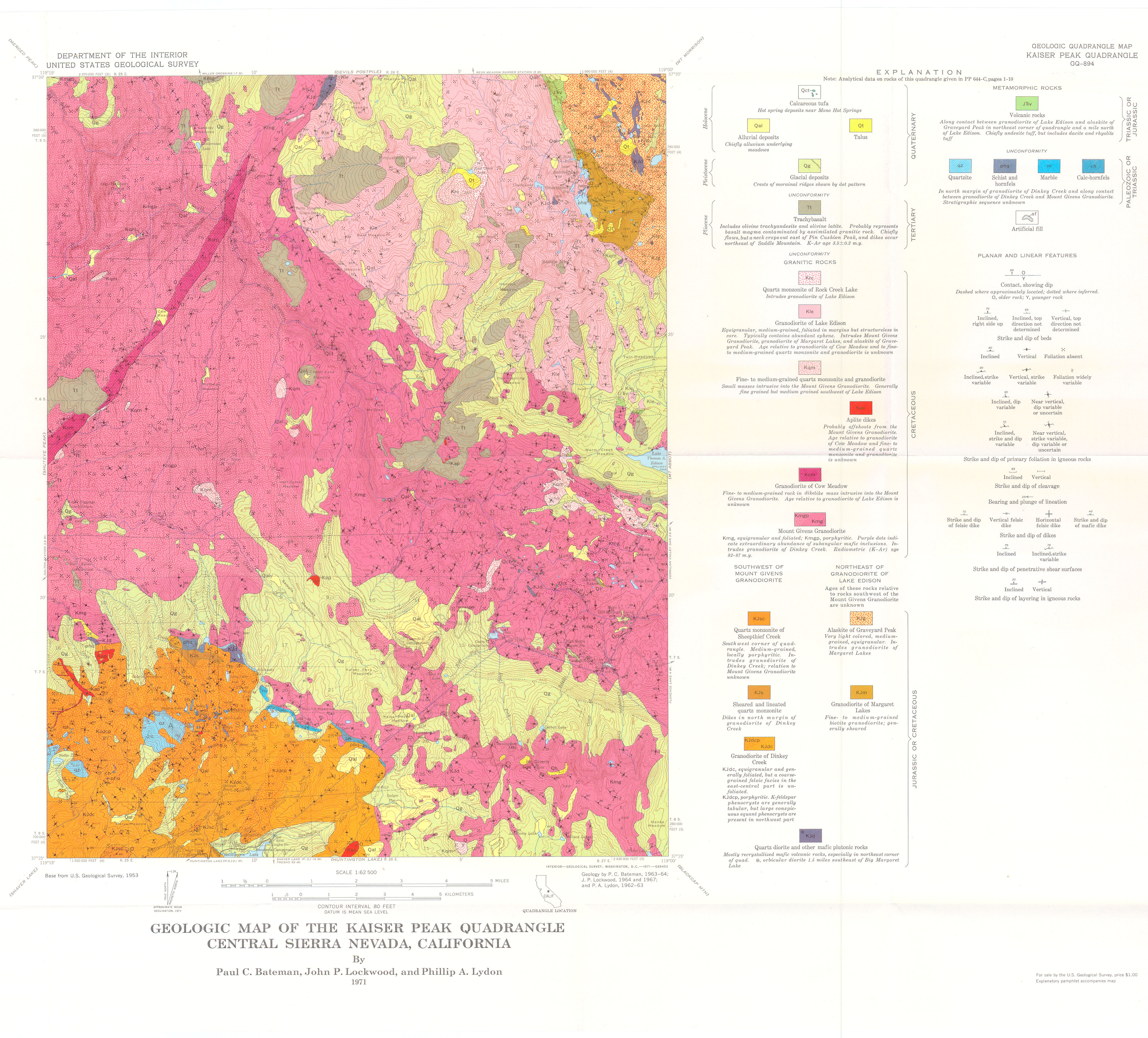
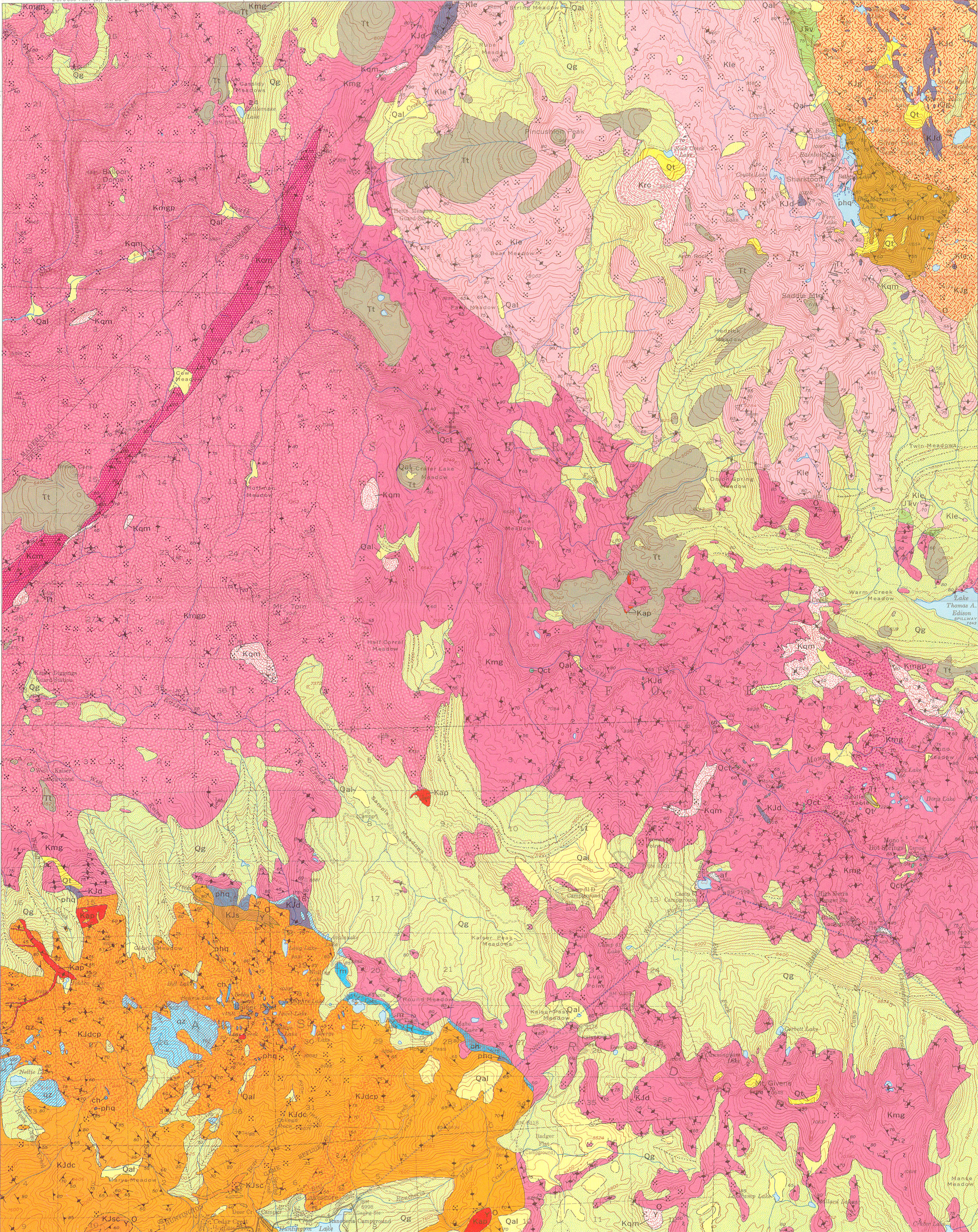
Map Name:
Geologic map of the Kaiser Peak Quadrangle, central Sierra Nevada, California
Author(s):
Source: Geologic Quadrangle Map - U. S. Geological Survey, Report: GQ-0894, 1971
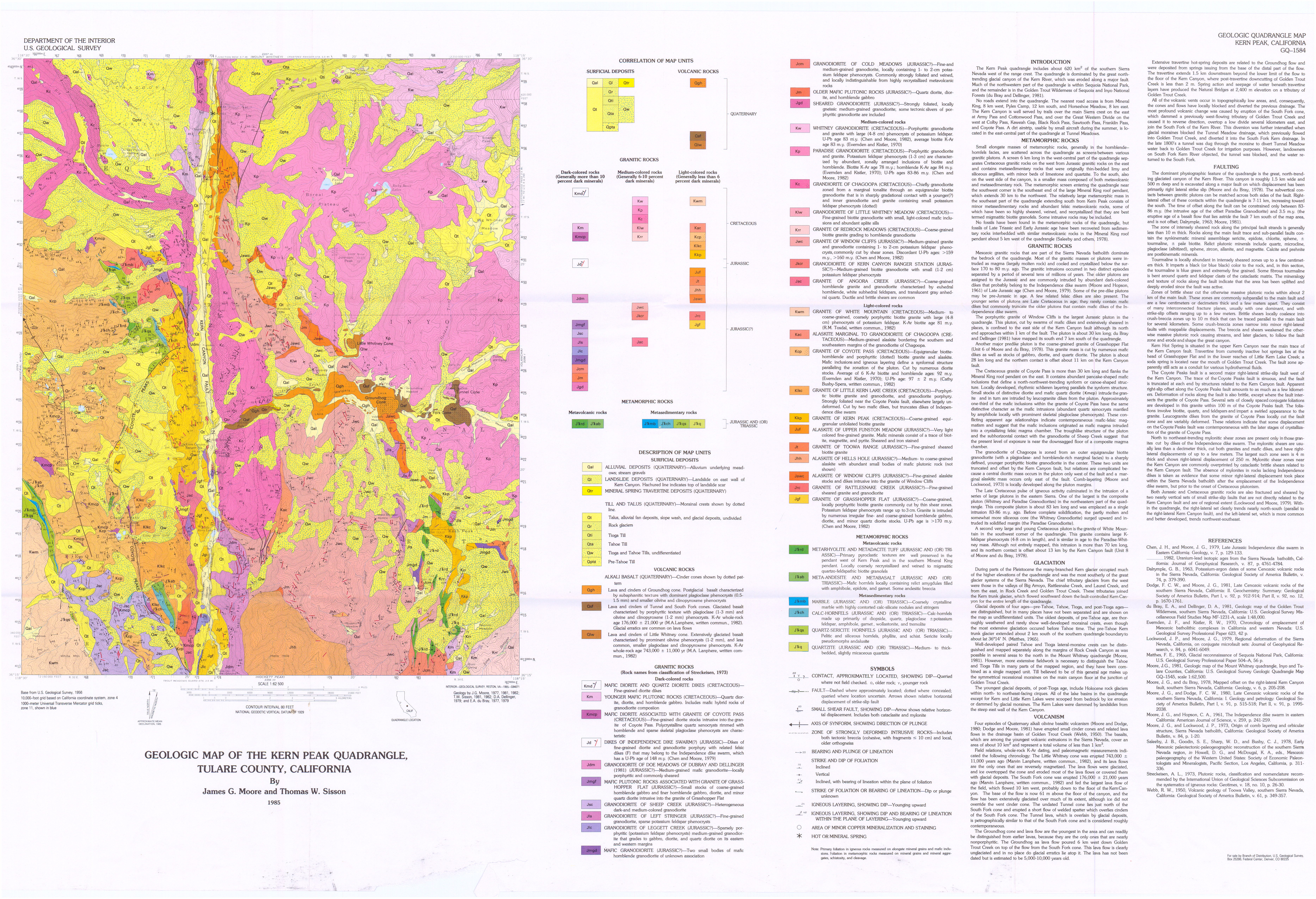
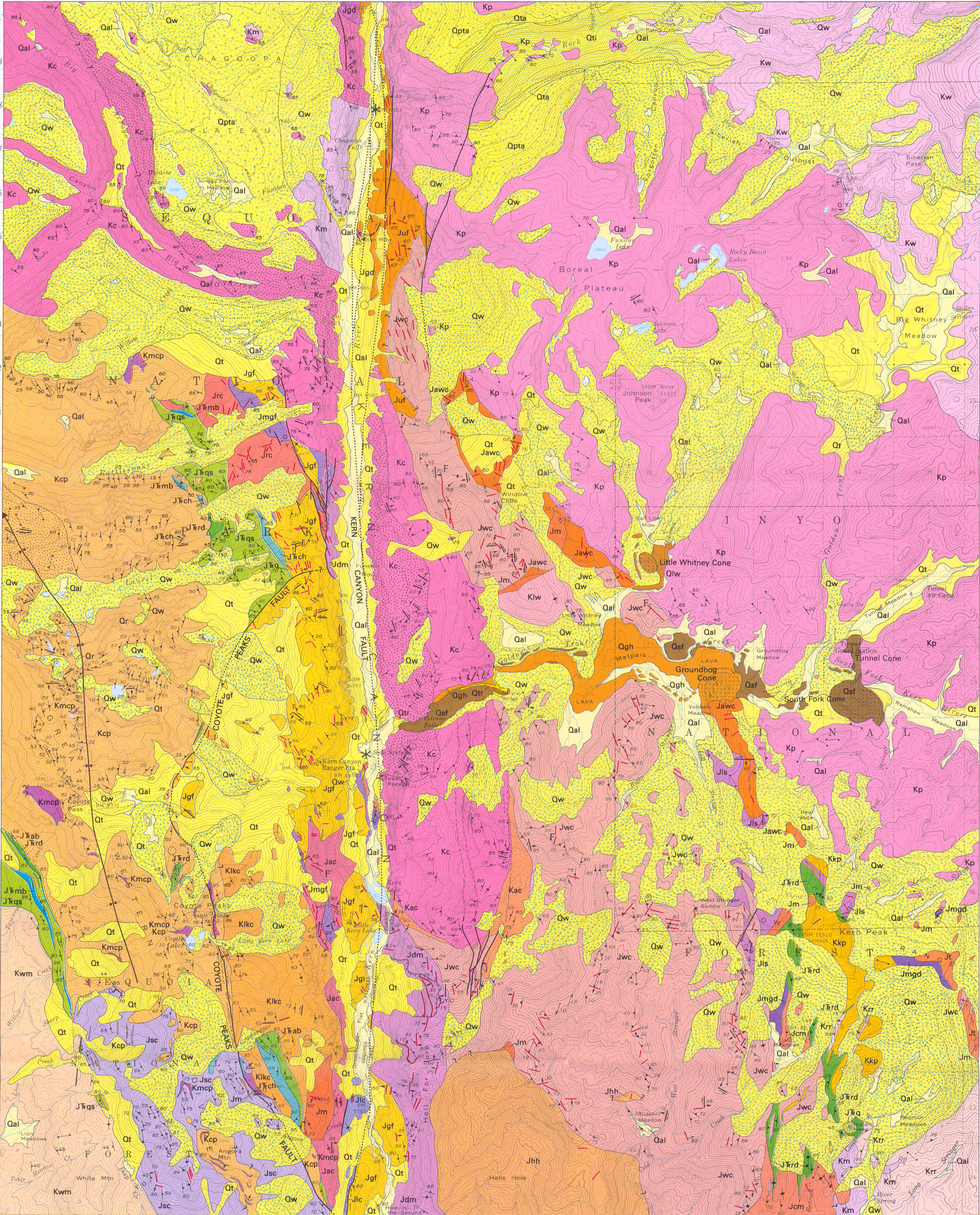
Map Name:
Geologic map of the Kern Peak Quadrangle, Tulare County, California
Author(s):
Source: Geologic Quadrangle Map - U. S. Geological Survey, Report: GQ-1584, 1 sheet, 1985
Map Name:
Geologic map of the Lake Eleanor Quadrangle, central Sierra Nevada, California
Author(s):
Source: Geologic Quadrangle Map - U. S. Geological Survey, Report: GQ-1639, 1 sheet, 1987
Map Name:
Geologic map of the Lone Pine 15' quadrangle, Inyo County, California
Author(s):
Source: Geologic Investigations Series - U. S. Geological Survey, Report: I-2617, 1 sheet, 2000
Map Name:
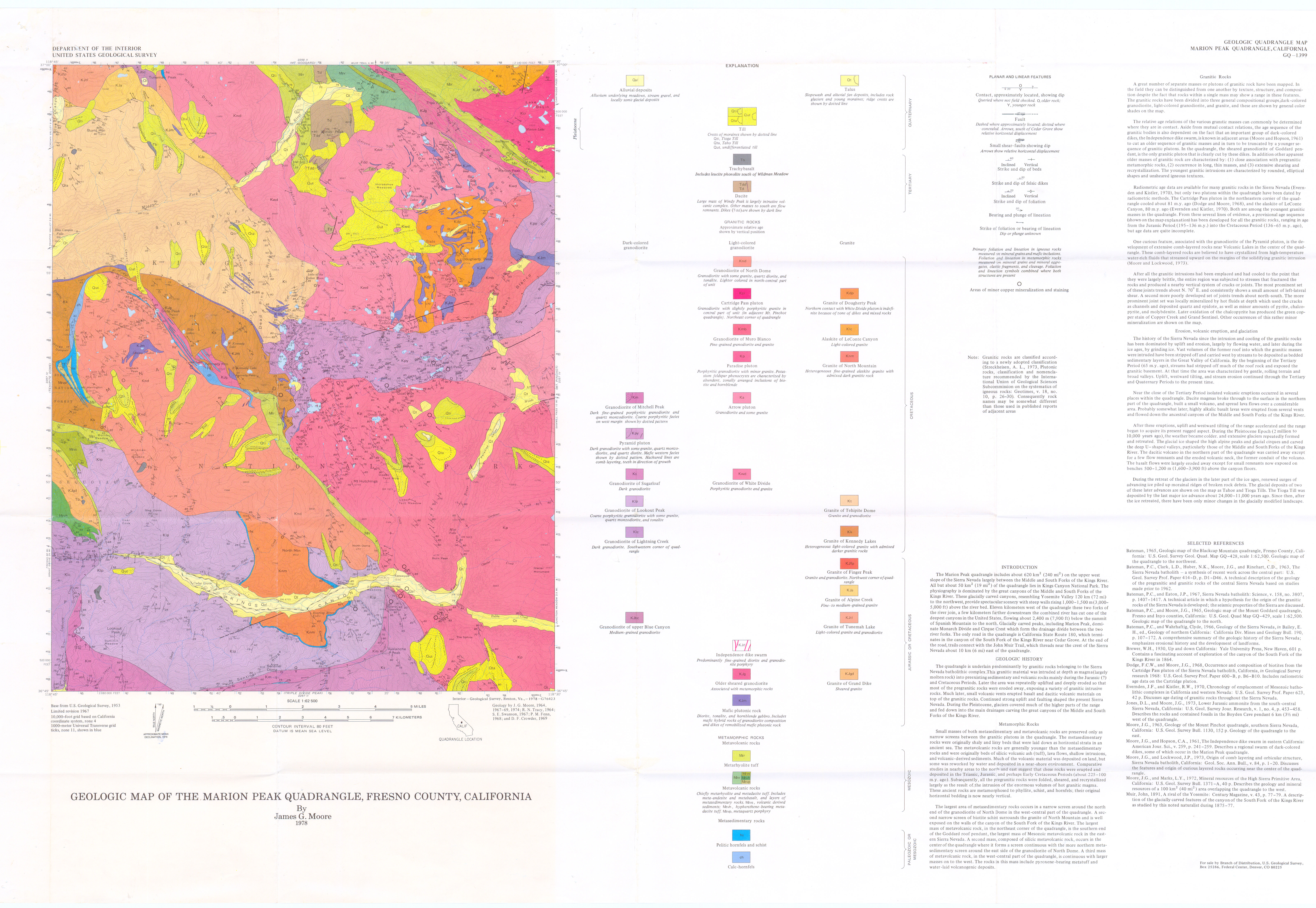
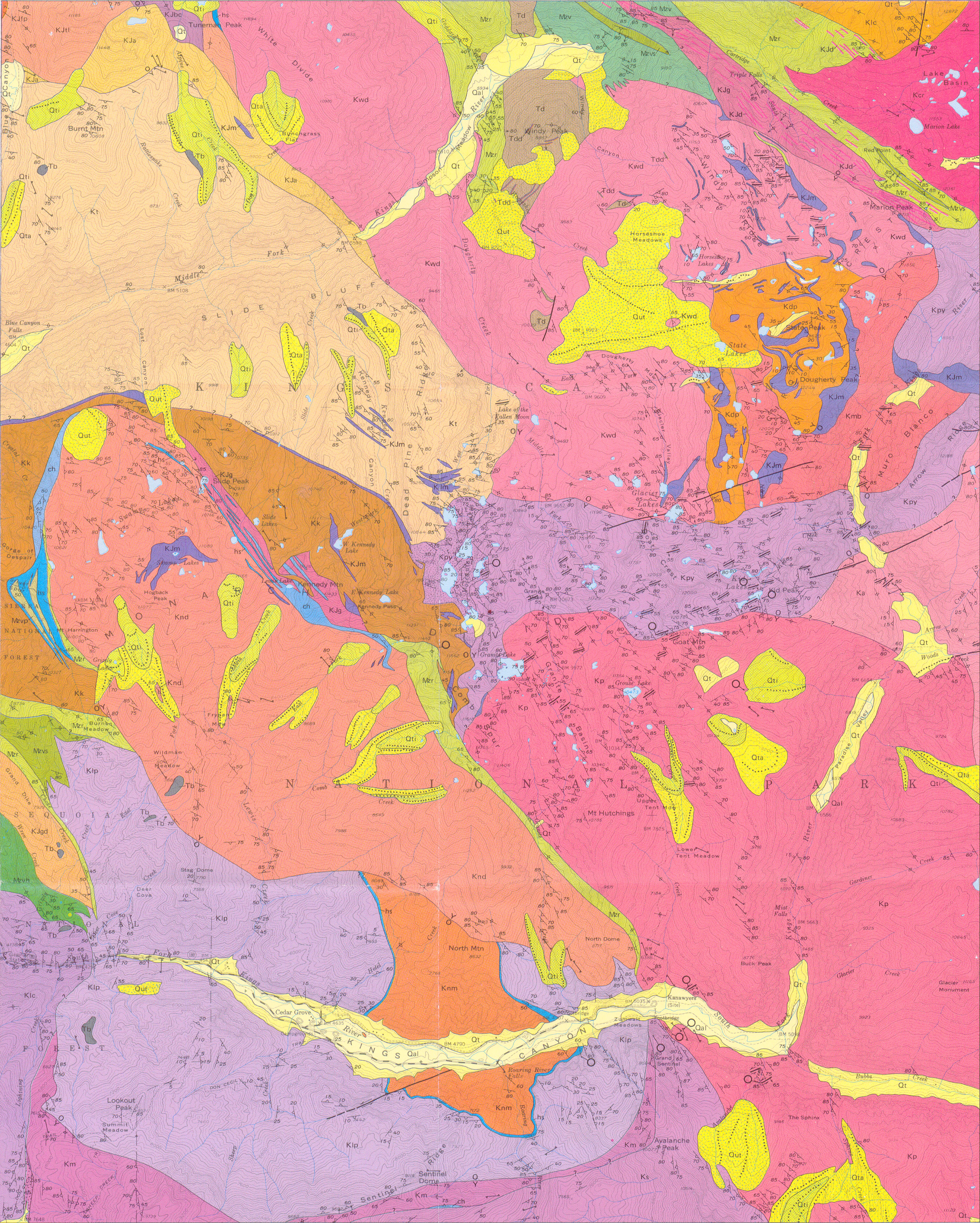
Geologic map of the Marion Peak Quadrangle, Fresno County, California
Author(s):
Source: Geologic Quadrangle Map - U. S. Geological Survey, Report: GQ- 1399, 1 sheet, 1978
Map Name:
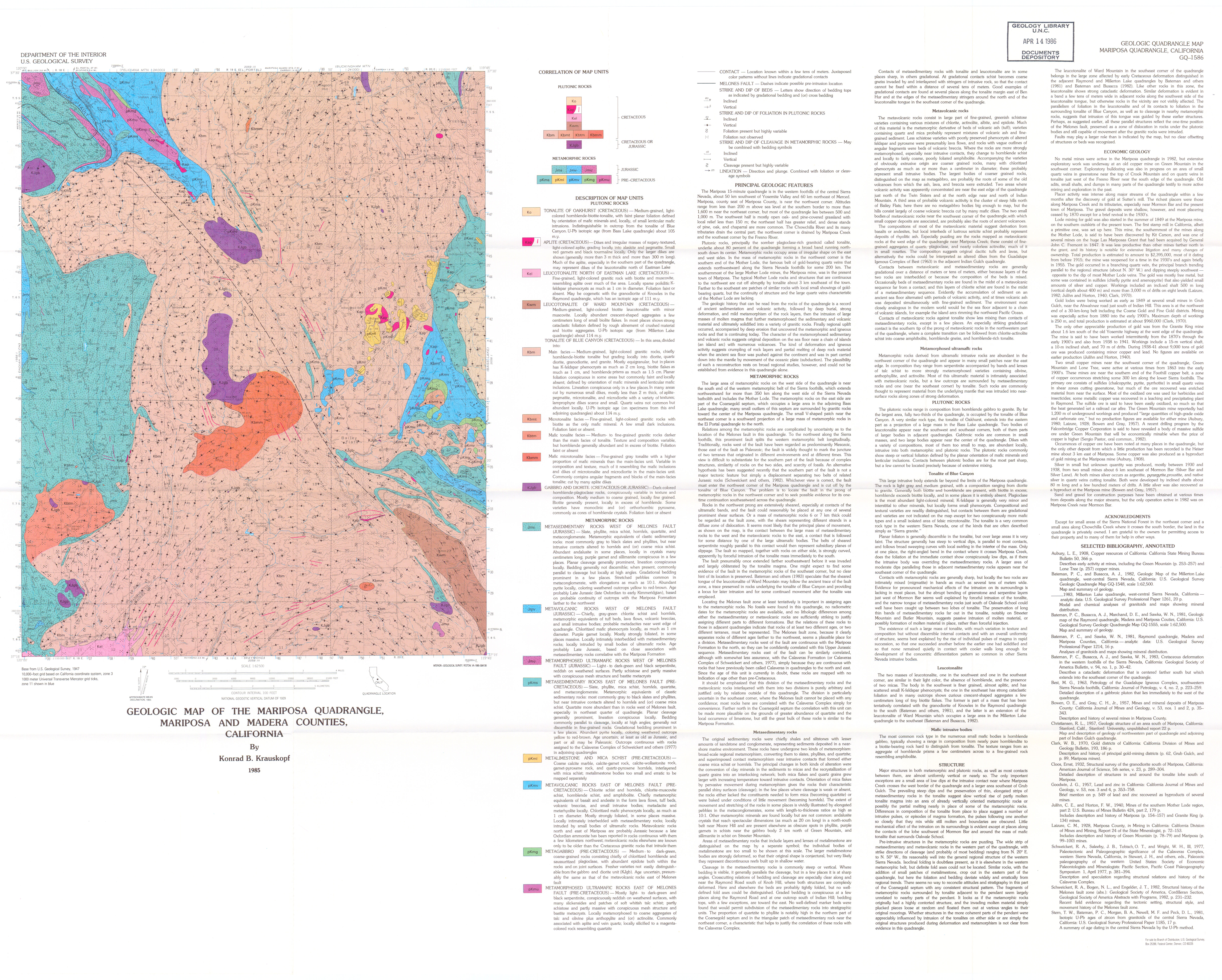
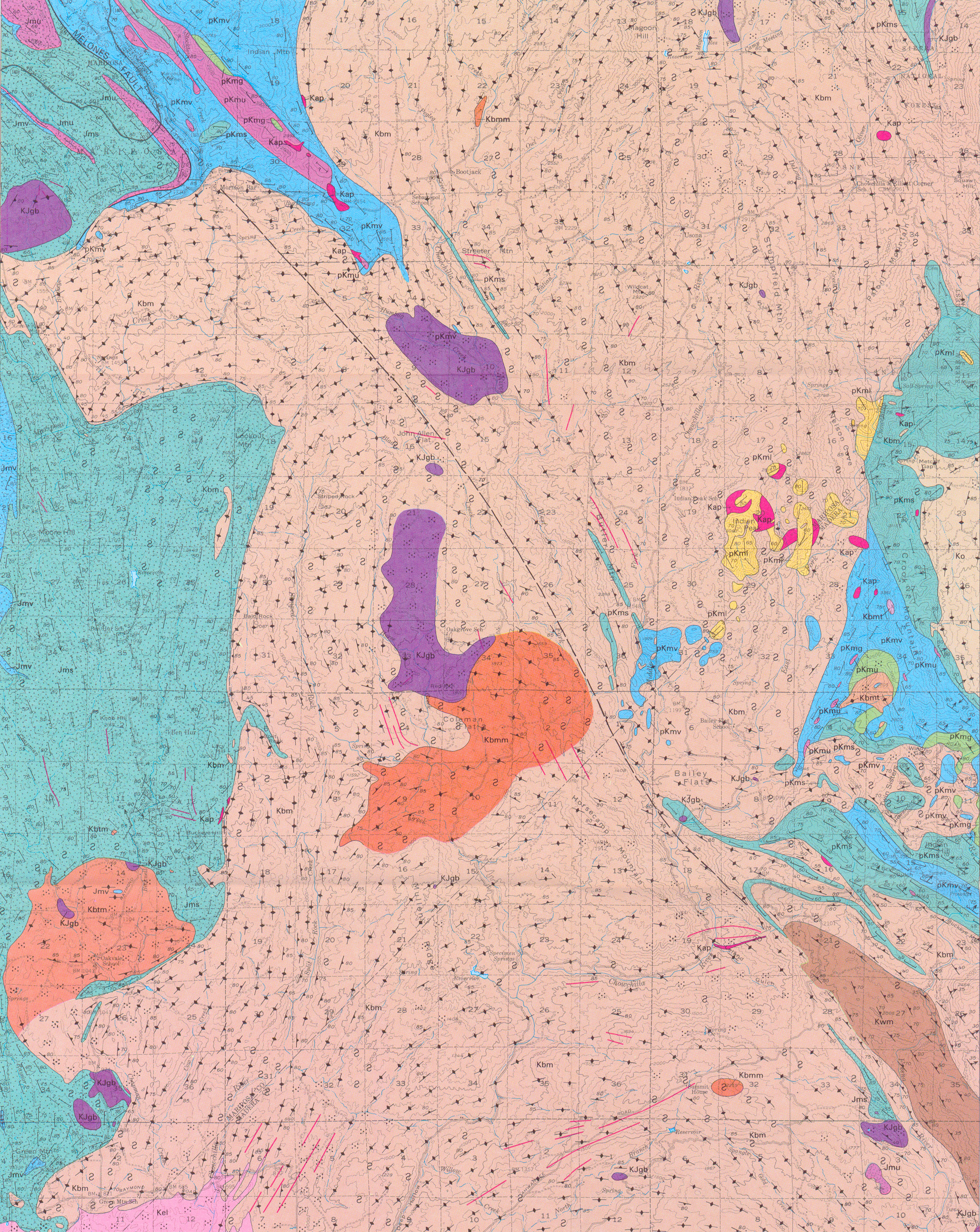
Geologic map of the Mariposa Quadrangle, Mariposa and Madera counties, California
Author(s):
Source: Geologic Quadrangle Map - U. S. Geological Survey, Report: GQ-1586, 1 sheet, 1985
Map Name:
Geologic map of the Markleeville 15-minute Quadrangle, Alpine County, California
Author(s):
Source: Miscellaneous Investigations Series - U. S. Geological Survey, Report: I-1474, 1 sheet, 1984
Map Name:
Geologic map of the Merced Peak Quadrangle, central Sierra Nevada, California
Author(s):
Source: Geologic Quadrangle Map - U. S. Geological Survey, Report: GQ- 1531, 1 sheet, 1980
Map Name:
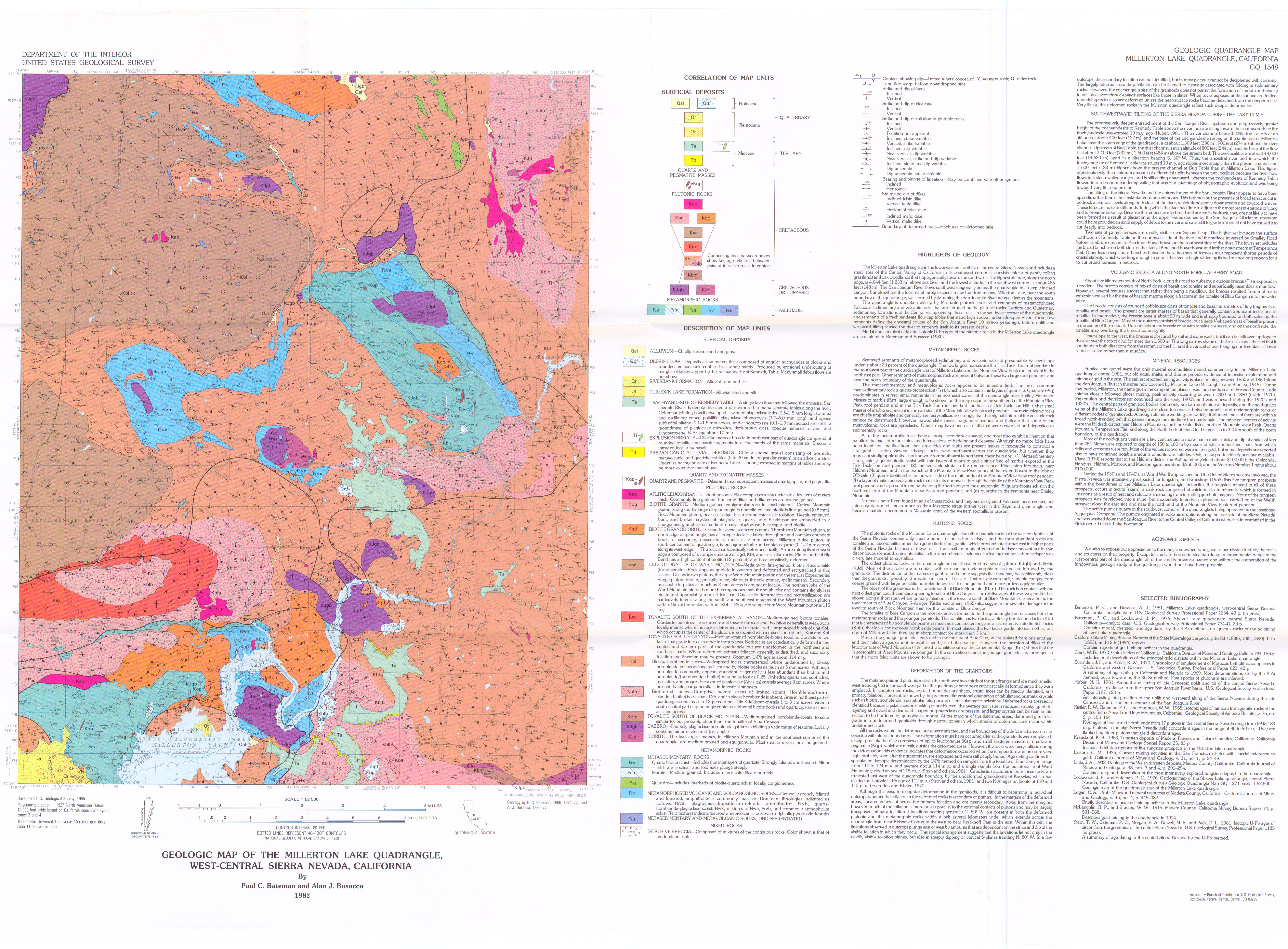
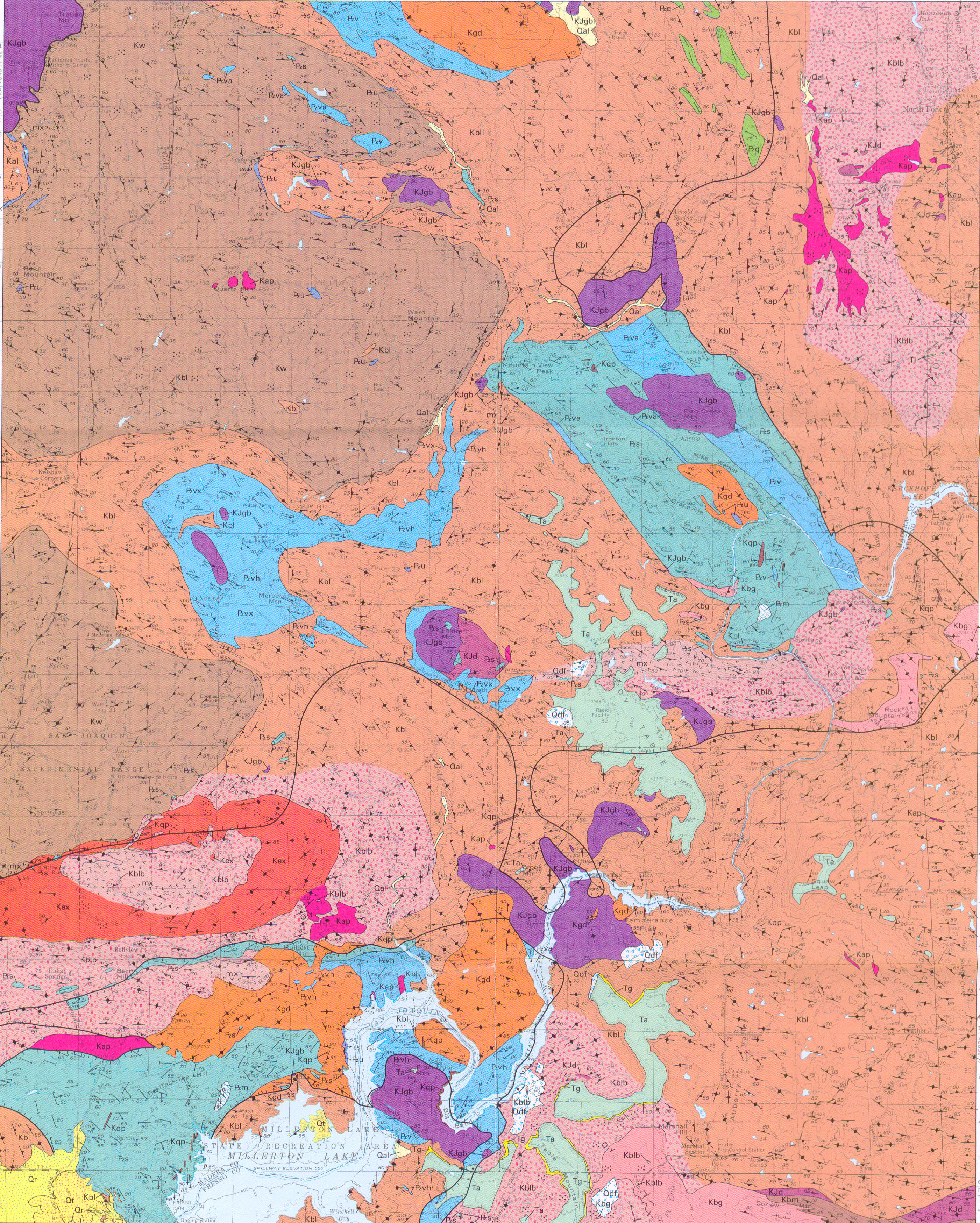
Geologic map of the Millerton Lake Quadrangle, west-central Sierra Nevada, California
Author(s):
Source: Geologic Quadrangle Map - U. S. Geological Survey, Report: GQ- 1548, 1 sheet, 1982
Map Name:
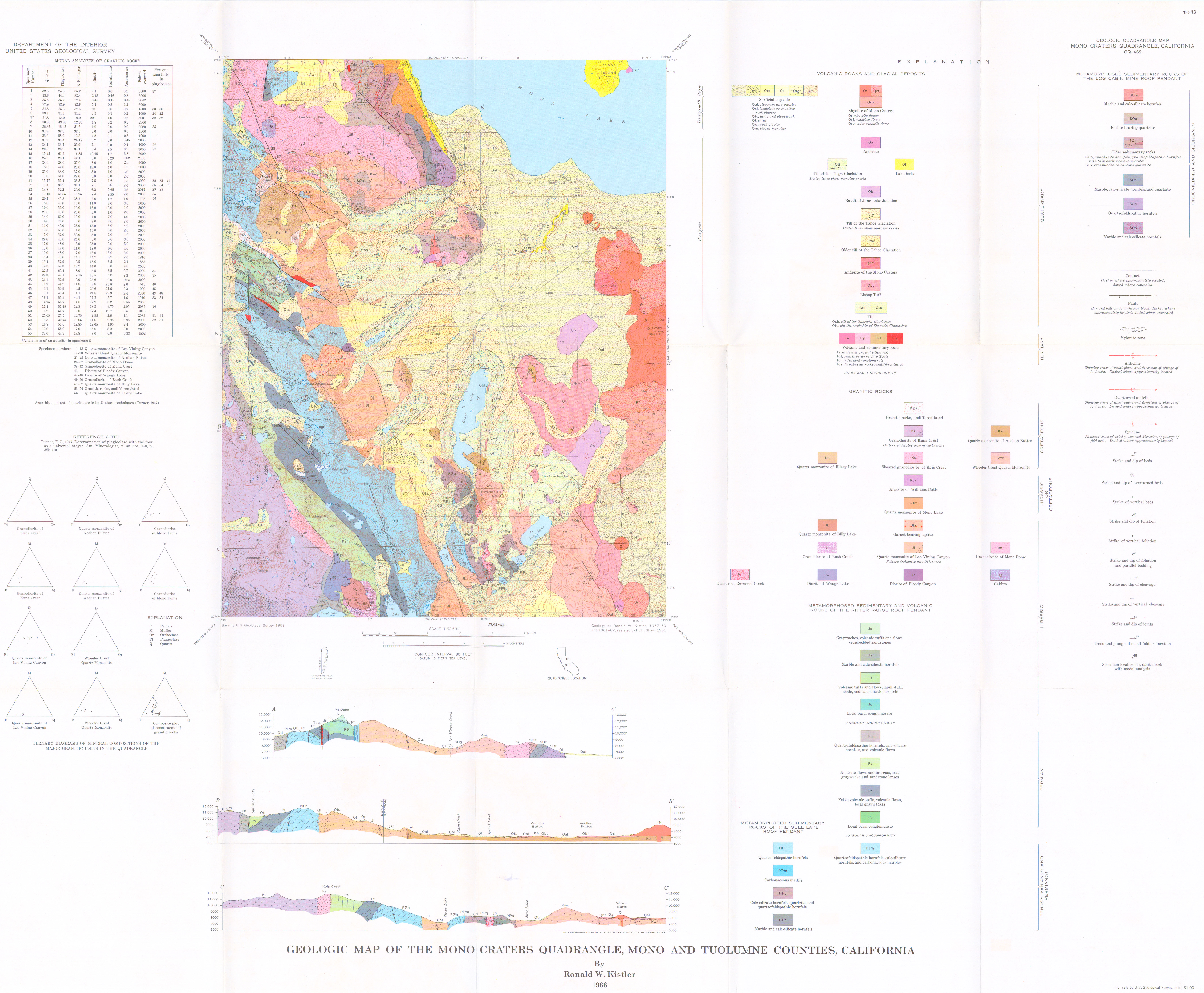
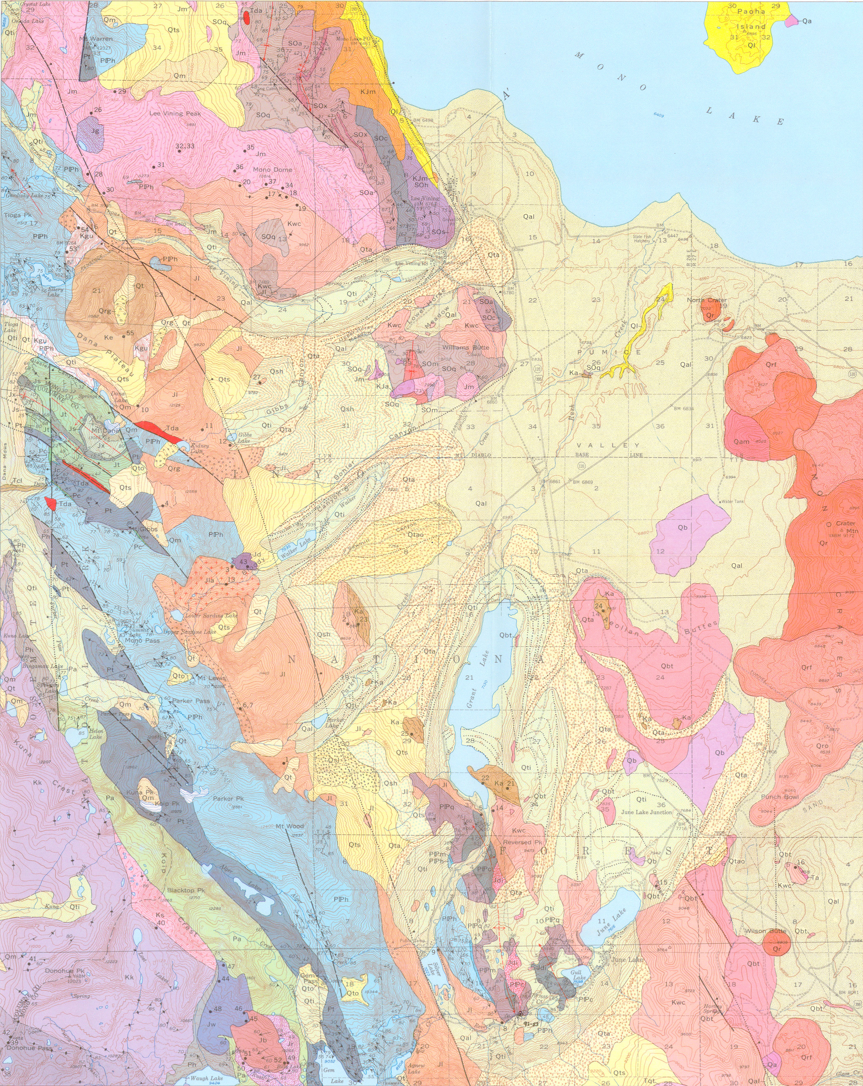
Geologic map of the Mono Craters Quadrangle, Mono and Tuolumne counties, California
Author(s):
Source: Geologic Quadrangle Map - U. S. Geological Survey, Report: GQ-0462, 1966
Map Name:
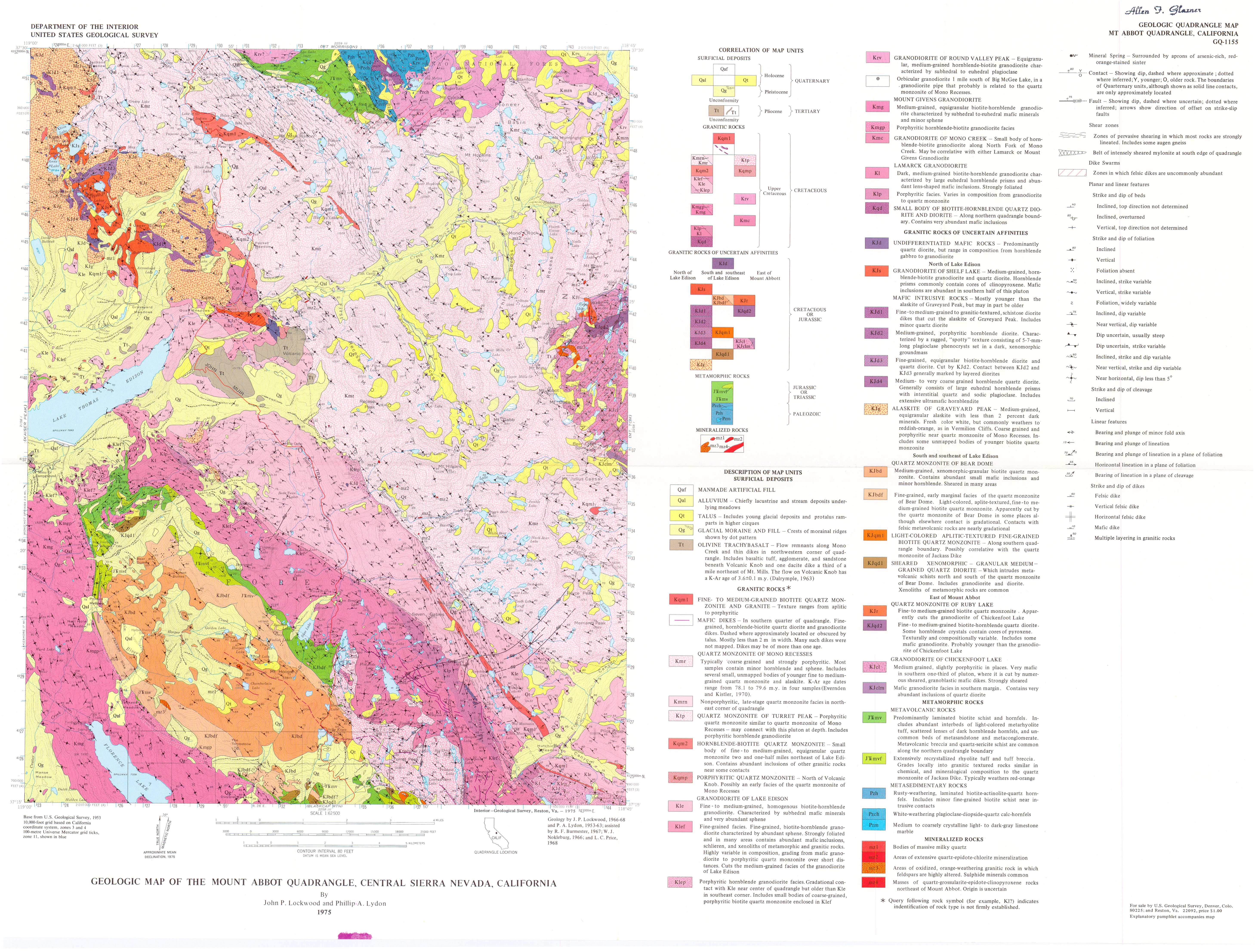
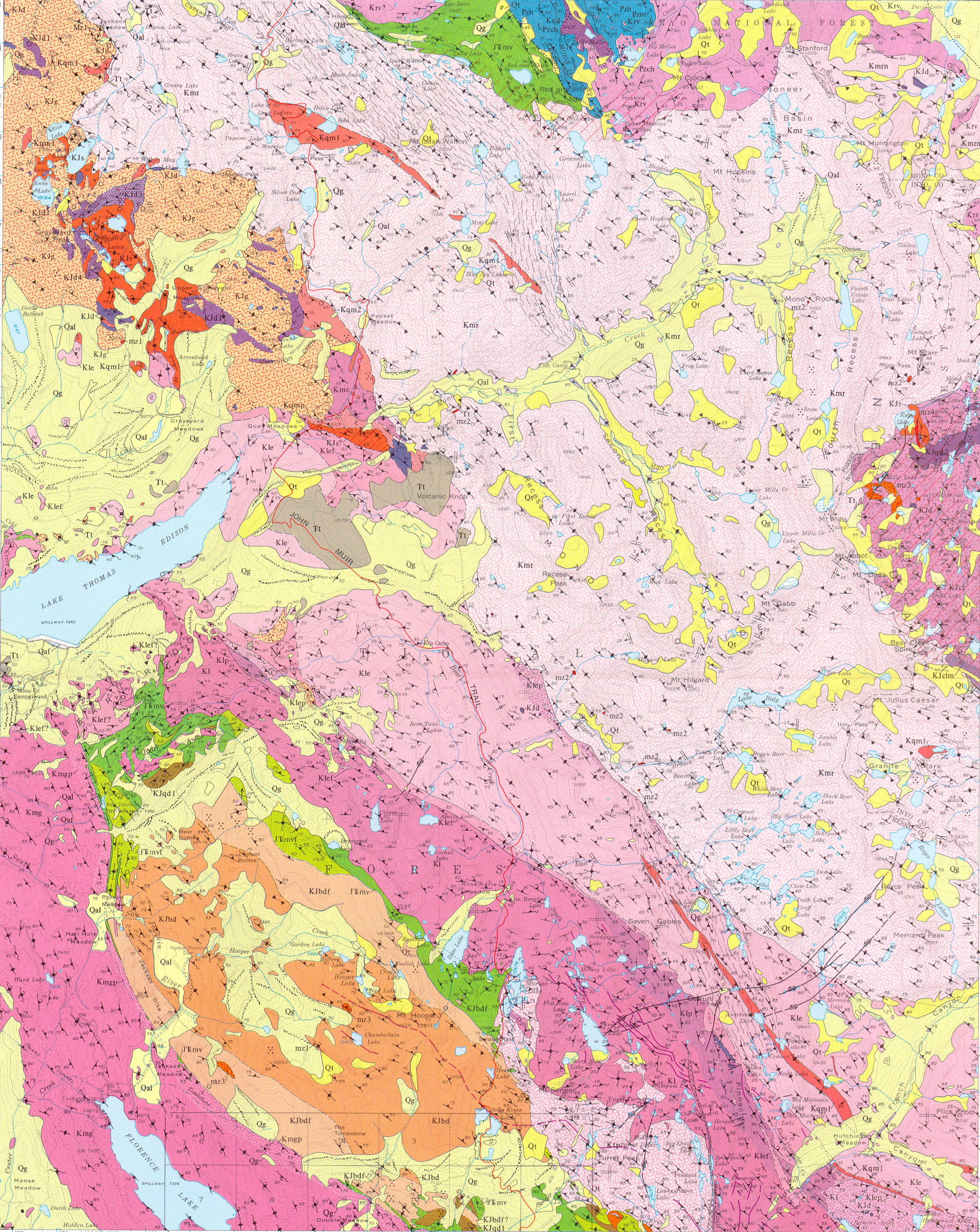
Geologic map of the Mount Abbot Quadrangle, central Sierra Nevada, California
Author(s):
Source: Geologic Quadrangle Map - U. S. Geological Survey, Report: GQ-1155, 6 pp., 1975
Map Name:
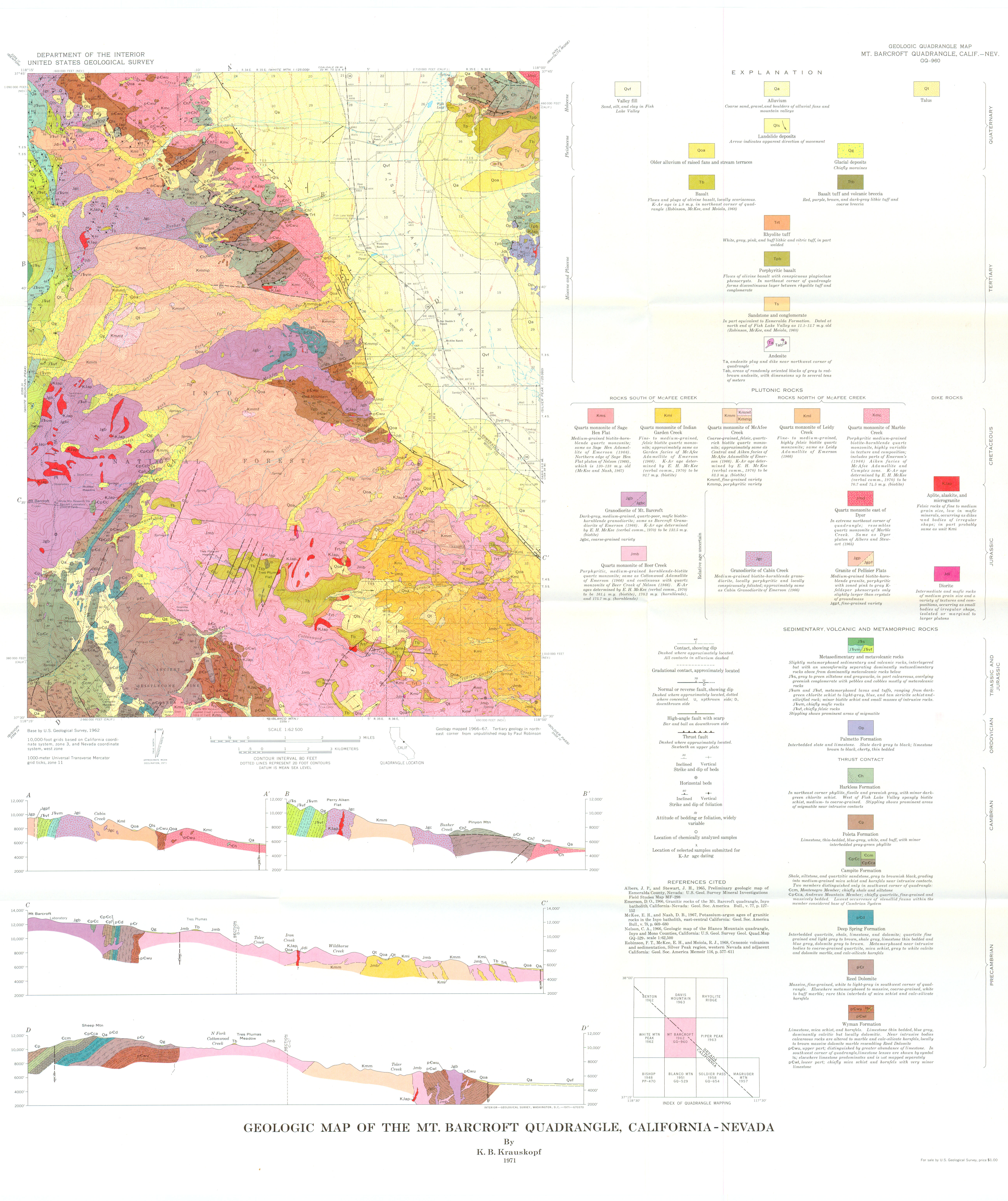
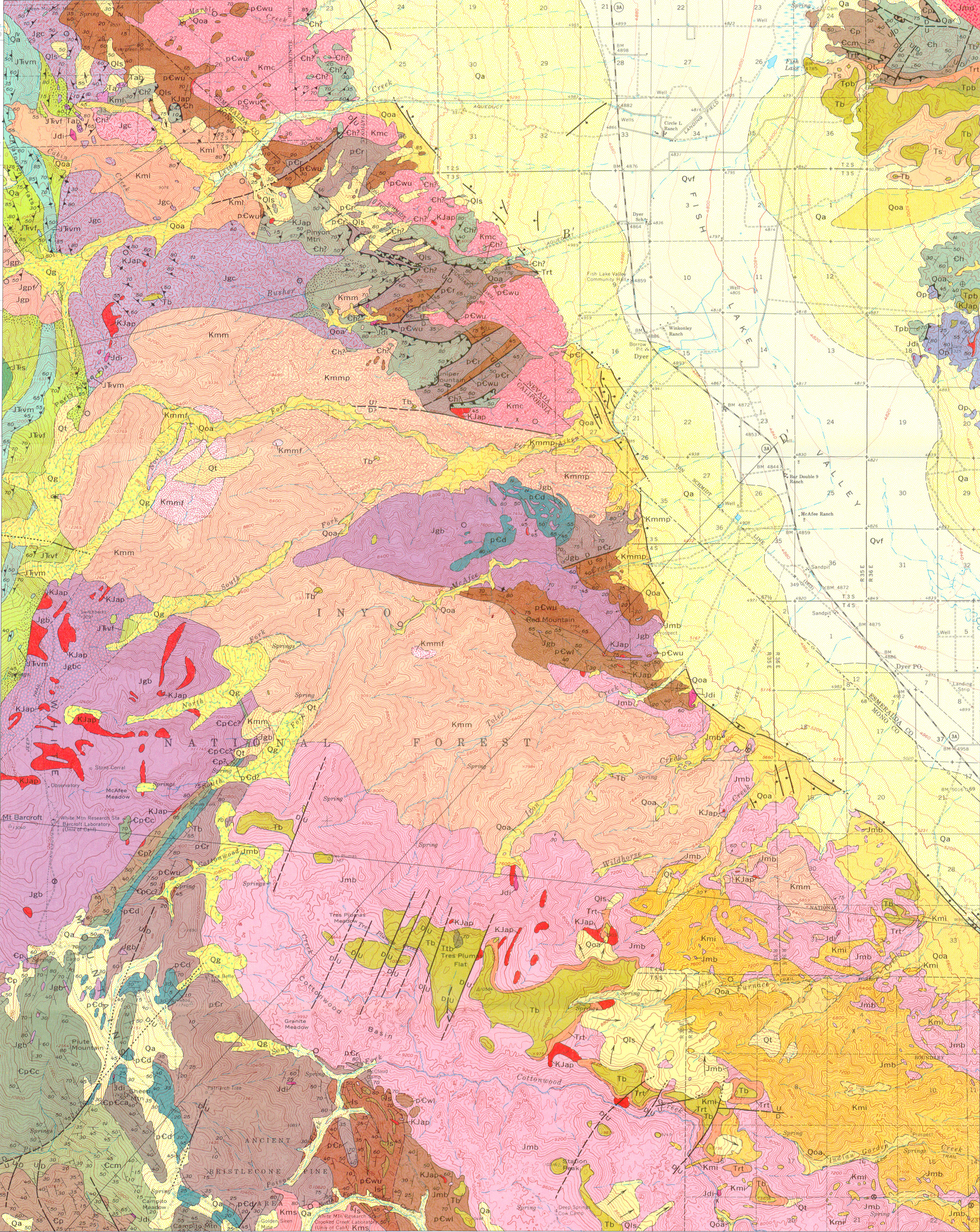
Geologic map of the Mount Barcroft Quadrangle, California-Nevada
Author(s):
Source: Geologic Quadrangle Map - U. S. Geological Survey, Report: GQ-0960, 1971
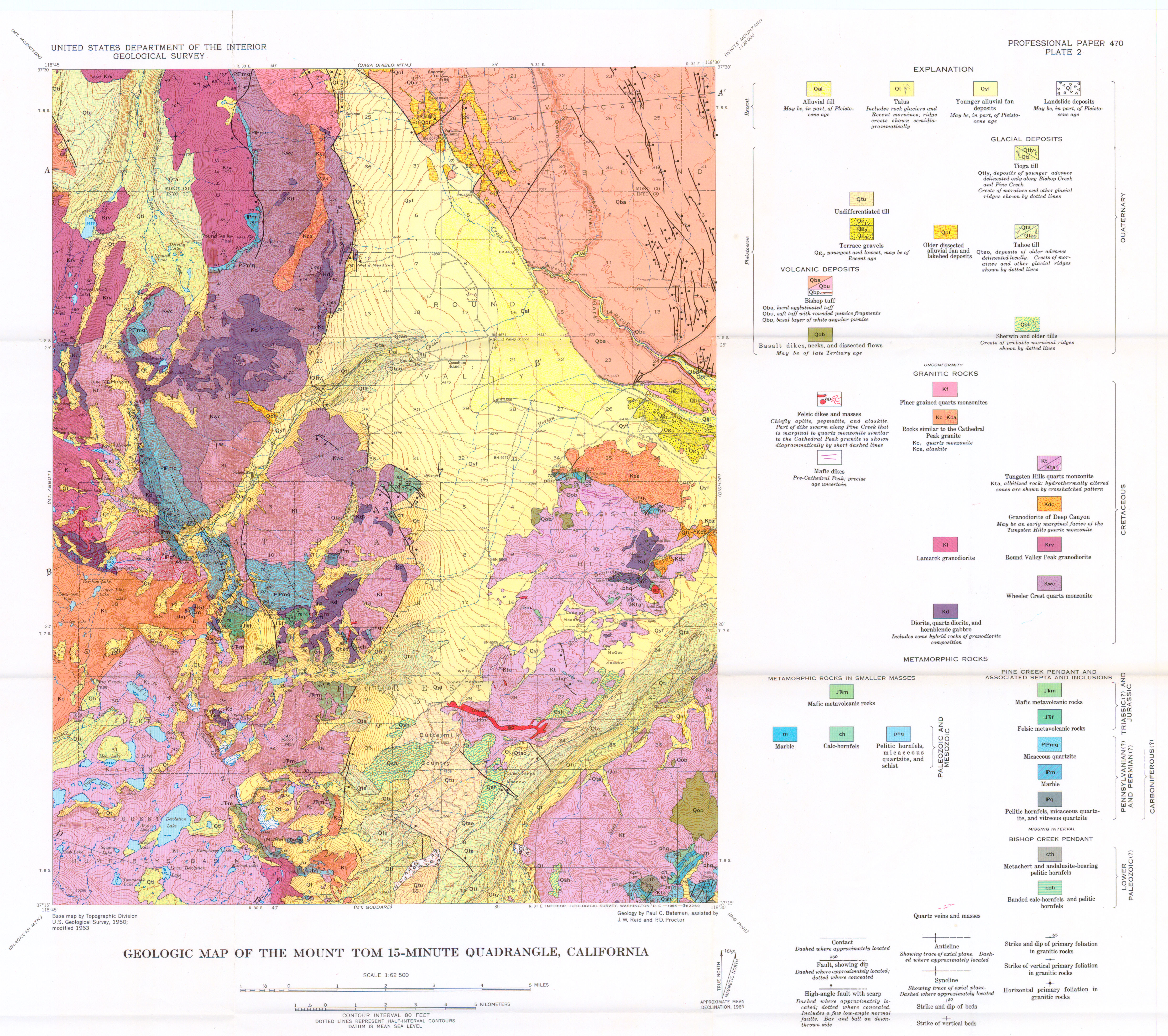
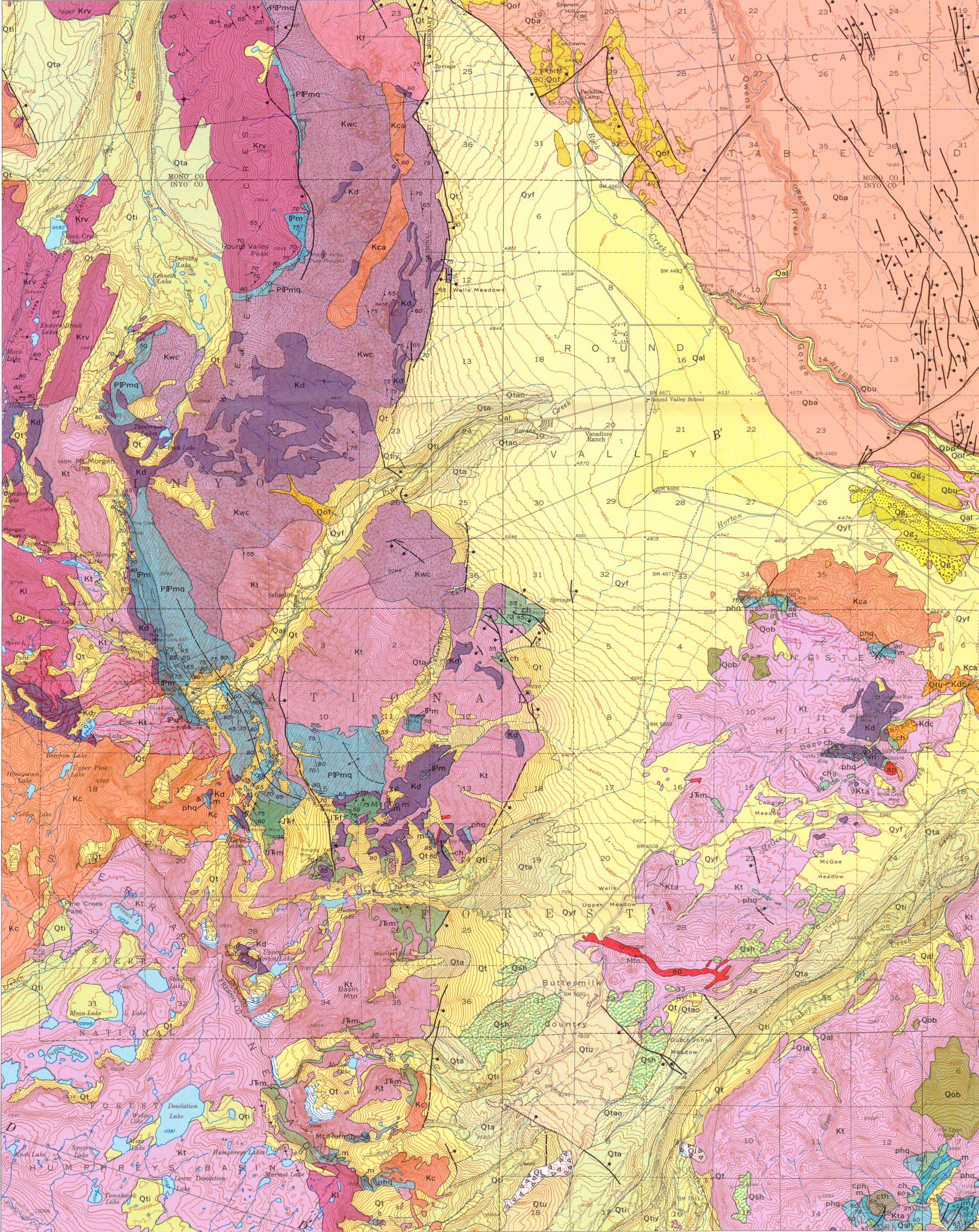
Map Name:
Geologic map of the Mount Goddard Quadrangle, Fresno and Inyo counties, California
Author(s):
Source: Geologic Quadrangle Map - U. S. Geological Survey, Report: GQ-0429, 1965
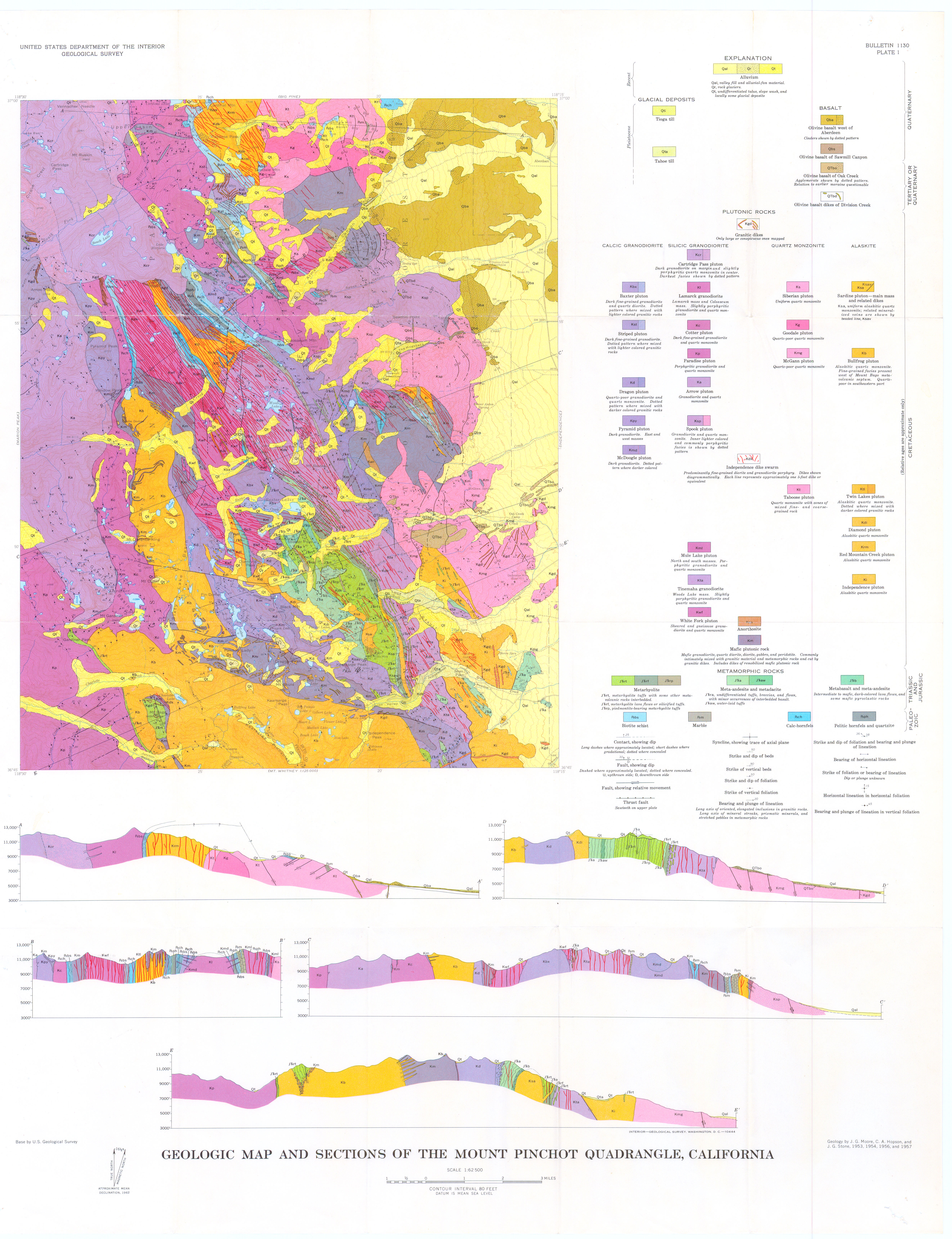
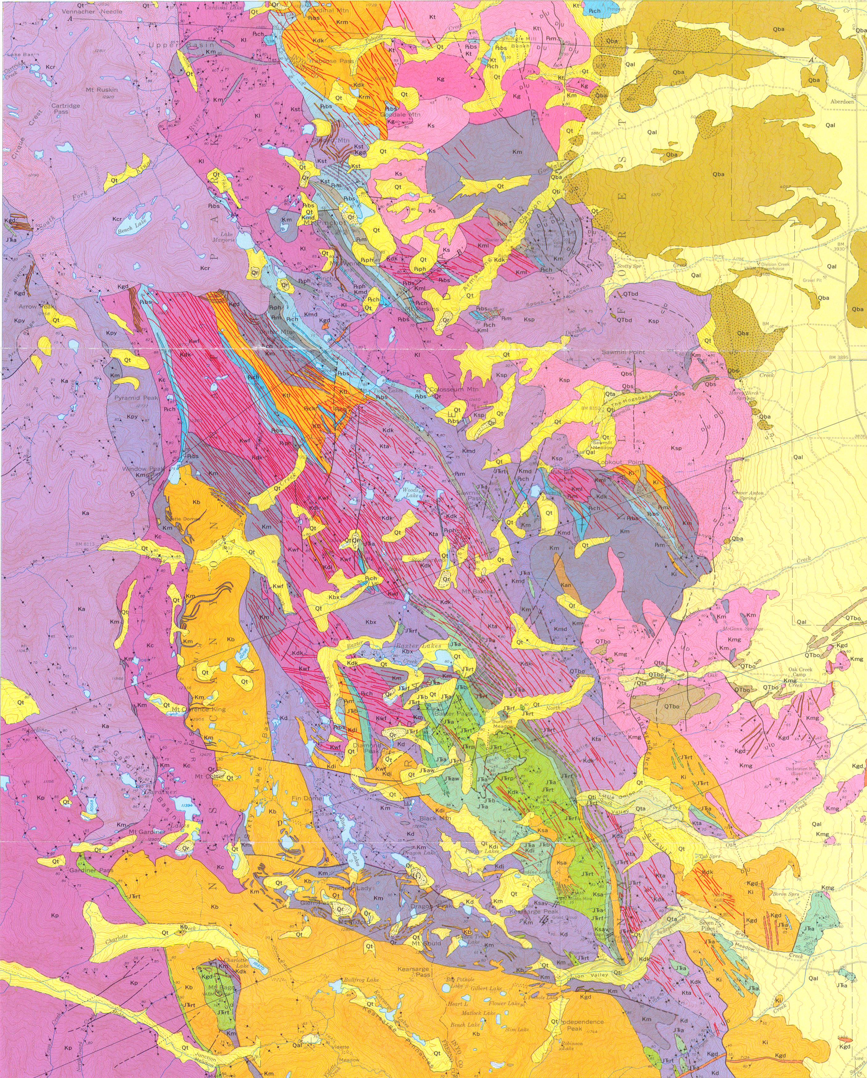
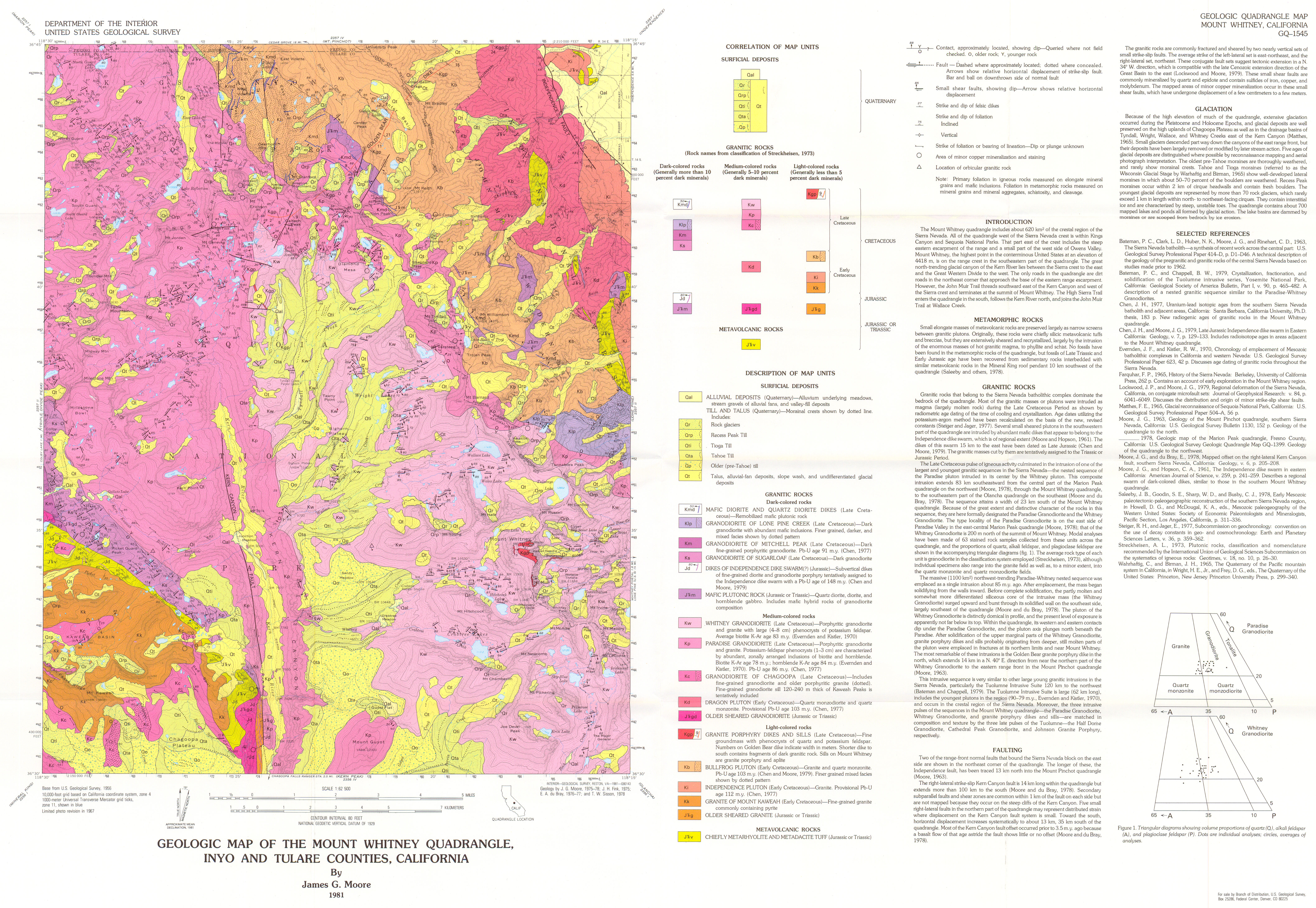
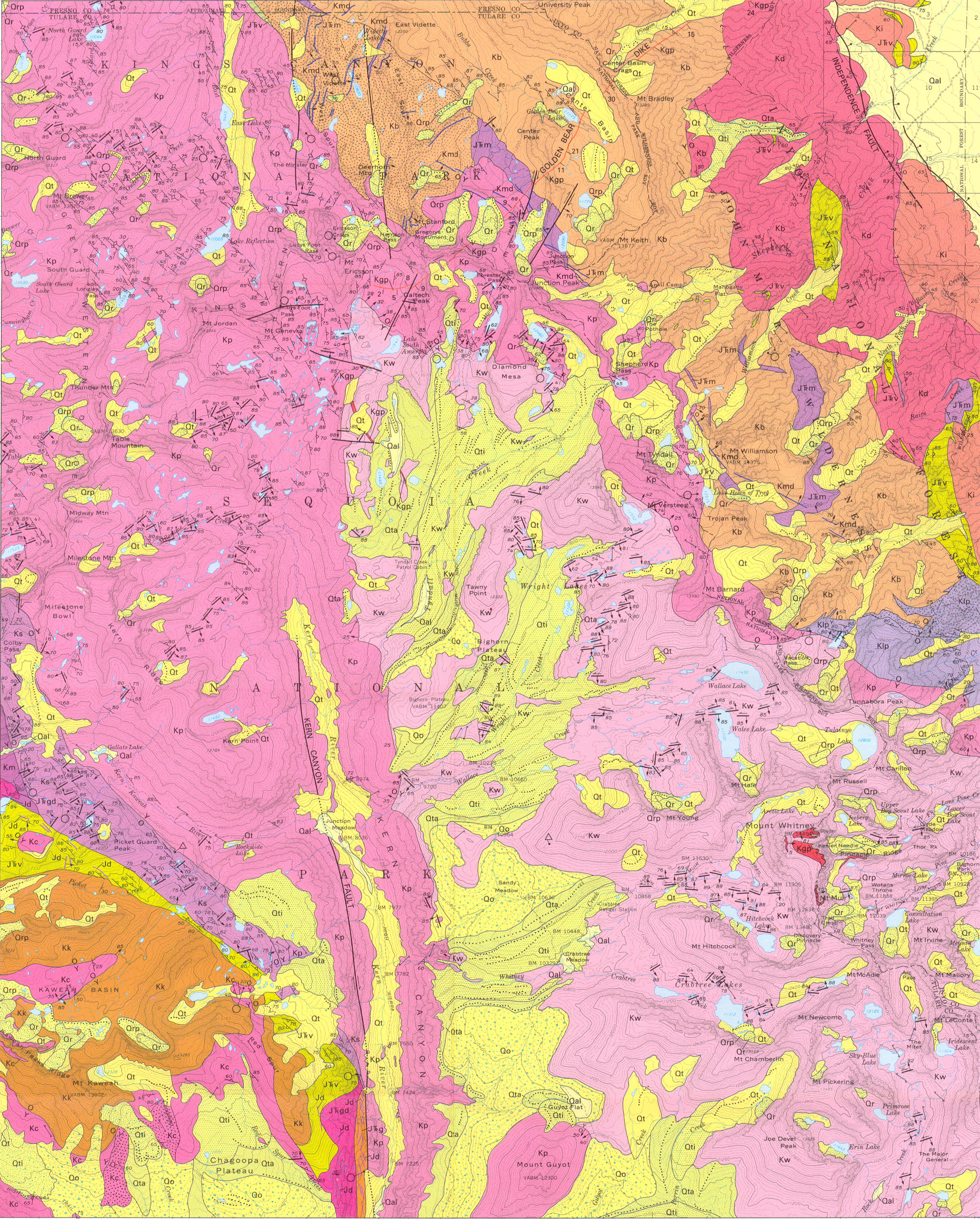
Map Name:
Geologic map of the Mount Whitney Quadrangle, Inyo and Tulare counties, California
Author(s):
Source: Geologic Quadrangle Map - U. S. Geological Survey, Report: GQ-1545, 1 sheet, 1981
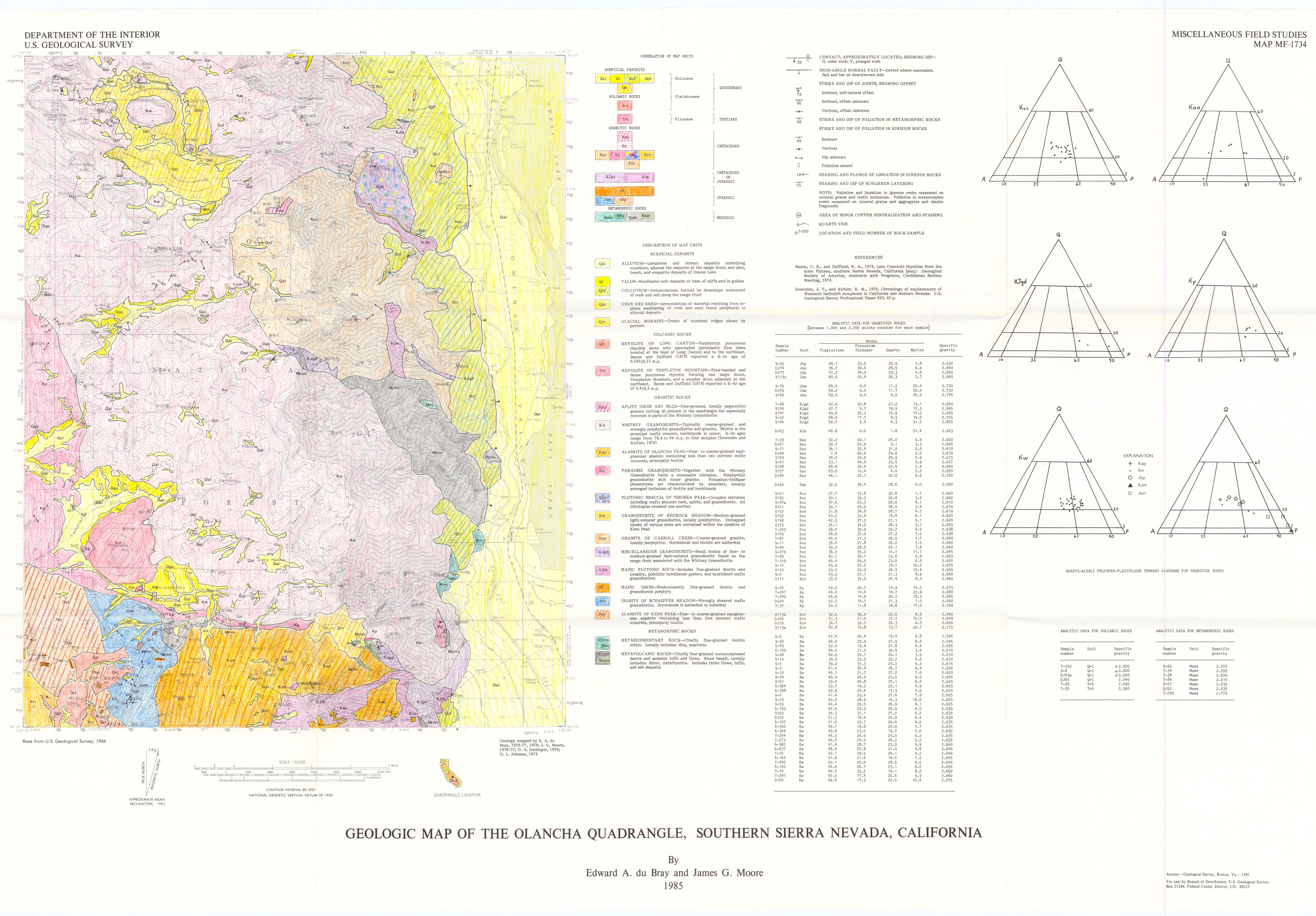
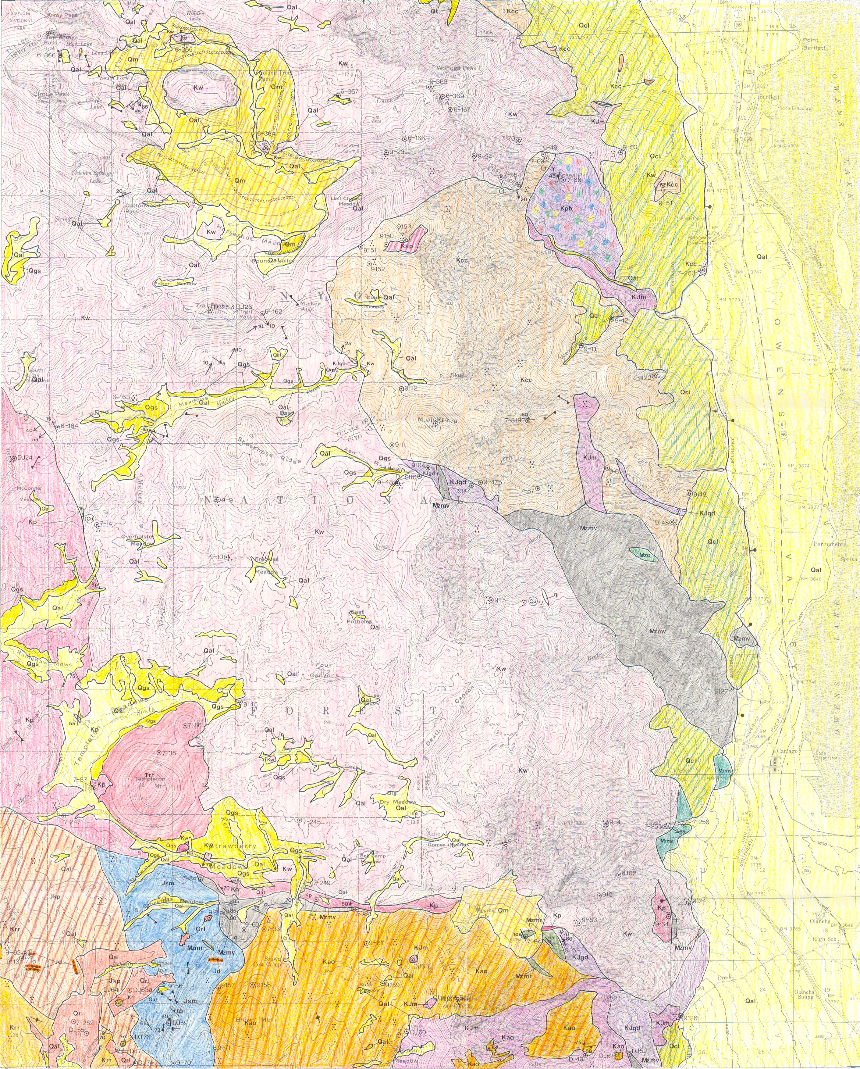
Map Name:
Geologic map of the Olancha Quadrangle, southern Sierra Nevada, California
Author(s):
Source: Miscellaneous Field Studies Map - U. S. Geological Survey, Report: MF-1734, 1 sheet, 1985
Map Name:
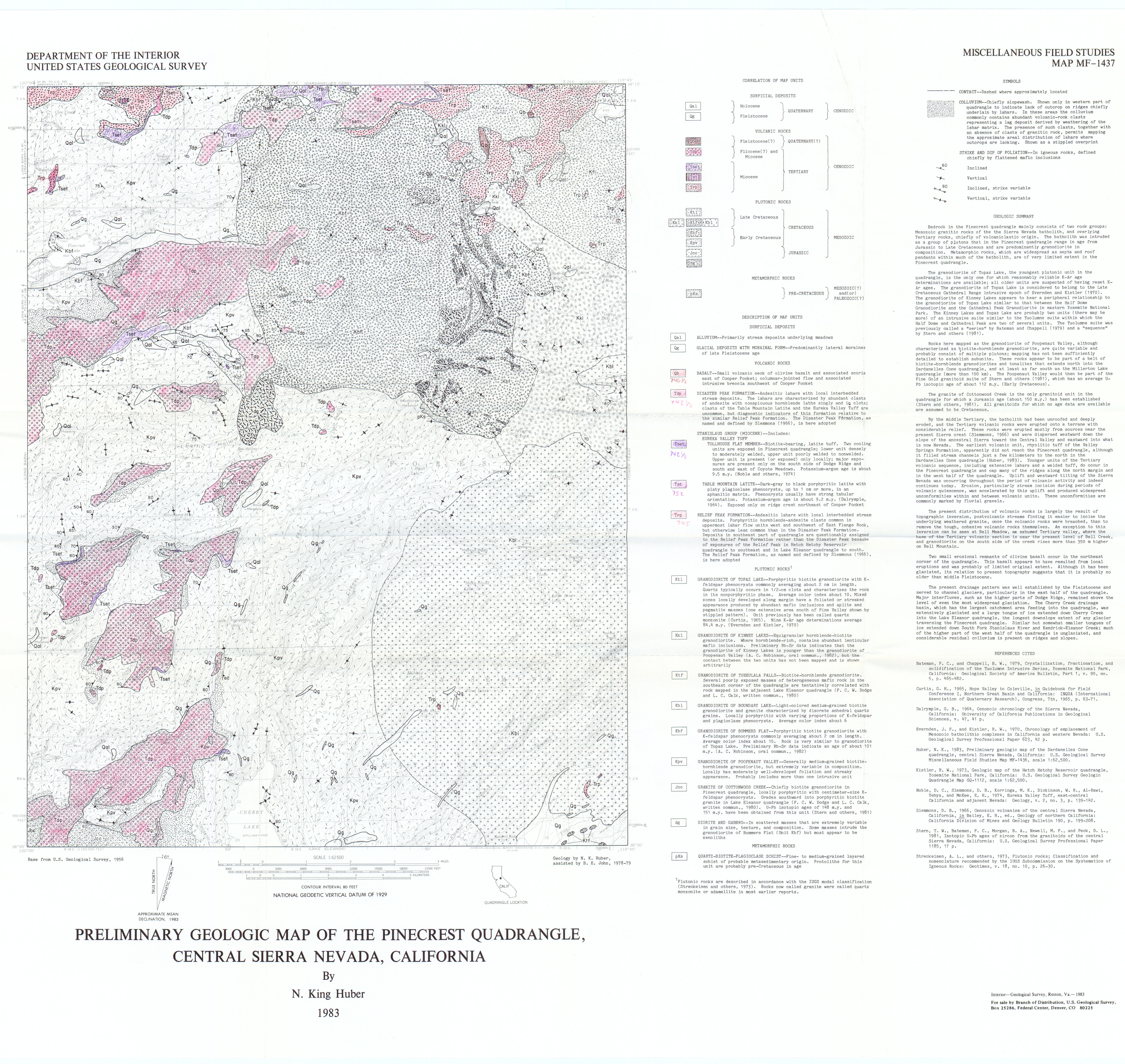
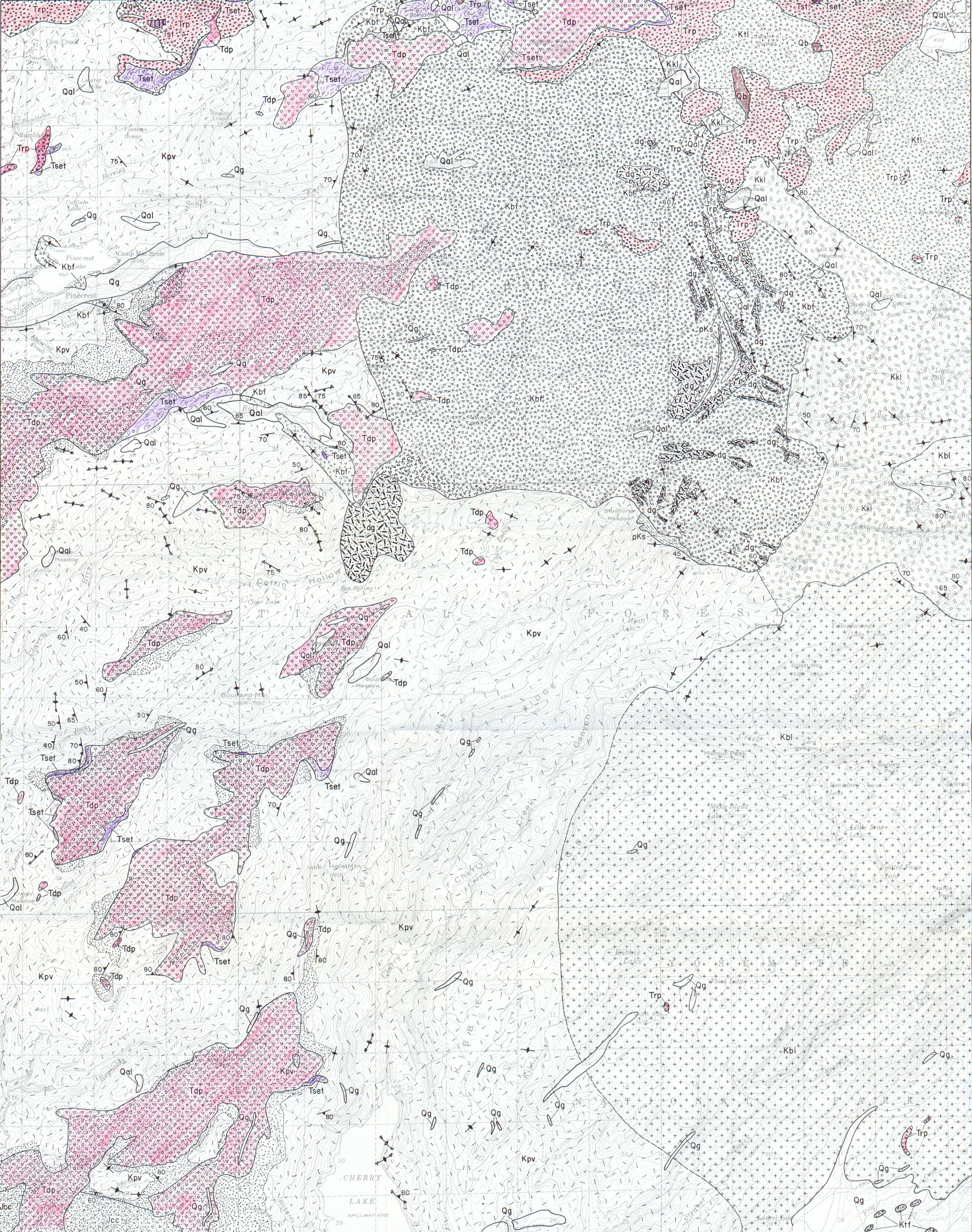
Preliminary geologic map of the Pinecrest Quadrangle, central Sierra Nevada, California
Author(s):
Source: Miscellaneous Field Studies Map - U. S. Geological Survey, Report: MF-1437, 1 sheet, 1983
Map Name:
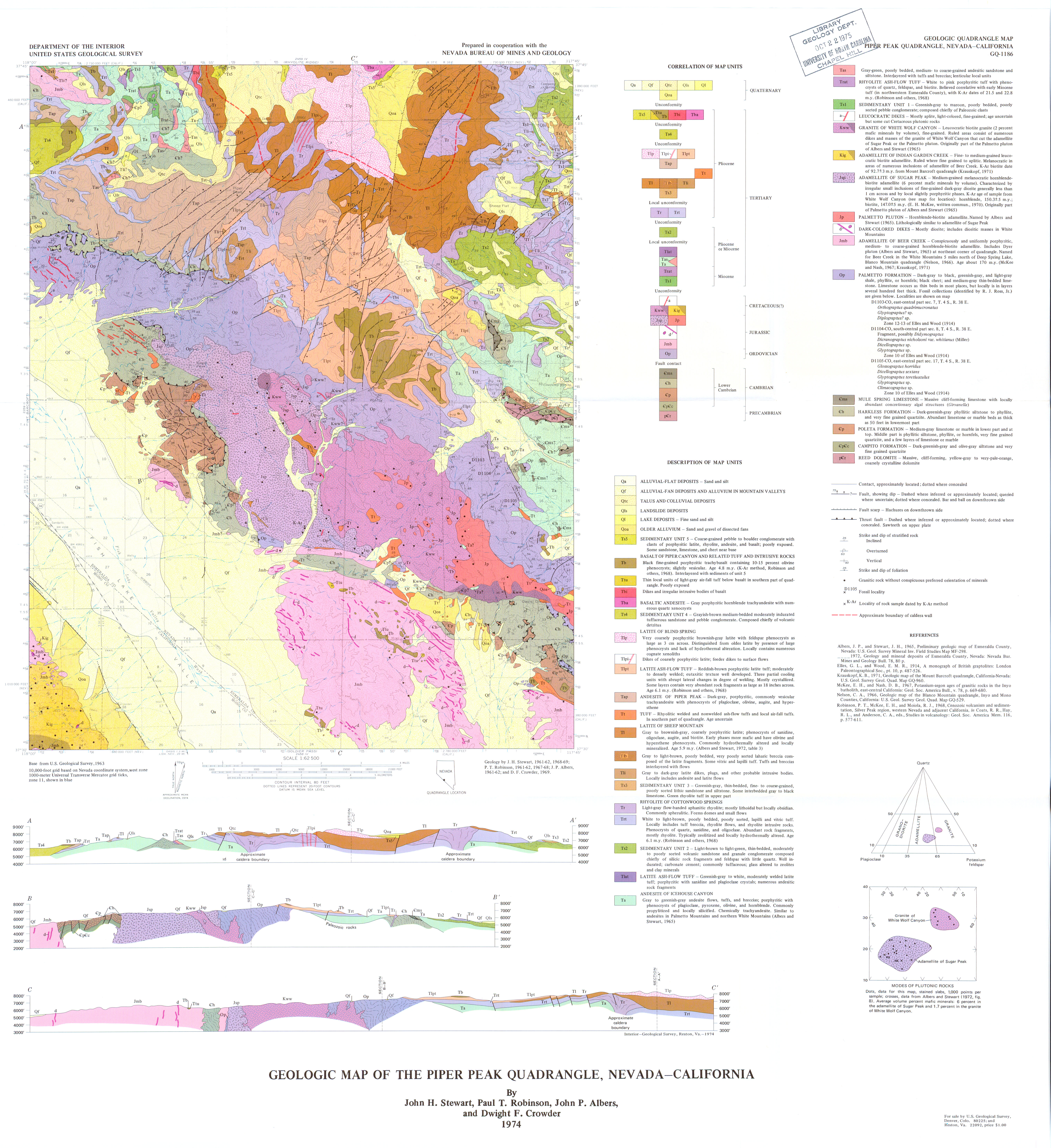
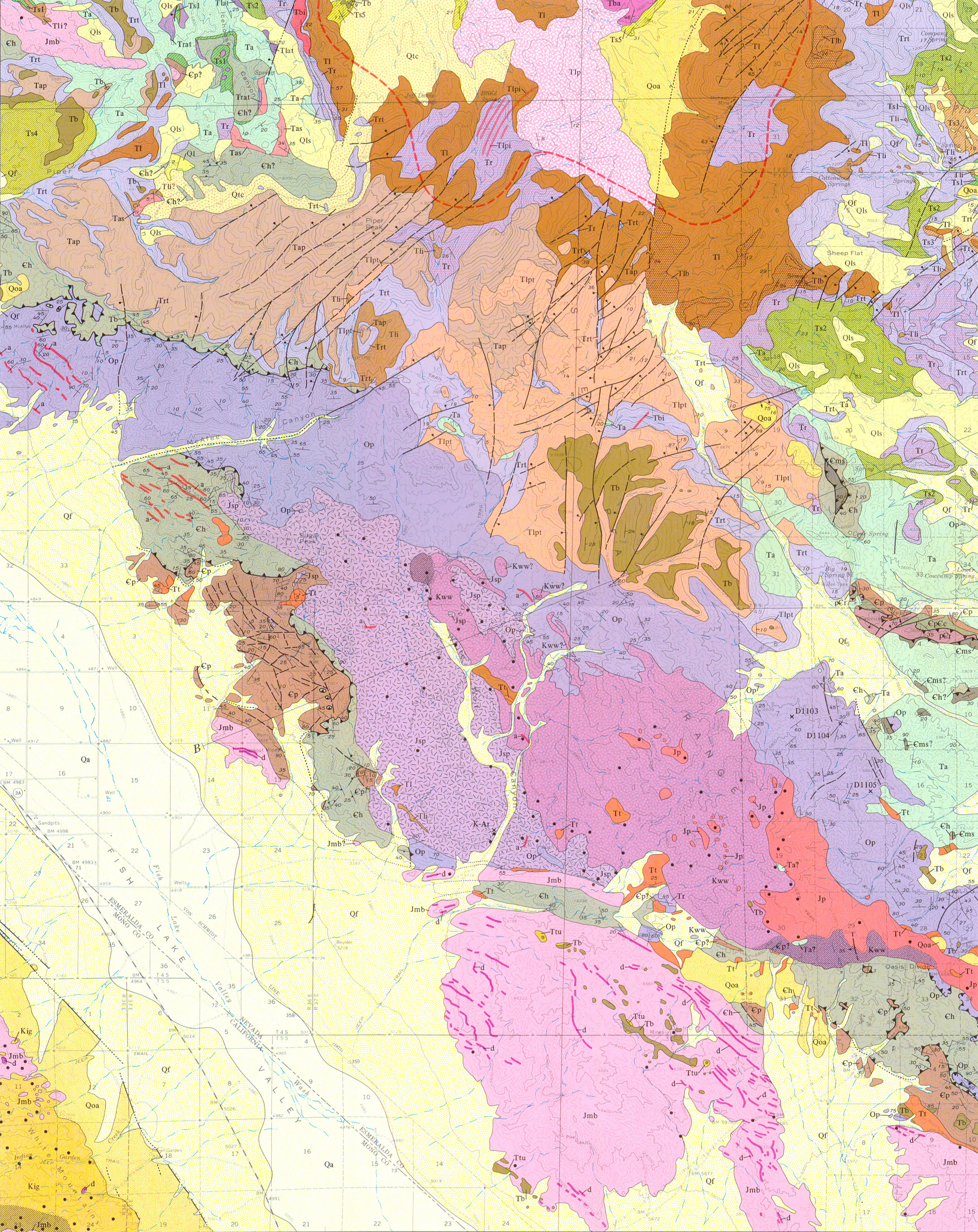
Geologic map of the Piper Peak Quadrangle, Nevada-California
Author(s):
Source: Geologic Quadrangle Map - U. S. Geological Survey, Report: GQ-1186, 1974
Map Name:
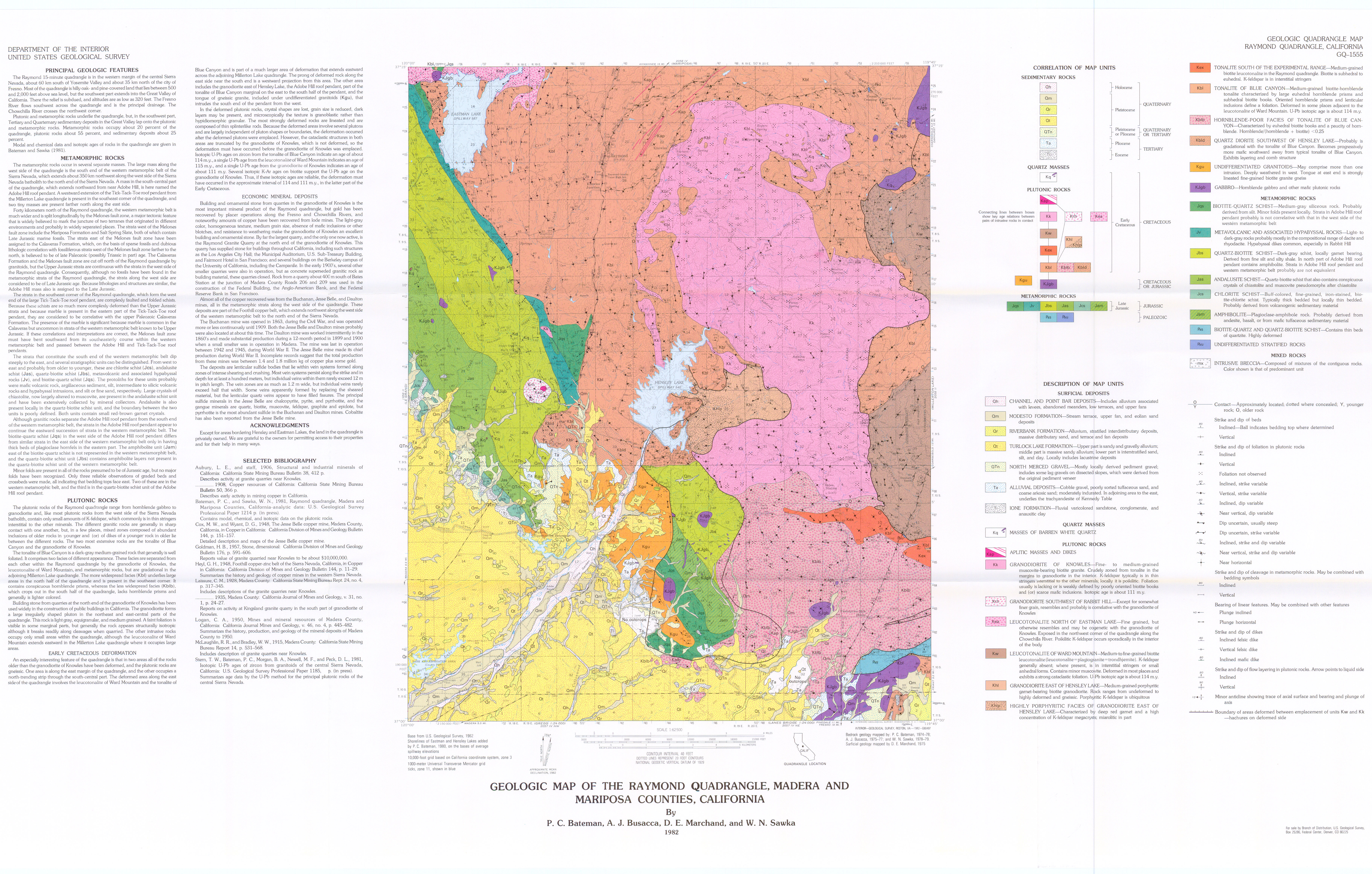
Geologic map of the Raymond Quadrangle, Madera and Mariposa counties, California
Author(s):
Source: Geologic Quadrangle Map - U. S. Geological Survey, Report: GQ- 1555, 1 sheet, 1982
Map Name:
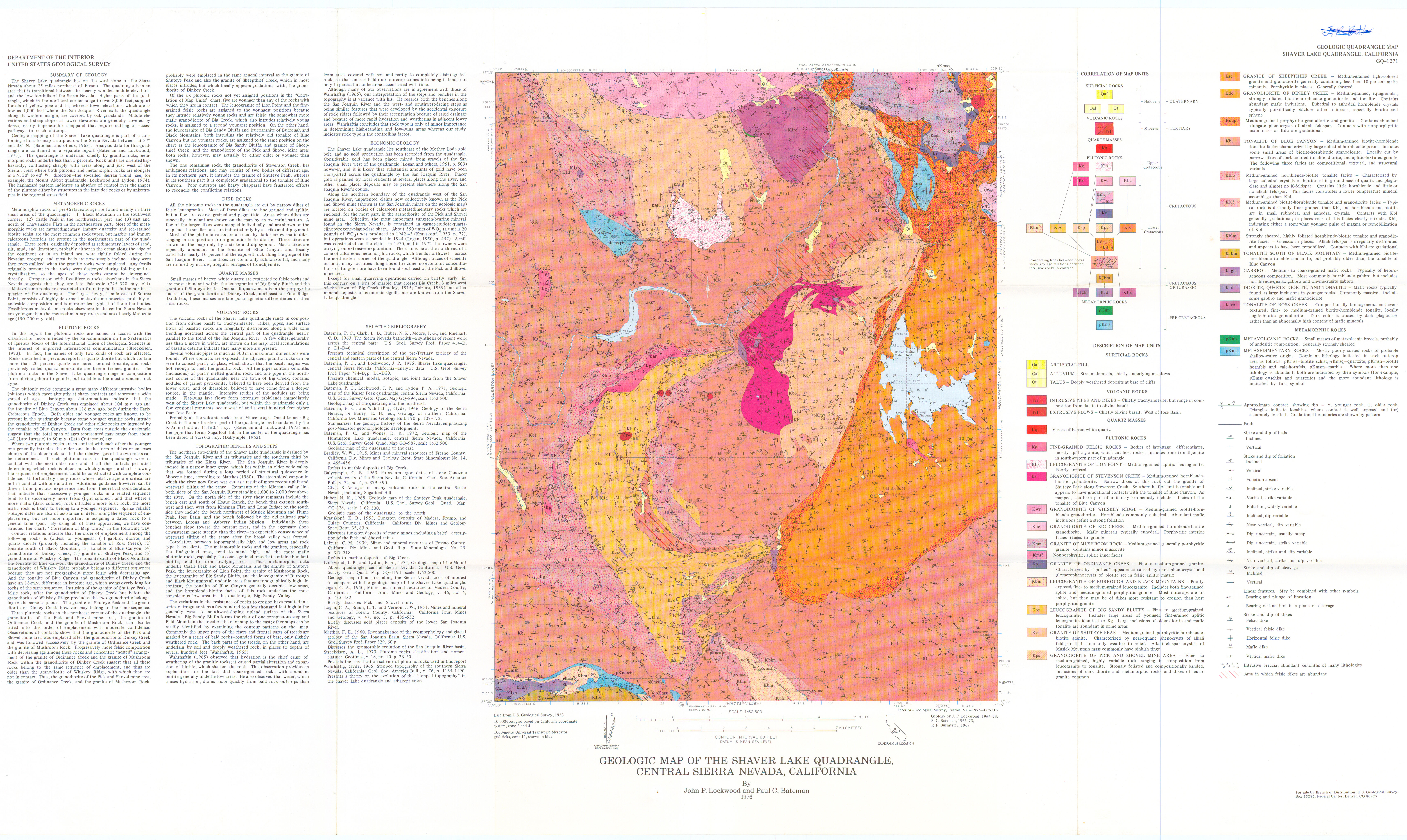
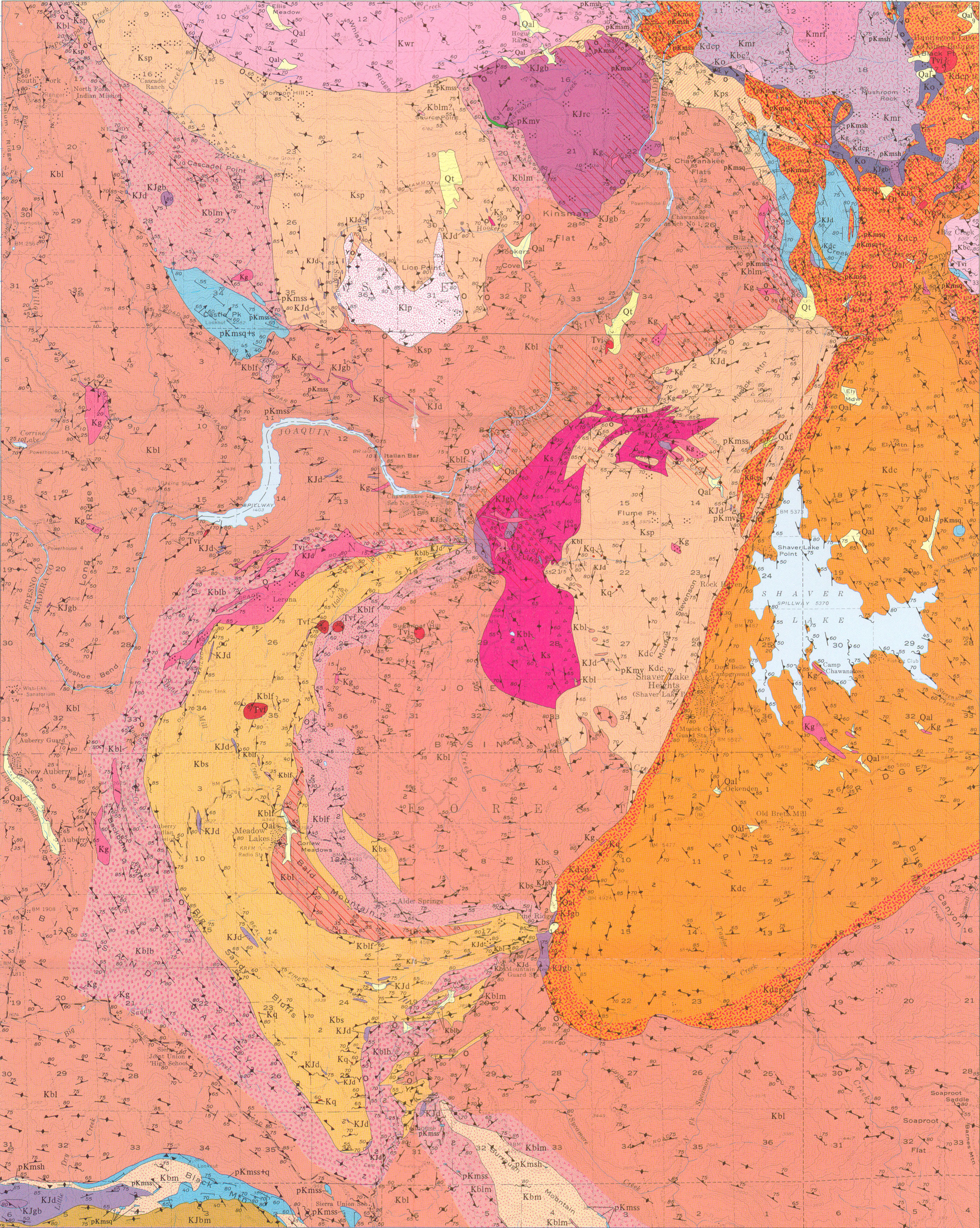
Geologic map of the Shaver Lake Quadrangle, central Sierra Nevada, California
Author(s):
Source: Geologic Quadrangle Map - U. S. Geological Survey, Report: GQ-1271, 1976
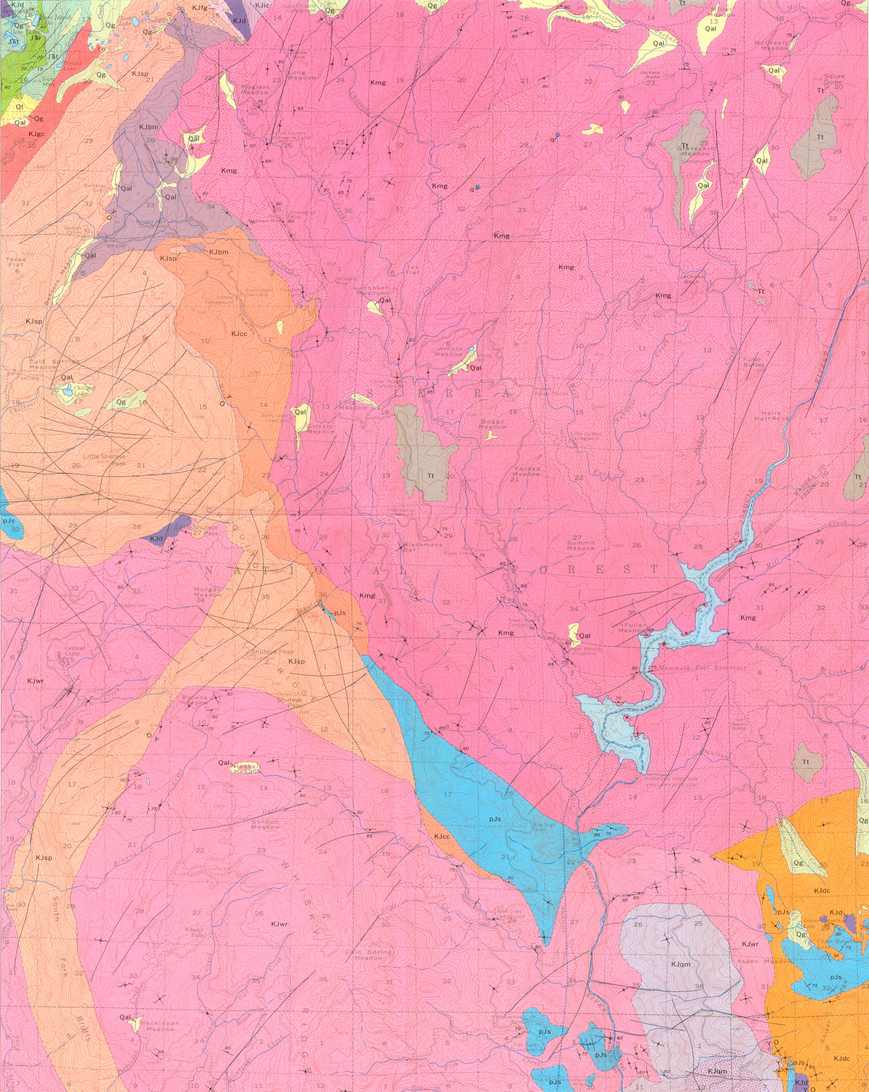
Map Name:
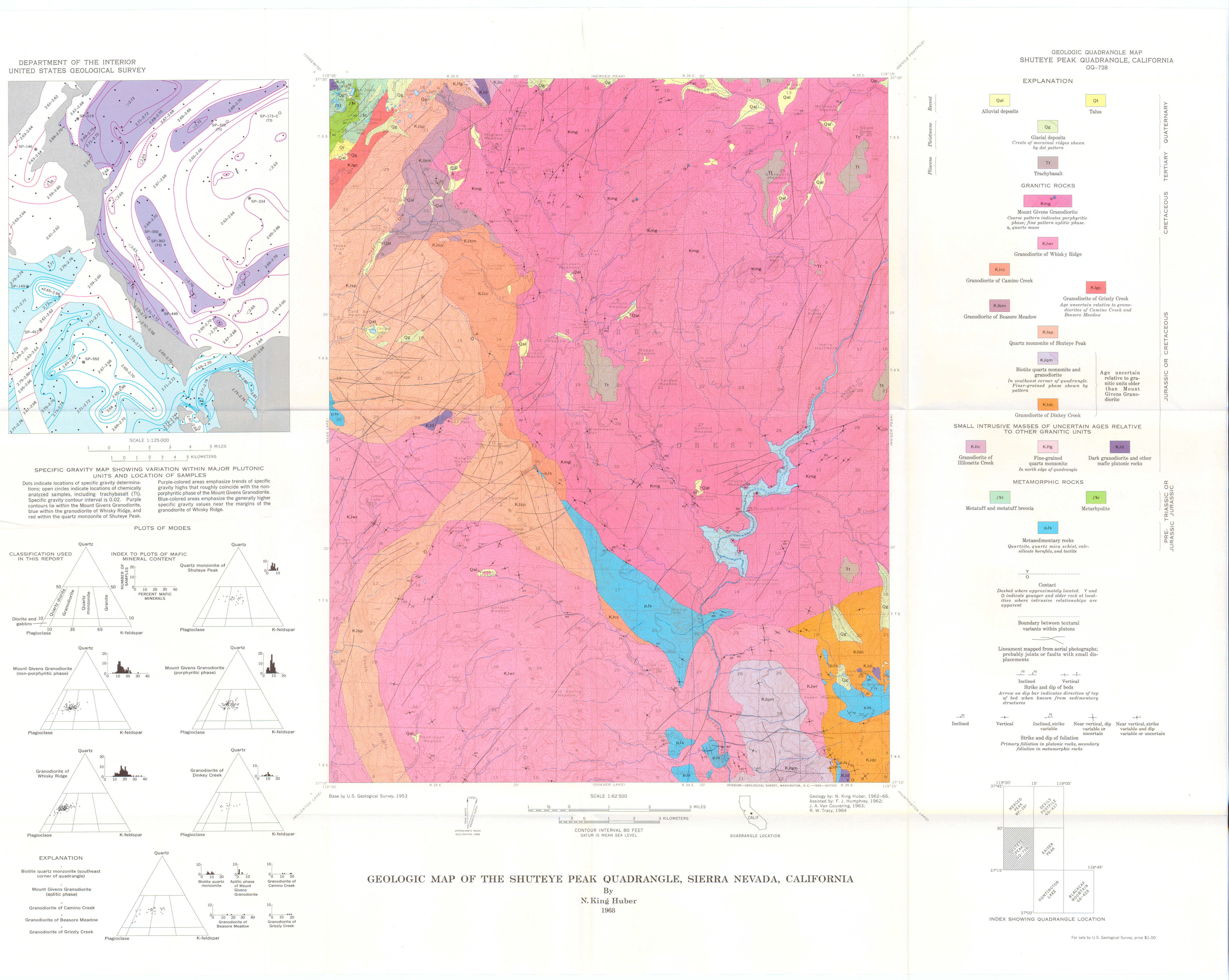
Geologic map of the Shuteye Peak Quadrangle, Sierra Nevada, California
Author(s):
Source: Geologic Quadrangle Map - U. S. Geological Survey, Report: GQ-0728, 1968
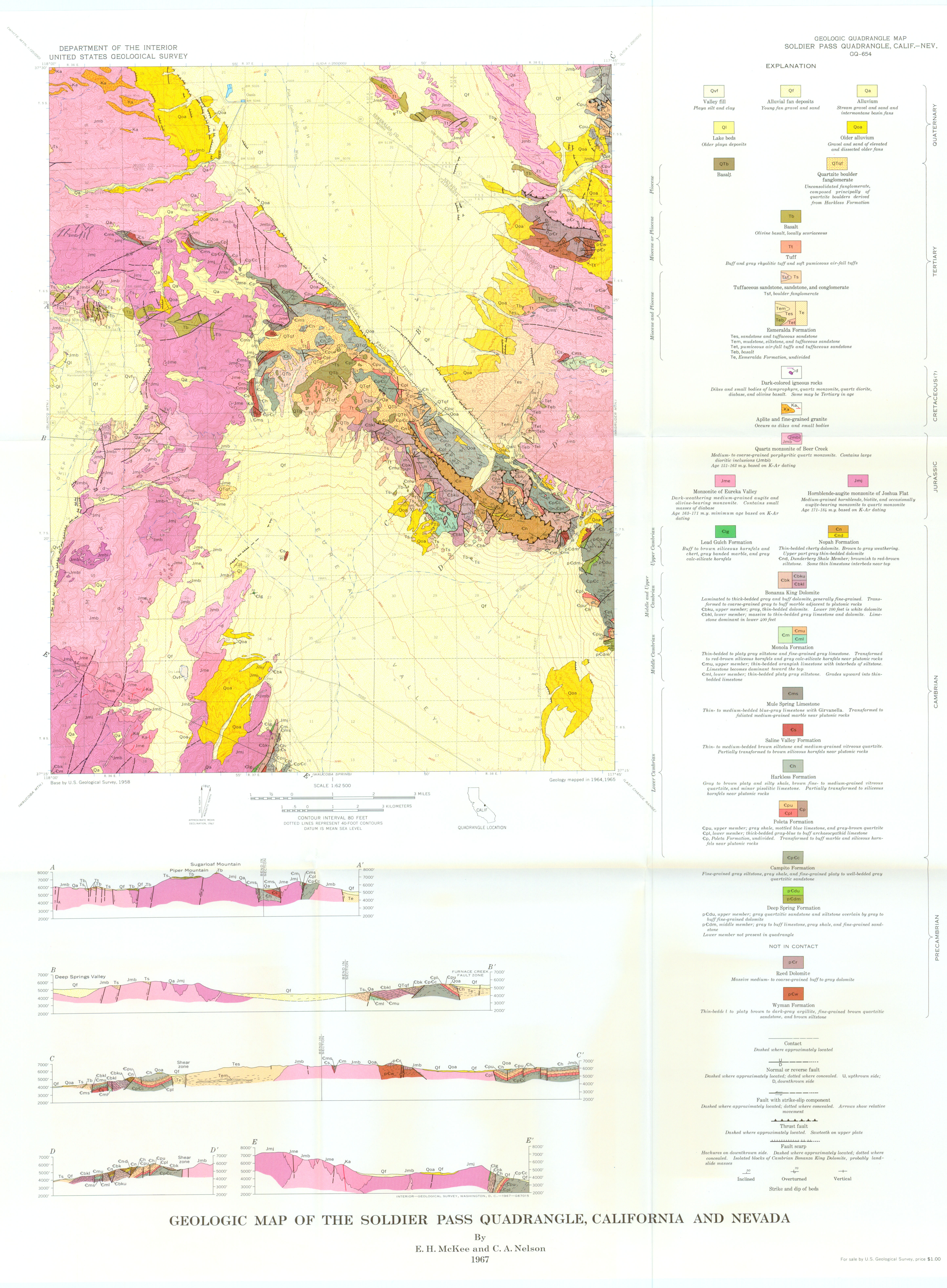
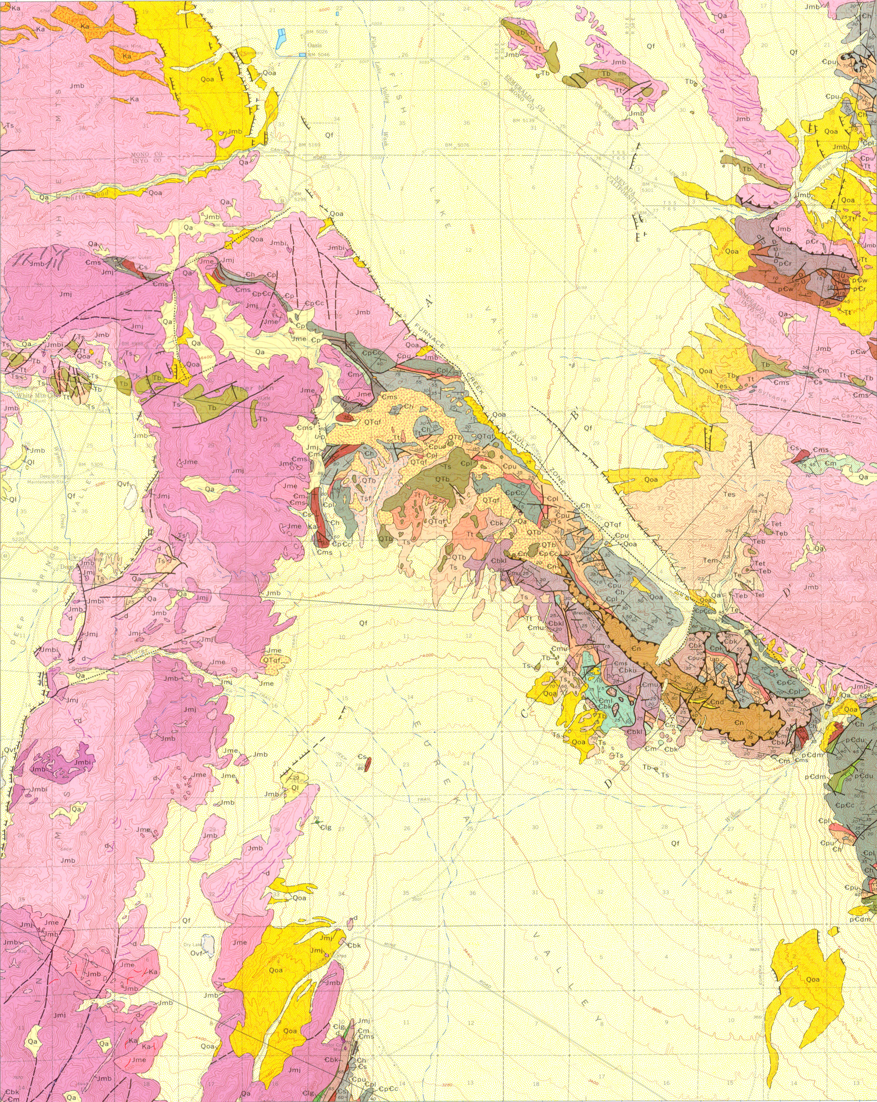
Map Name:
Geologic map of the Soldier Pass Quadrangle, California and Nevada
Author(s):
Source: Geologic Quadrangle Map - U. S. Geological Survey, Report: GQ-0654, 1967
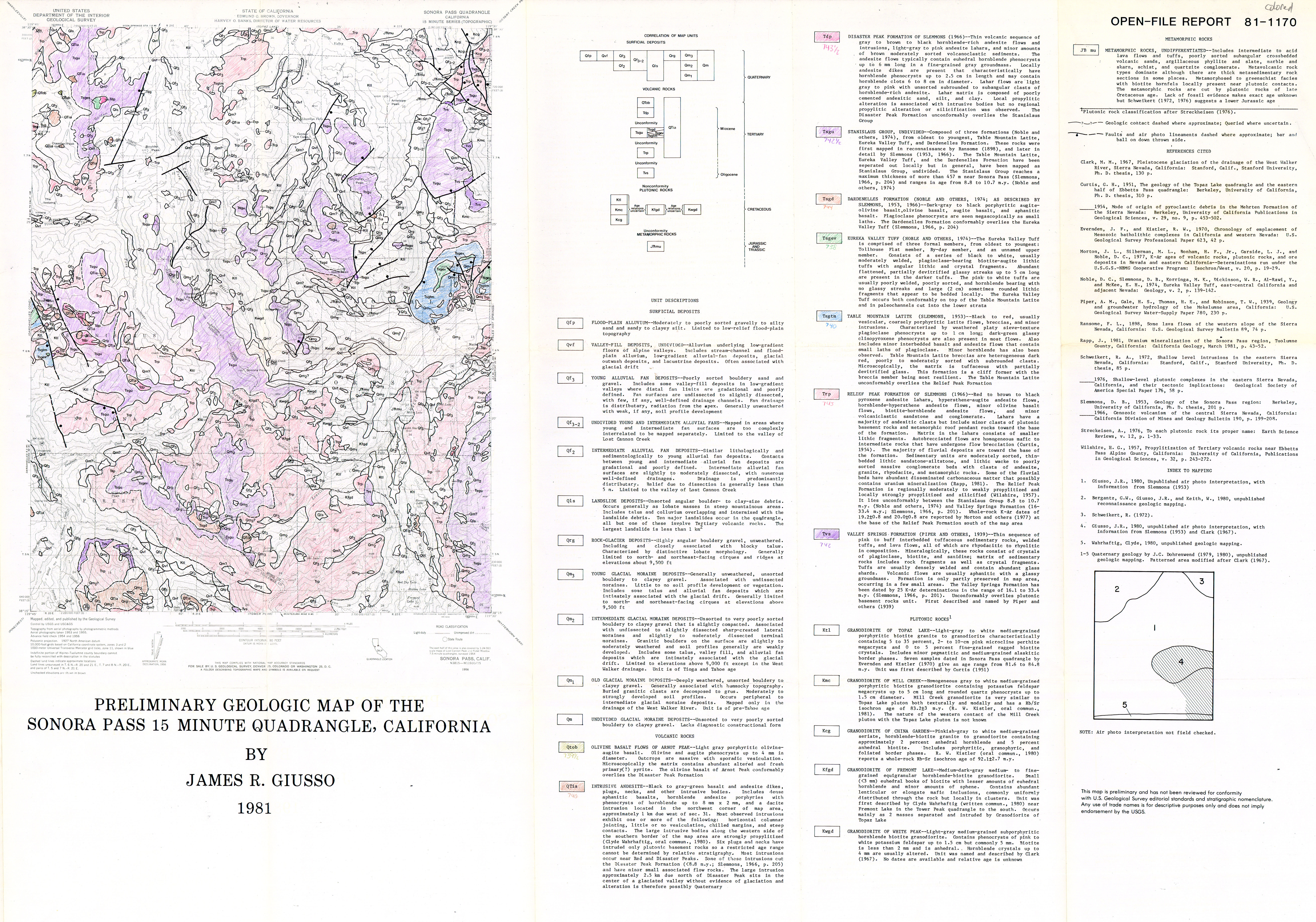
Map Name:
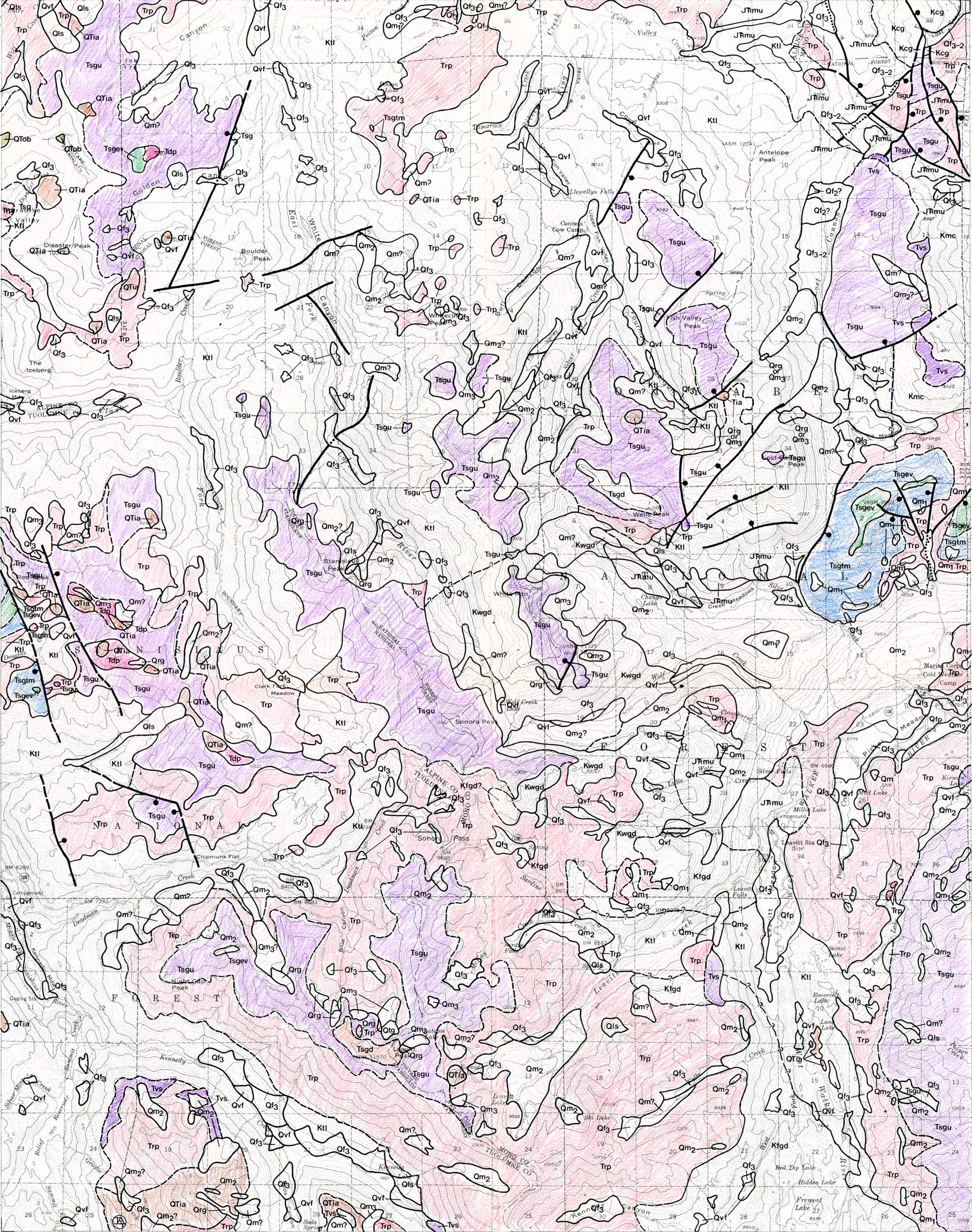
Preliminary geologic map of the Sonora Pass 15-minute Quadrangle, California
Author(s):
Source: Open-File Report - U. S. Geological Survey, Report: OF 81-1170, 1 sheet, 1981
Map Name:
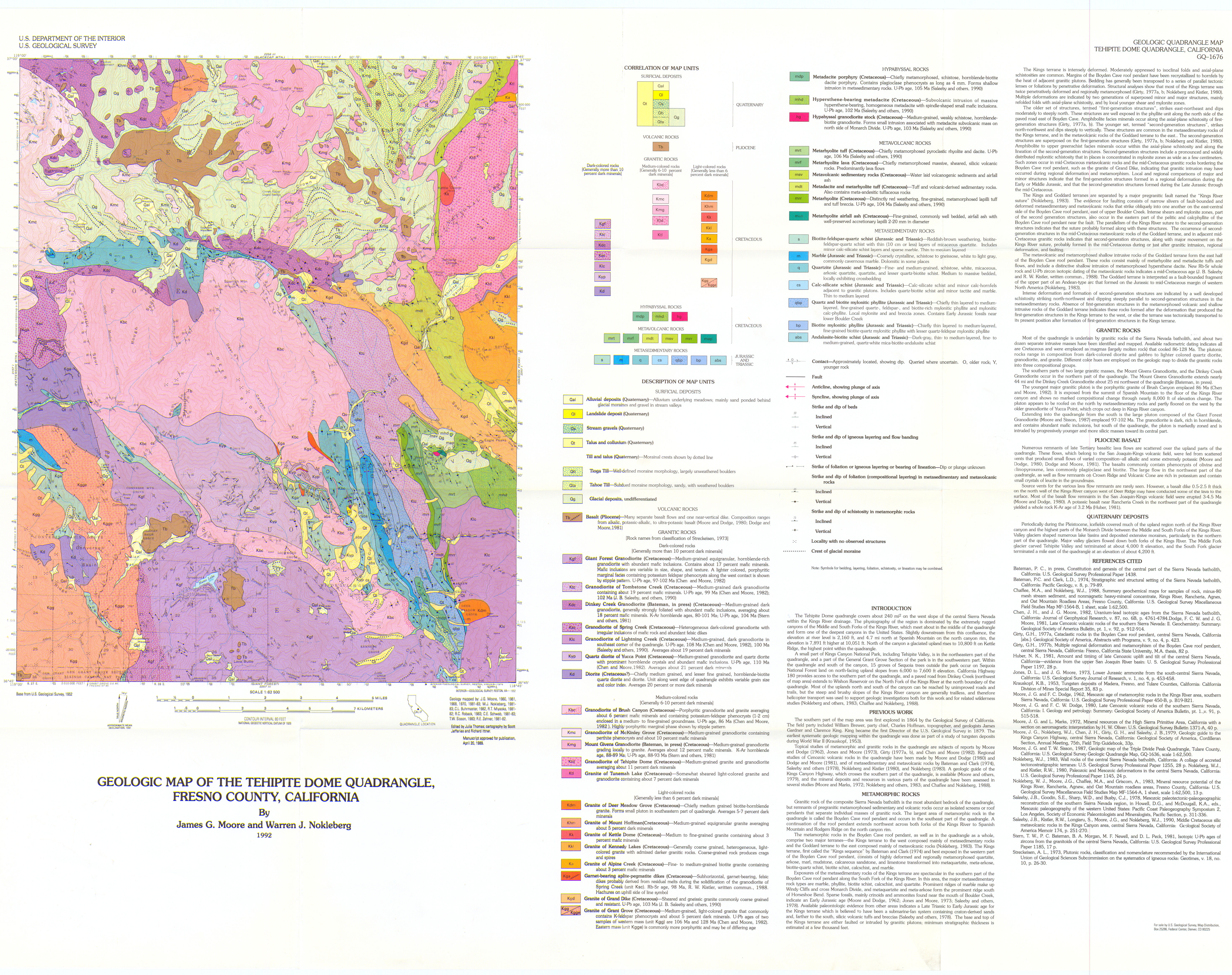
Geologic map of the Tehipite Dome Quadrangle, Fresno County, California
Author(s):
Source: Geologic Quadrangle Map - U. S. Geological Survey, Report: GQ-1676, 1 sheet, 1991
Map Name:
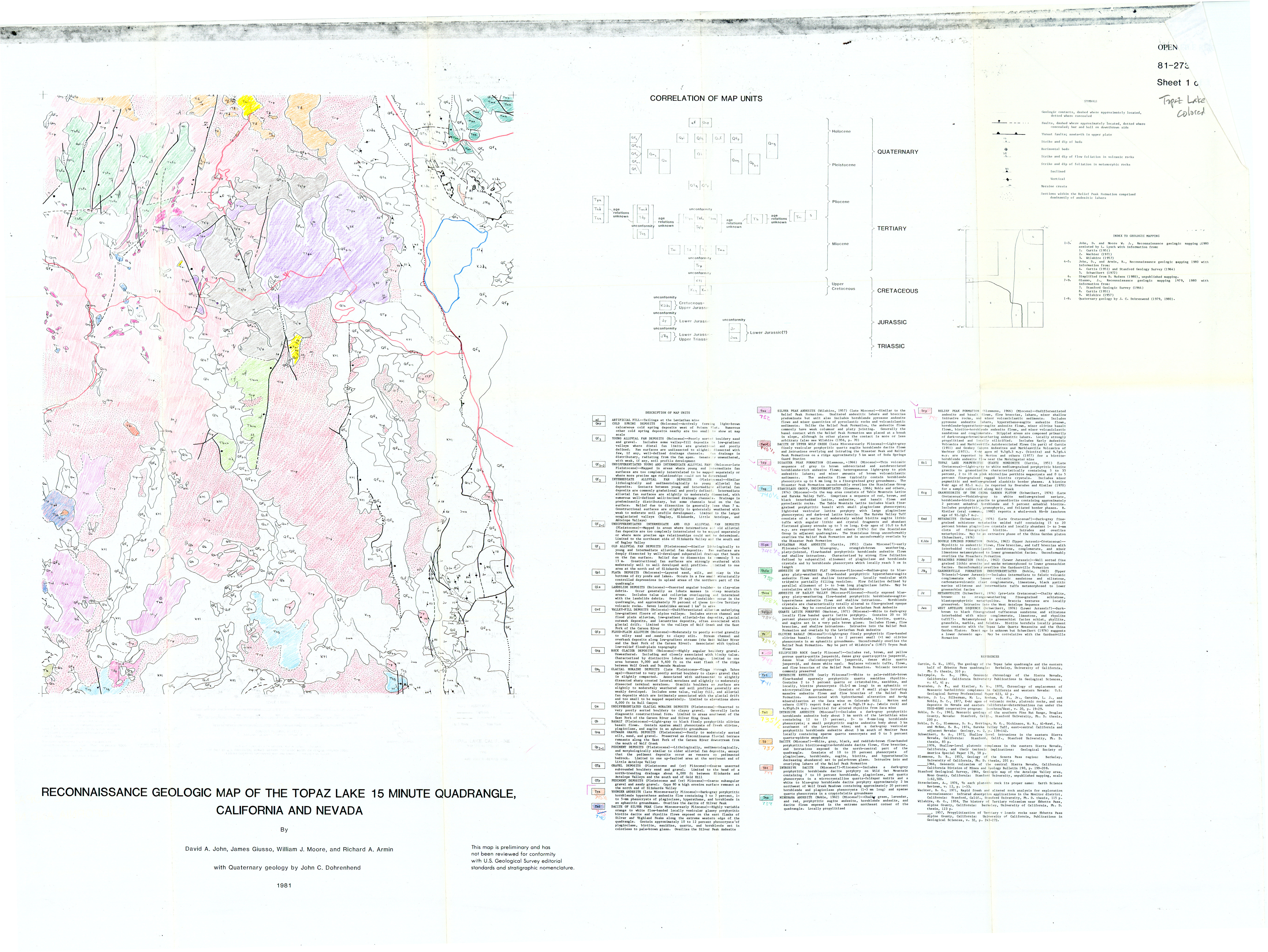
Reconnaissance geologic map of the Topaz Lake 15-minute quadrangle, California-Nevada
Author(s):
Source: Open-File Report - U. S. Geological Survey, Report: OF 81-0273, 1 sheet, 1981
Map Name:
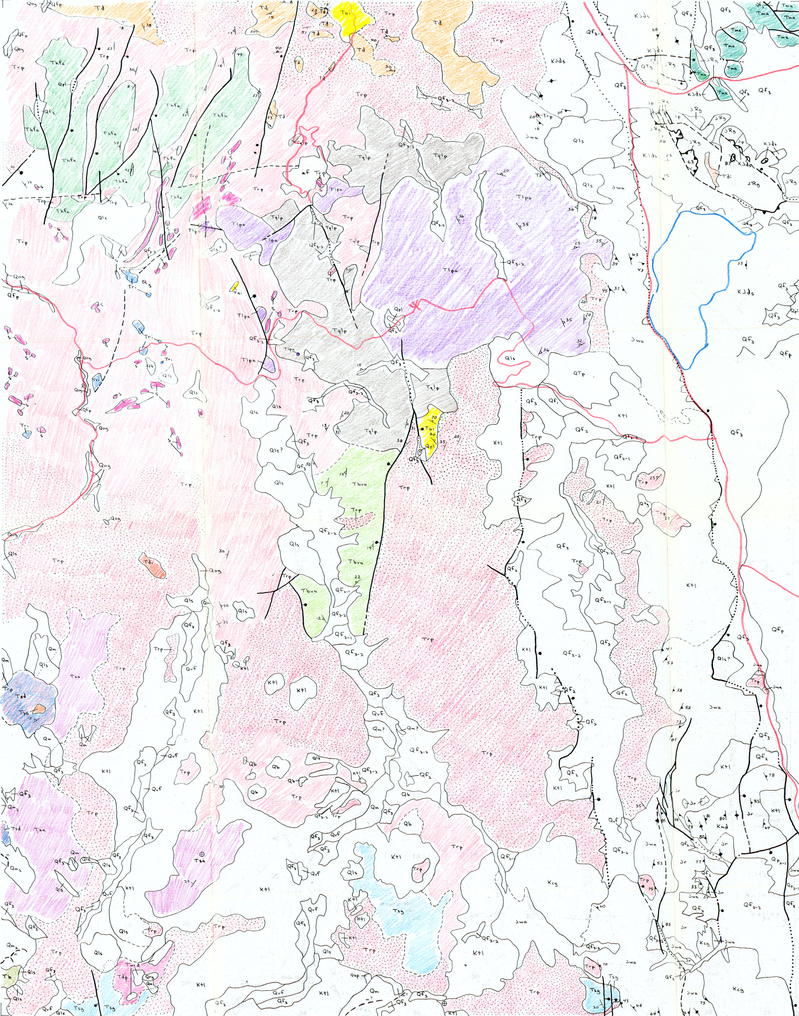
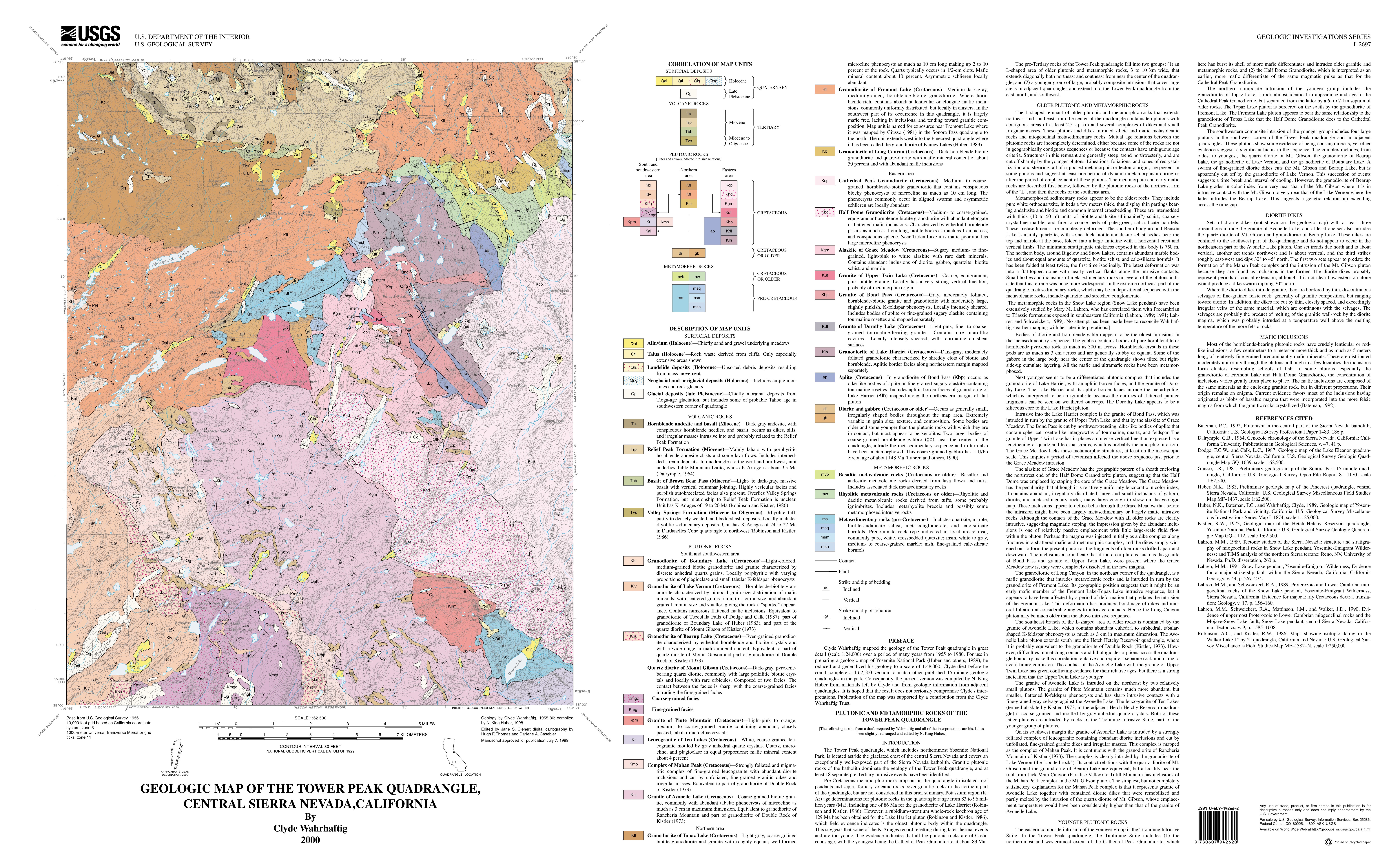
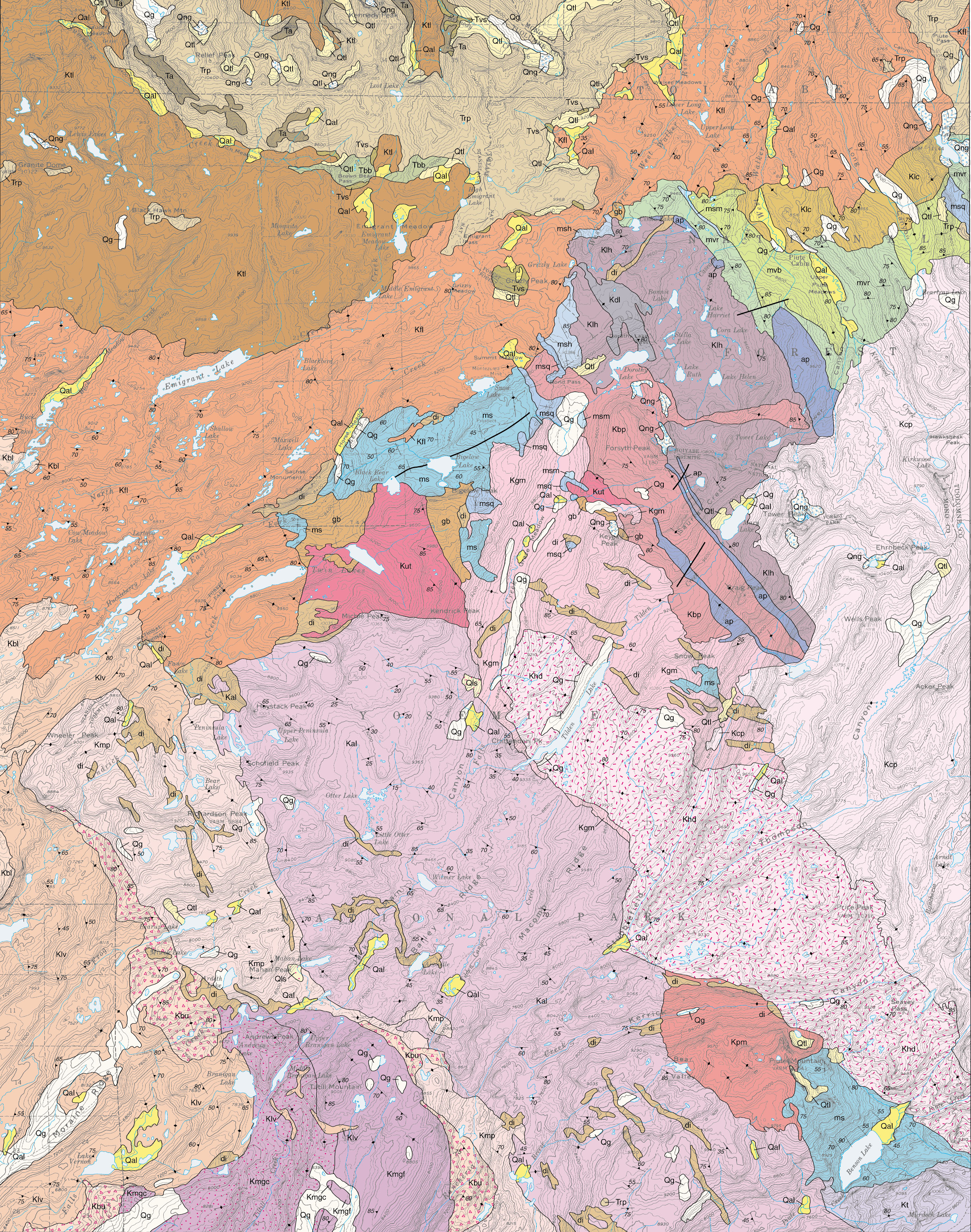
Geologic map of the Tower Peak Quadrangle, central Sierra Nevada, California
Author(s):
Source: Geologic Investigations Series - U. S. Geological Survey, Report: I-2697, 1 sheet, 2000
Map Name:
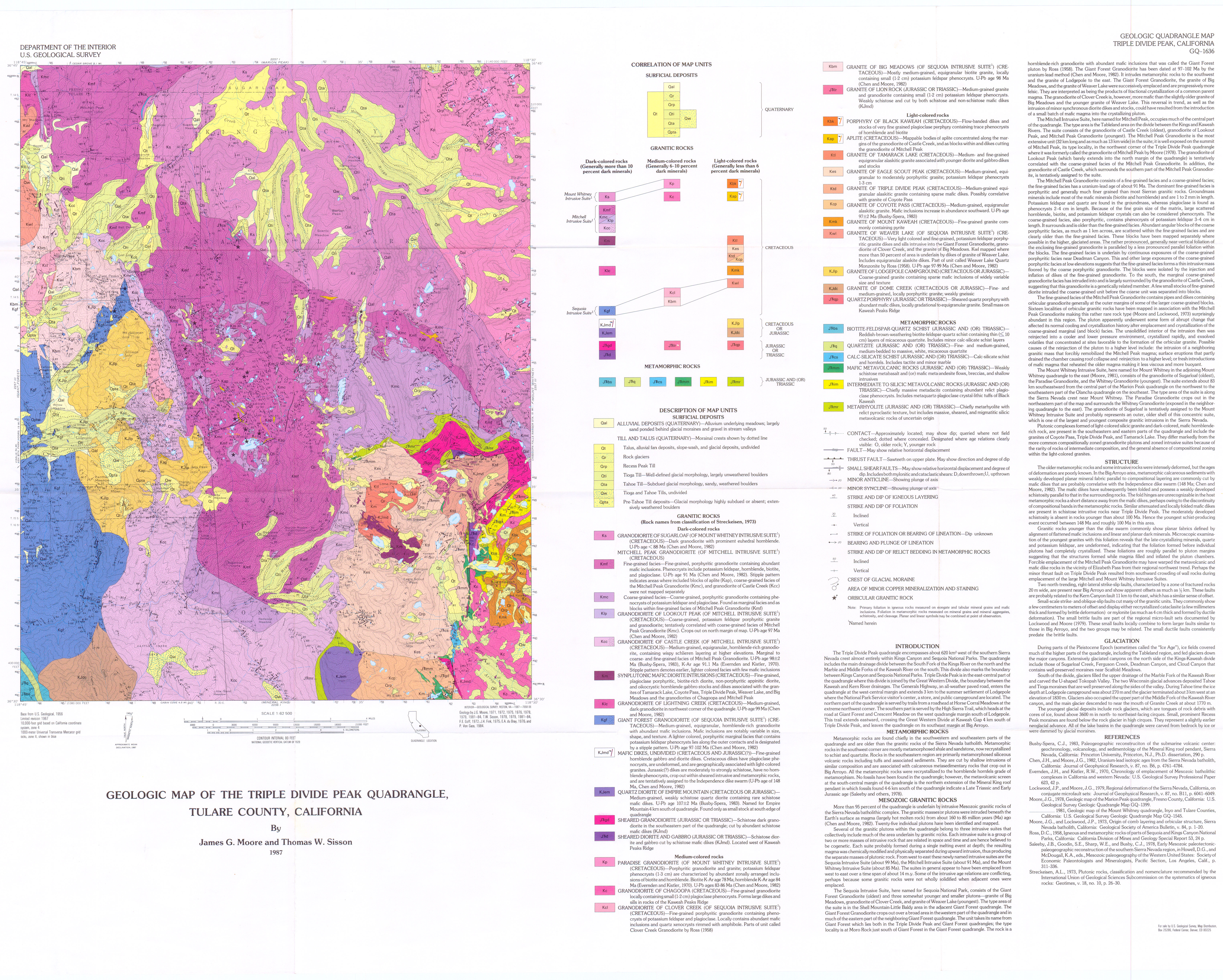
Geologic map of the Triple Divide Peak Quadrangle, Tulare County, California
Author(s):
Source: Geologic Quadrangle Map - U. S. Geological Survey, Report: GQ-1636, 1 sheet, 1987
Map Name:
Geologic map of the Tuolumne Meadows Quadrangle, Yosemite National Park, California
Author(s):
Source: Geologic Quadrangle Map - U. S. Geological Survey, Report: GQ-1570, 1 sheet, 1983
Map Name:
Geologic map of the Waucoba Mountain Quadrangle, Inyo County, California
Author(s):
Source: Geologic Quadrangle Map - U. S. Geological Survey, Report: GQ-0528, 1966
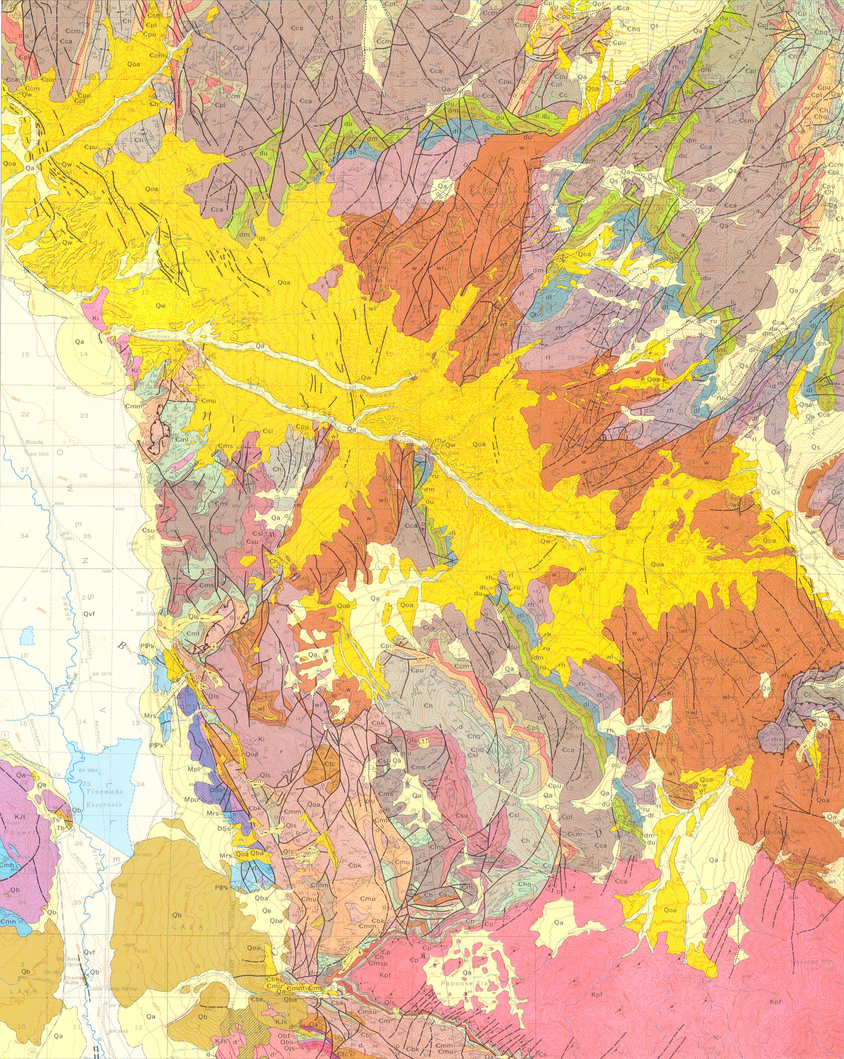
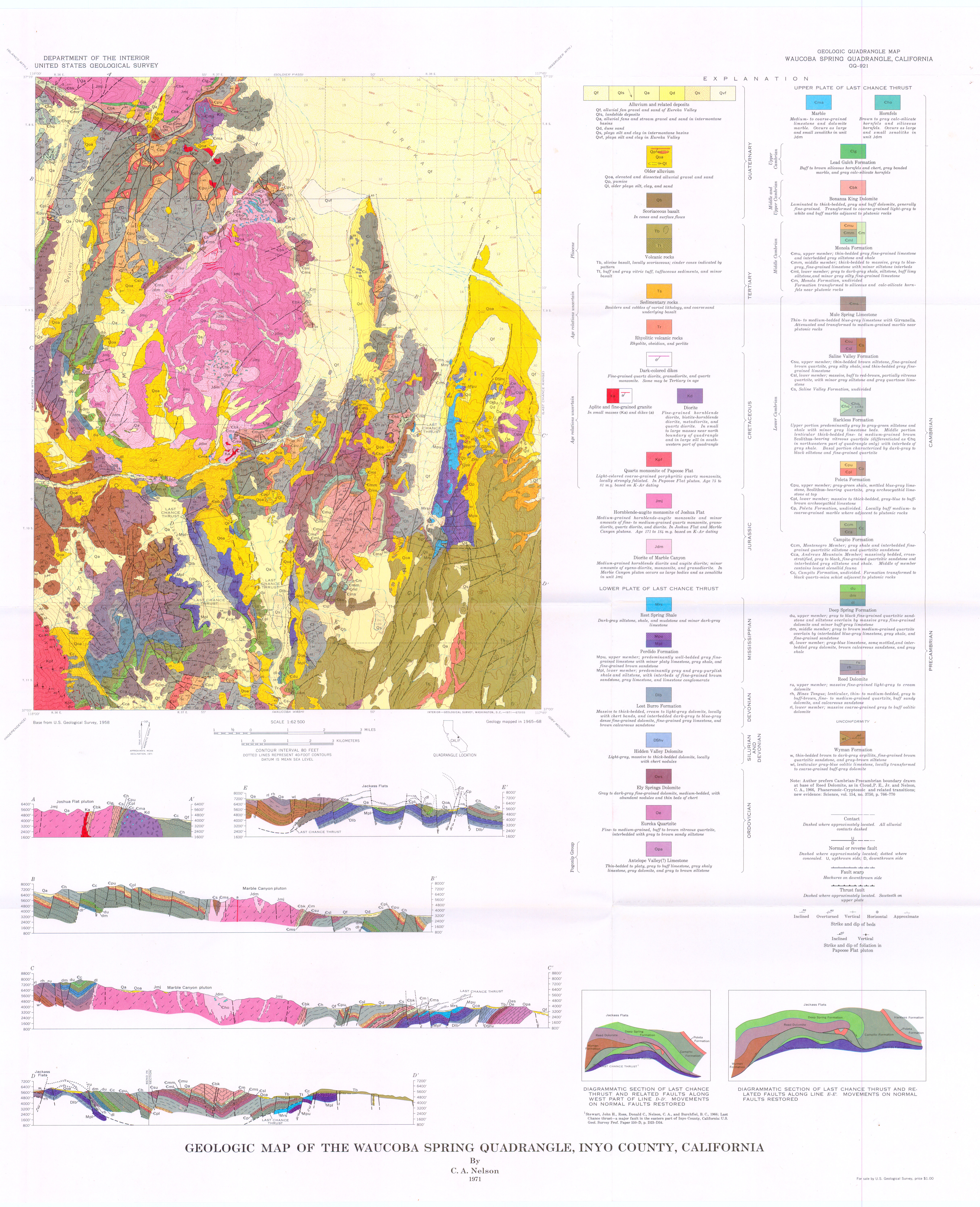
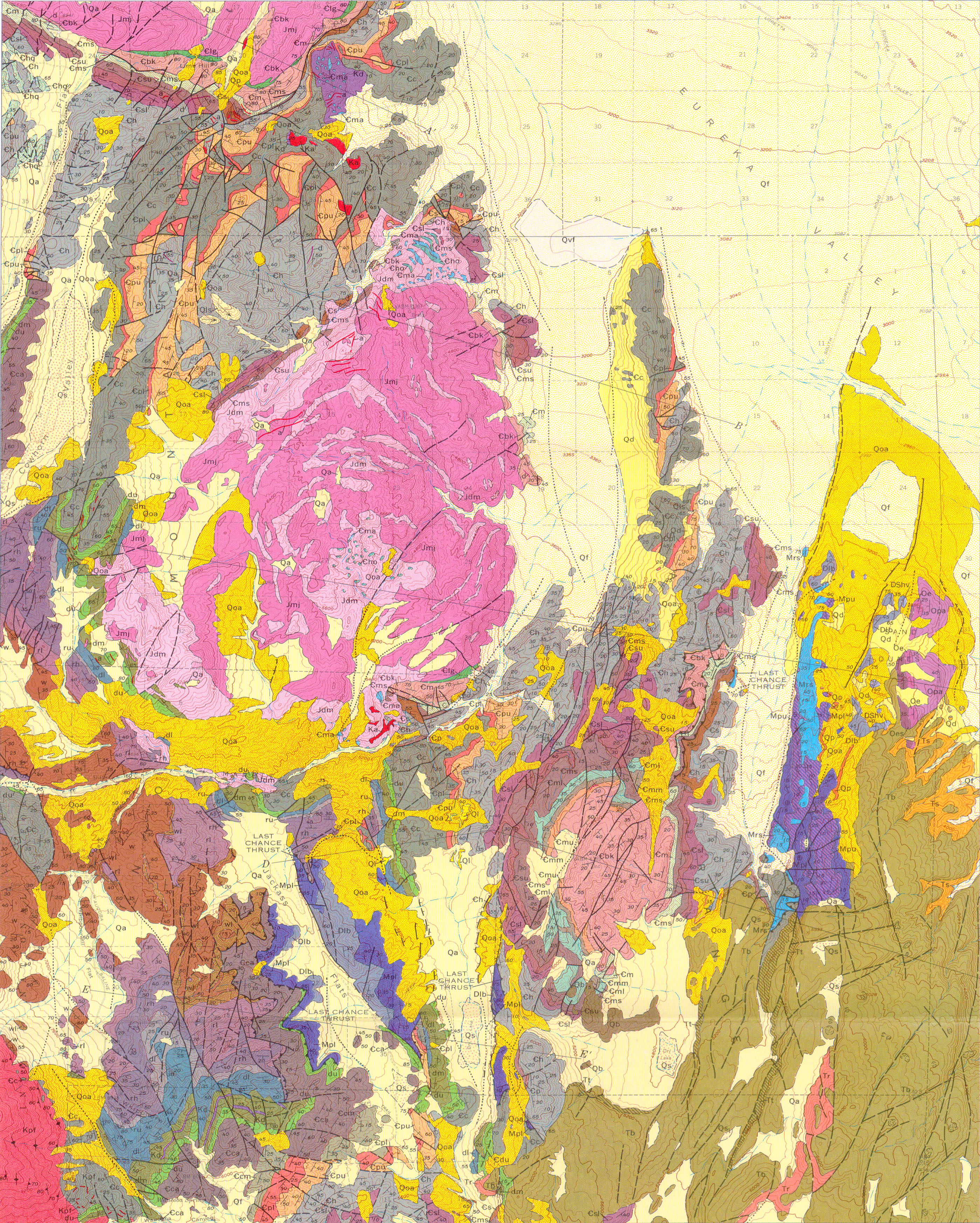
Map Name:
Geologic map of the Waucoba Spring Quadrangle, Inyo County, California
Author(s):
Source: Geologic Quadrangle Map - U. S. Geological Survey, Report: GQ-0921, 1971
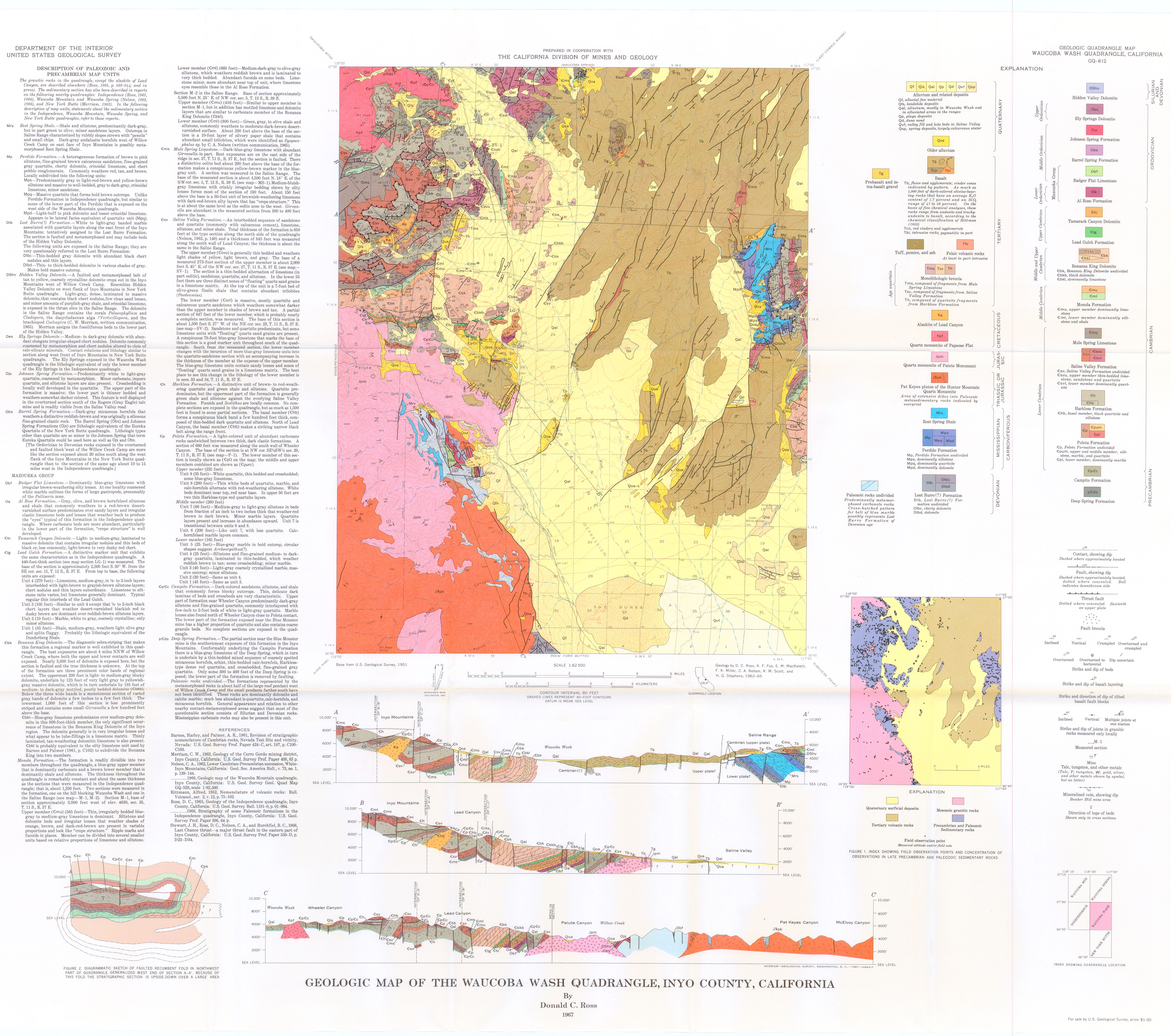
Map Name:
Geologic map of the Waucoba Wash Quadrangle, Inyo County, California
Author(s):
Source: Geologic Quadrangle Map - U. S. Geological Survey, Report: GQ-0612, 1967
Map Name:
Geologic map of the White Mountain Peak Quadrangle, Mono County, California
Author(s):
Source: Geologic Quadrangle Map - U. S. Geological Survey, Report: GQ-1012, 1972
Map Name:
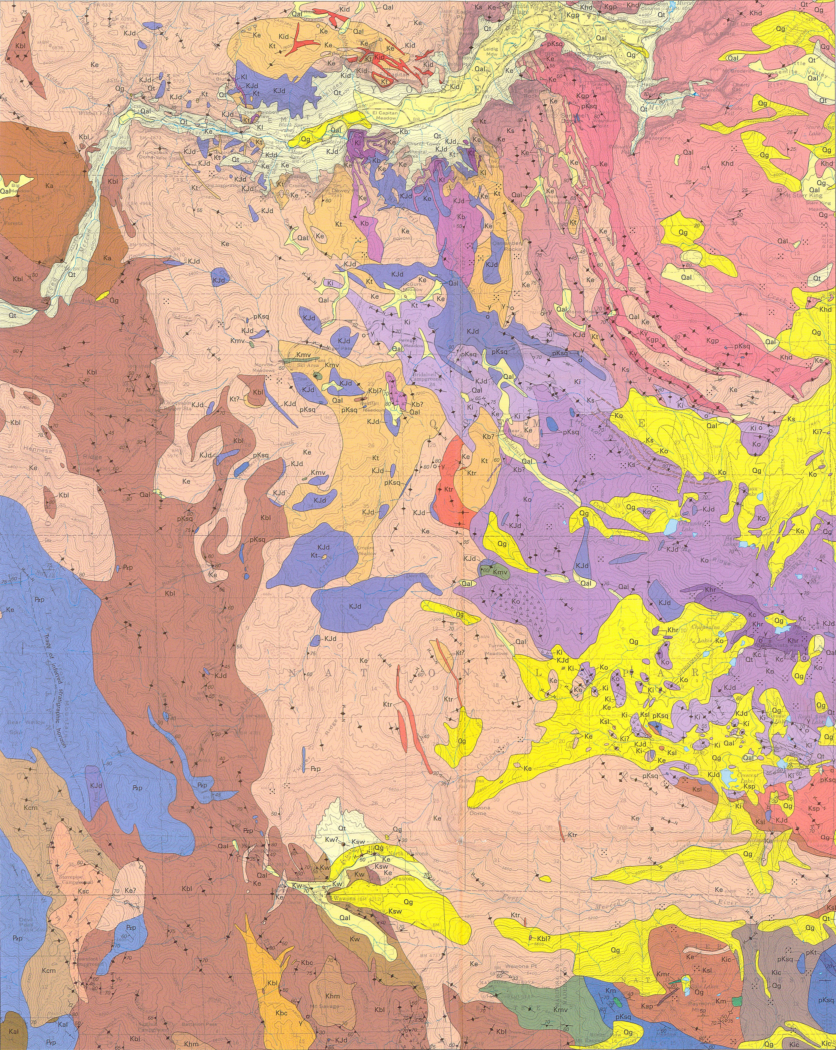
Geologic map of the Yosemite Quadrangle, central Sierra Nevada, California
Author(s):
Source: Geologic Investigations Series - U. S. Geological Survey, Report: I-2751, 1 sheet, 2002
Website
created by Nolan Caudill
(mailto: ncaudill@email.unc.edu)
January 2005